

As Maine prepared for a weather event that forecasters compared to the devastating ice storm of 1998, the national weather service continued to issue urgent warnings Saturday.
Freezing rain is expected to cause significant ice buildup on roads, walkways, power lines and tree limbs, making some roads impassable and power outages likely.
Additional Photos
A relatively light bout of freezing rain Friday night sent dozens of vehicles off the road, and on Saturday, retailers of snow tires and generators said significant numbers of both were being sold as people prepared for the worst.
“The biggest storm was ’98, but we have them every few years,” said Eric Schwibs, a meteorologist with the National Weather Service in Gray.
While northern Maine is expected to get more snow and sleet, adding up to as much as a foot of precipitation, southern Maine is more likely to get freezing rain.
The Waterville area is predicted to be in the middle of the thickest band of freezing rain, which means it will be among the areas most at risk for power outages, according to Schwibs.
He said about three-quarters of an inch was expected by Sunday evening, when the storm was expected to end.
On Saturday afternoon, the weather service issued an ice storm warning in which it urged motorists and pedestrians to stay indoors if at all possible. The warning is in effect until 7 a.m. Monday.
“Roads and sidewalks will become very slippery and make driving and walking difficult,” the service warned. “Significant amounts of ice accumulations will make travel dangerous our impossible. Travel is strongly discouraged.”
Those who must travel were advised to stock their vehicle first with an extra flashlight, food and water to guard against an emergency.
“Freezing rain is always one of our biggest concerns,” Gail Rice, the spokesperson for Central Maine Power Co., said in a statement the company released Friday.
Rice said the power company prepared by fueling and equipping utility trucks and was working to line up contract crews to help restore power in the wake of anticipated outages.
She urged customers to recognize the dangers of a downed line and to let trained crews handle them.
“Everyone should stay clear of any downed power lines or fallen trees that may be tangled in the lines,” she said. “All downed lines should be considered live and dangerous.”
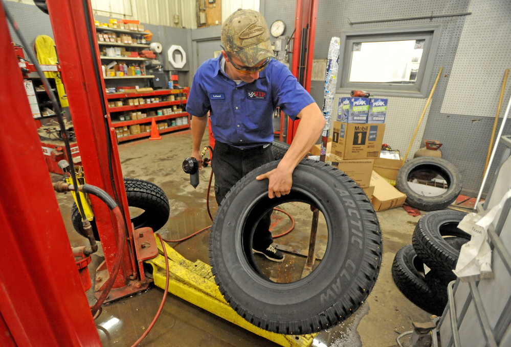
Rob Hersom, the towing manager for Ace Tire and Auto Service in Waterville, said snow tire sales have definitely been boosted by the weather.
“The first snowstorm is like a bell going off: ‘Come get your tires!’” he said. “It’s been a wave of people.”
And when the retail operation closes, Hersom said, he has been busy towing those who have slid off the road because of slippery road conditions.
In the past week alone, he said, he towed four vehicles that slid off the road and broke telephone poles.
In the 24-hour period beginning about 3 p.m. Friday, the Somerset County Sheriff’s Department reported more than two dozen accidents in Anson, Augusta, Bingham, Fairfield, Madison, Mercer, Newport, Norridgewock, Pittsfield, Solon, Skowhegan, Starks and Waterville.
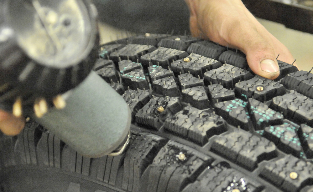
Hersom said he’s seen many cases in which car accidents could have been prevented by a better tire.
“It’s no different than your shoes,” he said. “If you’re wearing something with no traction, you’re going to slip and slide around. If you’re operating on a tire that’s not very good, it inhibits your ability to control the vehicle.”
Other retailers reported similar increases.
“We’ve had a lot more people getting snow tires lately,” said Laura Lamport, assistant manager of VIP Tires and Service in WInslow. “The volume’s definitely picked up.”
Nick Dumas, a worker at Power Equipment Plus in Sidney, said early Saturday afternoon the company had sold four or five generators and more people had been coming in or calling to ask about them than normally would on a Saturday, because of the predicted ice storm.
He said the store had only a few left and didn’t expect to get more in until at least Christmas.
“We’re definitely getting more people looking for them” because of the ice storm, Dumas said.
In northern parts of central Maine, including Jackman, Madison, Pittsfield and Skowhegan, snow accumulations were predicted at 4 to 8 inches, with up to a half-inch of ice possible.
Schwibs said there was a hope that the cold front could wind up to be deeper than expected, resulting in conditions that are less dangerous. When it’s 1,000 feet high, the cold air causes the dangerous freezing rain; but when it’s 2,000 to 3,000 feet high, the moisture has more time to freeze, resulting in relatively harmless sleet.
“That’s the only thing you can hope for,” he said, although he added that, in this case, the chances of a more benign sleet storm were slim.
Staff writer Keith Edwards contributed to this report,
Matt Hongoltz-Hetling — 861-9287 mhhetling@centralmaine.com Twitter: @hh_matt
Send questions/comments to the editors.

Success. Please wait for the page to reload. If the page does not reload within 5 seconds, please refresh the page.
Enter your email and password to access comments.
Hi, to comment on stories you must . This profile is in addition to your subscription and website login.
Already have a commenting profile? .
Invalid username/password.
Please check your email to confirm and complete your registration.
Only subscribers are eligible to post comments. Please subscribe or login first for digital access. Here’s why.
Use the form below to reset your password. When you've submitted your account email, we will send an email with a reset code.