

I’ve been checking off the mountains on the New Hampshire 4,000-footer list – the 48 highest peaks in New Hampshire – for five years.
I’ve climbed 44 and aim to finish the list this summer. It’s filled many of my weekends with one singular objective: getting to the top. This focus has helped me cross peaks off my list, but sometimes I prefer a less goal-oriented outing.
Every now and then I enjoy a good ramble – a “walk taken for pleasure, especially in the countryside.” It isn’t a charge up a mountain peak, a scramble over stony fields or a 15-mile out-and-back. It’s a relaxing stroll through the woods, taken to re-energize, connect with nature, wander with your thoughts and breathe in the fresh, wild air. And I think I may have found the perfect trail for a ramble on the Boothbay Peninsula.
The River-Link Initiative is an ambitious project to connect the Damariscotta and Sheepscot rivers on either side of the Boothbay Peninsula by way of a continuous, publicly accessible wilderness trail. Since 2002, several land trusts and preserves – including the Damariscotta River Association, Sheepscot Valley Conservation Association, Boothbay Region Land Trust and the Schmid Land Preserve – have worked toward this goal. In 2010, the River-Link Trail officially opened, running approximately five miles between Dodge Point Preserve in Newcastle and the church property in Edgecomb, a parcel acquired by the Boothbay Regional Land Trust through a Land for Maine’s Future grant.
While the River-Link doesn’t quite connect the Damariscotta and Sheepscot rivers just yet, its gentle, meandering route travels through woods and fields, over hills and streams, and past old orchards and stone walls. Since it passes through a number of reserves, there are multiple ways to access the trail for short explorations or a full end-to-end traverse. For a ramble through the woods with no particular destination in mind, it couldn’t be better.
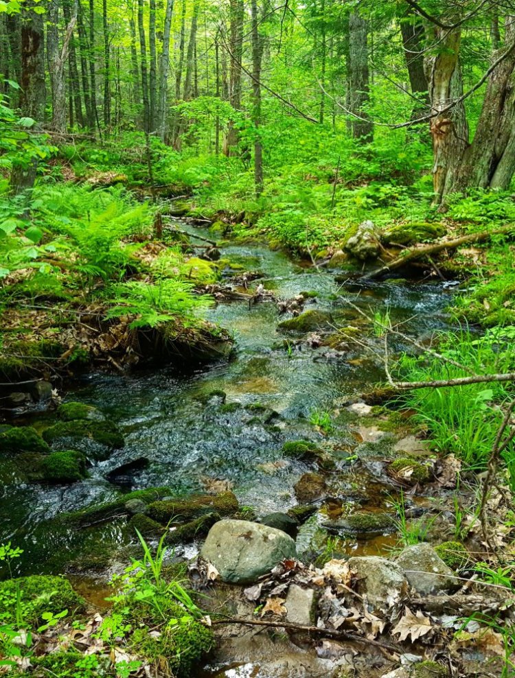
For my north-to-south River-Link ramble, I parked at Dodge Point Preserve – easy to find on River Road, only about five minutes south of Route 1 and the town of Damariscotta. From the lot, it’s an easy quarter-mile stroll up the wide Farm Road Trail to reach the River-Link, marked by a sign and a trail breaking off to the west. The trail travels over a small rise, then downhill to cross River Road and continue on an old logging road deeper into the heart of the peninsula. In some places, the route can be a little difficult to follow – stay aware of River-Link signs, blazes, and flags along the path.
The trail continues through dense spruce words, dipping gradually toward some marshland and crossing a wooden bridge before rising toward the Rocky Ridge Preserve. A couple switchbacks up the ridge, featuring some beautiful stonework by the Maine Conservation Corps, make the climb a bit easier. This is the rhythm of the River-Link Trail – rising and falling, crossing streams and ridges, as you continue through a public land easement and onto Edgecomb’s sprawling 766-acre Schmid Preserve.
Managed by the town of Edgecomb since 1979, the Schmid Preserve has nearly five miles of trails to explore – a great destination in its own right. These trails criss-cross the hilly, wooded preserve, providing a glimpse into the region’s past. At one time this area known as Mount Hunger was inhabited, and there are still orchards, stone walls and wells to mark the efforts of the former residents.
These features are something I love about many preserves, easements and protected public lands in Maine. As the trail continues south, along the eastern edge of the preserve, it crosses a number of old logging roads and stone walls, sometimes following them for a time.
Weaving between hills, the trail eventually leaves the Schmid Preserve and enters BRLT’s Church Parcel, the southernmost preserve on the route. It passes to the west of the highest point in Edgecomb – a 320-foot hill called “Mount Edgecombe” on some maps – before descending, crossing a footbridge and finally ending at the River-Link parking area on McKay Road.
Hiking the five miles from River Road to McKay Road took me a couple hours, and I could definitely feel the effort in my legs. While the trail is never too difficult, the climbs over Rocky Ridge and into the Schmid Preserve and Mount Hunger put some sweat on my brow. According to the DRA, many hikers leave a car at McKay Road or Dodge Point so they can shuttle back after a “thru-hike,” and I highly recommend this method – it’s a good way to experience the whole trail (and get somebody else to come along and experience it with you).
For my part, I only brought one car, and after reaching McKay Road I turned on my heel and walked the whole trail again, south to north. Ten miles of strolling through the woods on a beautiful summer weekend, without a destination in mind. That’s what rambling is all about.
Jake Christie is a freelance writer living in Portland. Along with his brother, Josh, he writes about great Maine destinations for outdoors enthusiasts. He can be reached at:
jakechristie@gmail.com
Send questions/comments to the editors.

Success. Please wait for the page to reload. If the page does not reload within 5 seconds, please refresh the page.
Enter your email and password to access comments.
Hi, to comment on stories you must . This profile is in addition to your subscription and website login.
Already have a commenting profile? .
Invalid username/password.
Please check your email to confirm and complete your registration.
Only subscribers are eligible to post comments. Please subscribe or login first for digital access. Here’s why.
Use the form below to reset your password. When you've submitted your account email, we will send an email with a reset code.