

PERTH, Australia — A Chinese plane crew spotted a white, square-shaped object in an area identified by satellite imagery as containing possible debris from the missing Malaysian airliner, China’s media said Monday, while the United States prepared to move a specialized device that can locate black boxes into the region.
The crew aboard an IL-76 plane sighted the object in the southern Indian Ocean search area and reported the coordinates to the Australian command center, which is coordinating the multinational search, as well as the Chinese icebreaker Snow Dragon, which is en route to the area, Xinhua News Agency reported.
Additional Photos
No further details were immediately given. Satellite images from Australia and China had earlier identified possible debris in the area that may be linked to the disappearance of Malaysia Airlines Flight 370 on March 8 with 239 people aboard.
The U.S. Pacific command said it was sending a black box locator in case a debris field is located. The Towed Pinger Locator, which is pulled behind a vessel at slow speeds, has highly sensitive listening capability so that if the wreck site is located, it can hear the black box pinger down to a depth of about 20,000 feet, Cmdr. Chris Budde, a U.S. Seventh Fleet operations officer, said in a statement.
“This movement is simply a prudent effort to preposition equipment and trained personnel closer to the search area so that if debris is found we will be able to respond as quickly as possible since the battery life of the black box’s pinger is limited,” Budde said.
There was no sign the move was because of any break in the mystery of the plane that went missing March 8 with 239 people on board, but rather as a preparation.
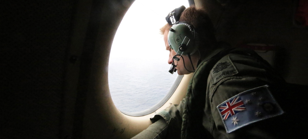
The Chinese plane was one of two Ilyushins that joined the search Monday from Perth, increasing the number of aircraft to 10 from eight a day earlier.
The Australian Maritime Safety Authority’s rescue coordination center said the weather in the area, about 1,550 miles southwest of Perth, was expected to deteriorate with rain likely.
Australian Transport Minister Warren Truss said “nothing of note” was found Sunday, which he described as a “fruitless day.”
“It’s going to be a challenge, but we’ll stick at it,” he told Australian Broadcasting Corp. radio before the first aircraft left Perth at dawn. “We’re just, I guess, clutching at whatever little piece of information comes along to try and find a place where we might be able to concentrate the efforts.”
A cyclone bearing down on the Australian northwest coast “could stir up less favorable weather,” he said.
Flight 370 while en route from Kuala Lumpur, Malaysia, to Beijing, setting off a multinational search that has turned up no confirmed pieces and nothing conclusive on what happened to the jet.
The latest French satellite data came to light Sunday as Australian authorities coordinating the search sent planes and a ship to try to locate a wooden pallet that appeared to be surrounded by straps of different lengths and colors.
The French data came after Australian and Chinese satellites earlier identified suspect objects.
The pallet was spotted Saturday from a search plane, but the spotters were unable to take photos of it.
Wooden pallets are most commonly used by ships but are also used airplane cargo holds, and an official with Malaysia Airlines said Sunday night that the flight was, in fact, carrying wooden pallets. The official spoke on condition of anonymity in keeping with company policy.
In Paris, French Foreign Ministry spokesman Romain Nadal said in an interview with The Associated Press that the satellite radar echoes “identified some debris that could be from the Malaysian Airlines plane.”
The spokesman said that these echoes “are not images with a definition like a photograph, but they do allow us to identify the nature of an object and to localize it.”
Gathering satellite echo data involves sending a beam of energy to the Earth and then analyzing it when it bounces back, according to Joseph Bermudez Jr., chief analytics officer at AllSource Analysis, a commercial satellite intelligence firm.
Satellite radar echoes can be converted into an image that would look similar to a black-and-white photo, though not as clear, he said. “You’d have to know what you’re looking at,” Bermudez said.
A Malaysian official involved in the search said the French data located objects about 575 miles north of the spots where the objects in the images released by Australia and China were located.
One of the objects located was estimated to be about the same size as an object captured Tuesday by the Chinese satellite that appeared to be 72 feet by 43 feet, said the official, who declined to be identified because he wasn’t authorized to speak to the media.
U.S. underwater wreck hunter David Mearns on Monday described the French satellite sighting of potential debris as a “positive development,” although he was unaware of the full details.
Copy the Story LinkSend questions/comments to the editors.

Success. Please wait for the page to reload. If the page does not reload within 5 seconds, please refresh the page.
Enter your email and password to access comments.
Hi, to comment on stories you must . This profile is in addition to your subscription and website login.
Already have a commenting profile? .
Invalid username/password.
Please check your email to confirm and complete your registration.
Only subscribers are eligible to post comments. Please subscribe or login first for digital access. Here’s why.
Use the form below to reset your password. When you've submitted your account email, we will send an email with a reset code.