

MANTEO, N.C. — Dare County officials have ordered a mandatory evacuation for residents and visitors on Hatteras Island as Tropical Storm Arthur draws closer to the North Carolina coast.
The order takes effect at 5 a.m. Thursday. After that, access to Hatteras Island is prohibited.
Additional Images
According to the order issued Wednesday, all Hatteras Island residents and visitors were advised to evacuate as expediently as possible during the day Thursday.
A state of emergency has been issued for Dare County, with the only restriction being the Hatteras Island evacuation.
The first named storm of the Atlantic hurricane season prompted a tropical storm warning for the entire North Carolina coast and had officials, hotel owners and would-be vacationers as far north as New England carefully watching forecasts.
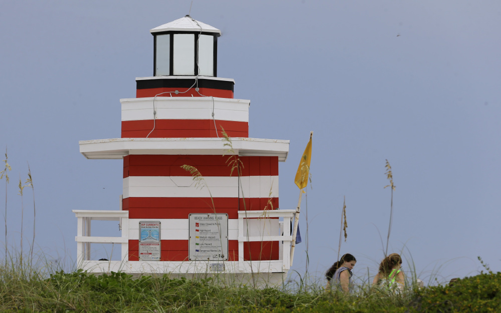
The 200-mile Outer Banks will be especially vulnerable, forecasters said. The area’s tourism agency expects about 250,000 people to travel there and stay in hotels and rental homes for the long holiday weekend.
“We want everybody to be safe and prepared, but we are not overly concerned at this point,” said Lee Nettles, the executive director the Outer Banks Visitors Bureau. He noted that forecasters were predicting the storm would move fast and be less severe than others in locals’ memories.
But flooding concerns remained: Twice in recent years, storm-driven waves have sliced North Carolina Route 12, the main road along the islands, rendering it unpassable. On Ocracoke Island, accessible only by ferry, a voluntary evacuation was announced.
Stores saw runs on generators, lanterns and flashlights, but even some workers weren’t yet concerned.
“I’ve been through Irene. I went through Isabelle,” said Bill Motley, who works at Ace Hardware in Nags Head has lived on the Outer Banks for 13 years. “I’m not even worried about this one. I’m more worried about my tomato plants. With the wind coming, if we get a 50-mph gust, it will knock over my tomato plants.”
At a news conference, Gov. Pat McCrory advised residents, “Don’t put your stupid hat on.” With concerns of rip tides, he urged surfers and swimmers not to get in the water regardless of how good the waves might be.
“Our major goal is to ensure that no lives are lost during this upcoming storm,” including those of emergency workers, McCrory said. He declared a state of emergency for 25 coastal and adjoining counties.
Nancy Janitz, 60, of Jacksonville, North Carolina, said she was ready, thanks to technology.
“I have my NOAA radio, and I keep tabs on Twitter and Facebook for updates,” she said. “I’m as prepared as I can possibly be.”
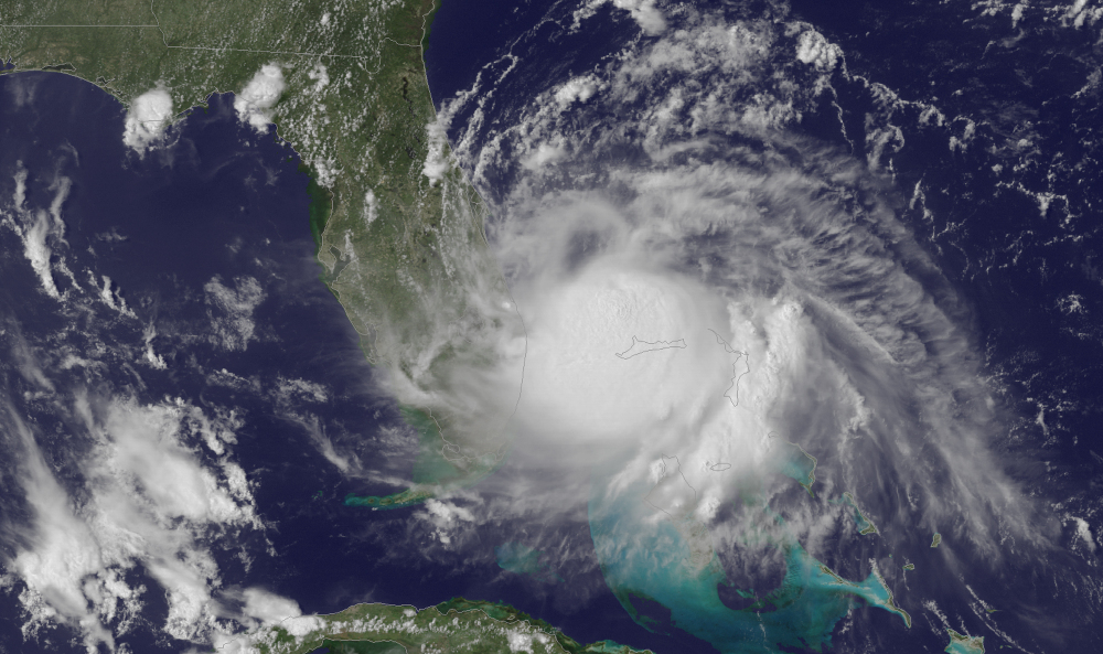
On Wednesday afternoon, Arthur was about 235 miles south of Charleston and moving north about 7 mph with maximum sustained winds of 60 mph. The National Hurricane Center predicted it would grow to a Category 1 hurricane with sustained winds of at least 74 mph Thursday.
The forecast did not call for a landfall in the U.S., but officials and travelers north to New England kept an eye on the storm’s projected path. Many areas warned of upcoming rain, wind and potential rip tides.
The worst of the storm should occur at Cape Hatteras, North Carolina, about dawn Friday, with 3 to 5 inches of rain and sustained winds up to 85 mph, said Tony Saavedra, a meteorologist at the National Weather Service. But forecasters said that by later Friday, the effects of Arthur would be passed the Outer Banks, with the rest of the weekend salvaged.
The Hurricane Center predicted the storm would be off the coast of New England later in the day and eventually make landfall in Canada’s maritime provinces as a tropical storm.
In the Myrtle Beach area, the heart of South Carolina’s $18 billion tourism industry, Arthur was expected to move by Thursday night, spinning wind gusts from 40 to 50 mph toward the high-rise hotels and condominiums lining the oceanfront.
Farther south, in Hilton Head Island on the state’s southern tip, most were confident would pass well out at sea.
“It will be a sold-out weekend,” said Charlie Clark, a spokeswoman for the local Chamber of Commerce. “… We’re not getting calls from visitors asking what’s up with this storm.”
Many in areas not directly in the storm’s path cited rip tides as the largest threat.
“There are a lot of people who aren’t familiar with rip tides because they don’t live near the coast,” said Jason Buelterman, mayor of Tybee Island, Georgia, which also expected a big holiday crowd. “The main thing is telling people if they have kids to be really, really careful.
Associated Press writers Russ Bynum in Savannah, Ga.; Martha Waggoner in Raleigh, N.C.; Matt Small in Washington; and Tony Winton in Miami contributed to this report.
Send questions/comments to the editors.

Success. Please wait for the page to reload. If the page does not reload within 5 seconds, please refresh the page.
Enter your email and password to access comments.
Hi, to comment on stories you must . This profile is in addition to your subscription and website login.
Already have a commenting profile? .
Invalid username/password.
Please check your email to confirm and complete your registration.
Only subscribers are eligible to post comments. Please subscribe or login first for digital access. Here’s why.
Use the form below to reset your password. When you've submitted your account email, we will send an email with a reset code.