


Even when a storm doesn’t amount to much in new snowfall, it still blows — keeping public works crews busy and putting motorists at risk.
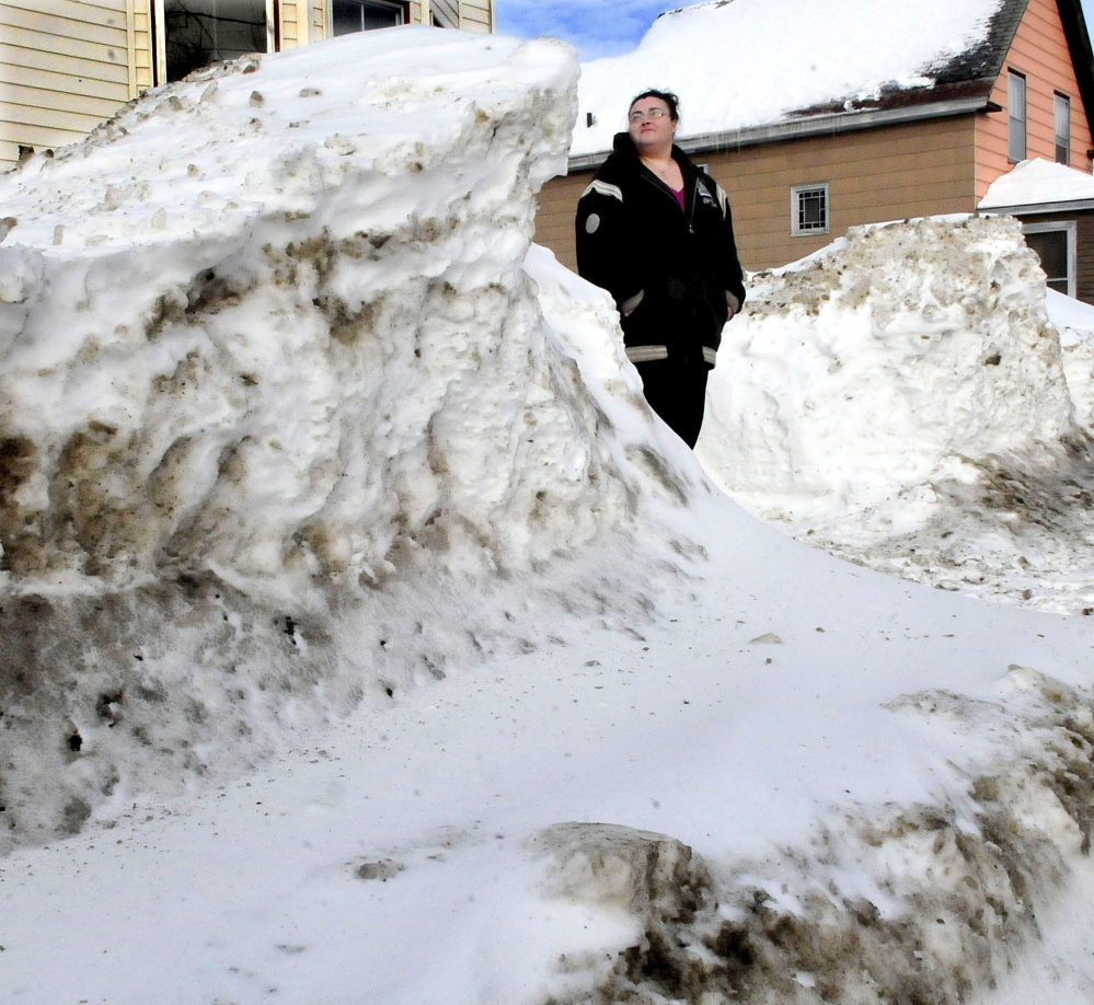
Relentlessly blowing wind and the light fluffy snow already on the ground got together to form snow drifts in central Maine on roads large and small. Even after a blizzard failed to bring much snow to the region this past weekend, plow crews were out in force dealing with the drifts.
“Drifting has absolutely been an issue” for snow removal workers, said Dale Doughty, director of maintenance and operations for the state Department of Transportation. “One of the bad things about a drifting storm is you need to have people out long after the storm has left to catch that drifting.”
Gene Field, public works foreman in Vassalboro, said Tuesday that the town’s small plow crew was out pretty steadily since Sunday in part to keep drifts from blocking roads, especially on roads going through fields. He said the wind finally settled down Monday night and remained calmer Tuesday.
“We kept the crew out there, so we didn’t have any roads become impassable,” he said. “They’ve been out pretty constantly, but it’s calming down.”
Meanwhile, a storm that may strike Wednesday night is as unpredictable as the blowing snow. Andy Pohl, a meteorologist with the National Weather Service, said parts of Maine could see heavy snowfall Wednesday night into Thursday, while other nearby areas could get no new snow at all.
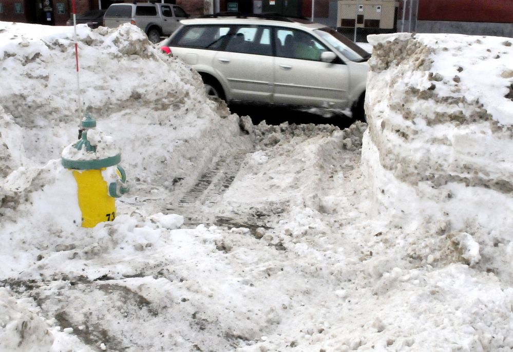
The potential storm comes as local public works crews are only beginning to get caught up with snow removal and plowing the numerous snowdrifts out of roads, where they pose a hazard to motorists in part because drifts are unexpected when most of the road is clear of snow.
Maine State Police Lt. Erik Baker, the commanding officer of Troop G, which is responsible for patrolling the Maine Turnpike, said drivers had to deal with snowdrifts up and down the interstate.
“It was causing problems even into New Hampshire,” Baker said.
Maine State Police Trooper Bill Baker, who responded to at least two crashes caused by snow drifts on the turnpike, including a four-car pileup in Litchfield that injured four people, said drifts added several inches of snow in some spots.
“Plow trucks had trouble keeping up,” Bill Baker said. “With the wind it was white-out in some areas.”
Signs posted along the interstate warned drivers of the drifts, but with most of the road free from ice and snow, drivers can become complacent, Bill Baker said. The highway can be covered by a layer of salt powder, which turns the blacktop white and makes the drifts difficult to see.
“You usually don’t see the drifts until you’re right on top of them,” he said.
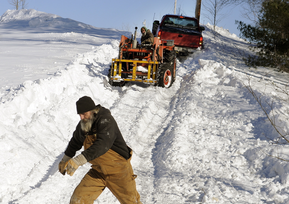
Plow drivers, many of whom were out much of the weekend, continued to plow early this week just to prevent drifts from getting out of control on some roads.
“We had quite a few drifts (over the weekend). We’re still working on them today, too,” said Bruce Balfour, public works director in Monmouth. “We have a lot of problems on the top of Norris Hill, on Route 32, and South Monmouth Road — those are some of our worst spots. South Monmouth Road is all fields, so you get a lot of drifting down there. They can become impassable. We go out and do what we can, at least get a lane through it.”
Balfour said crews didn’t have to work quite as much as they would have had to if the area had gotten the 18 to 24 inches of snow some forecasts had predicted, but still had to put in some time over the weekend and at night to keep up with the snowdrifts.
“It was blowing so hard you couldn’t keep up with it,” Balfour said. “Every six to eight hours, you’ve got to chase drifts down all over town.”
Pohl, of the weather service, said Friday could get a little gusty, with wind speeds of between 15 and 20 mph. But this past weekend’s gusts of more than 40 mph in central Maine are not expected to return.
Pohl said the unpredictability of Wednesday’s storm stems from a phenomenon known as a Norlun trough, in which a trough of low pressure forms between two low pressure zones over Maine. Most forecast models can’t figure out where the trough will bring the heaviest snow, he said. So while heavy snow — up to 2 to 6 inches falling per hour — is possible, some areas of the state won’t see much accumulation.
“If this sets up over Augusta, you could see some heavy snow overnight,” Pohl said. “Right now, we show the heaviest snow between Augusta and Lewiston. But that will change. This could be a high impact, but low probability event. Somebody is going to get a lot of snow and somebody 10 miles away” from there may not get anything.
As of Tuesday afternoon, the weather service’s forecast for the Augusta area predicted accumulations of 3 to 7 inches. A hazardous weather outlook for the area predicts light snowfall Wednesday into Thursday with the potential for significant snowfall “somewhere across western Maine.”
Doughty said most of this winter’s storms have been very cold and very windy in contrast to most storms last winter that brought heavier, wetter snow often followed by ice. This year’s light and fluffy dry snow is more prone to being blown around by the wind. He said drifts from the weekend’s storms were worst where the most snow fell, such as in York County and Downeast areas.
He said the state tries to use vegetative buffers, such as rows of trees, along the Interstate and other state roads to help catch blowing snow before it forms drifts in roads.
Decades ago the state and others frequently placed snow fences in fields and other areas prone to drifting, to try to catch the snow before it got to the road. He said in the 1950s snow fences were prevalent, but the practice faded out over the last 20 years or so, in part because of the labor and maintenance needed to install the fences.
Another consequence of the deep, drifting snow is doors and other exits to homes and businesses can become blocked by the snow. That, in turn, could trap someone inside a burning building, state Fire Marshal Joe Thomas warned in a news release Tuesday.
Thomas said his investigators and inspectors around the state have reported seeing many homes, businesses and even public buildings where snow is blocking emergency exits. He also warned residents to make sure all vents to heating sources are free of ice and snow to prevent carbon monoxide poisoning.
“A blocked exit may be the only way out in times of fire,” Thomas said in the release. “It’s vital for the safety of residents to make sure all exits are usable.”
Keith Edwards — 621-5647
kedwards@centralmaine.com
Twitter: @kedwardskj
Send questions/comments to the editors.

Success. Please wait for the page to reload. If the page does not reload within 5 seconds, please refresh the page.
Enter your email and password to access comments.
Hi, to comment on stories you must . This profile is in addition to your subscription and website login.
Already have a commenting profile? .
Invalid username/password.
Please check your email to confirm and complete your registration.
Only subscribers are eligible to post comments. Please subscribe or login first for digital access. Here’s why.
Use the form below to reset your password. When you've submitted your account email, we will send an email with a reset code.