

DENVER — Colorado is in for a few more days of violent storms and unstable weather, forecasters said Saturday. But the good news is that the storms are moving too quickly to cause widespread flooding.
The state was braced for at least two more nights of walloping rain, strong winds and isolated tornadoes.
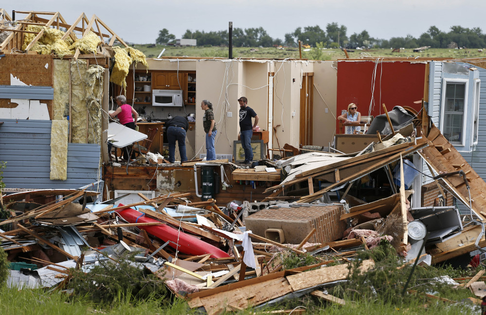
A third night of severe storms ripped across Colorado late Friday, downing tree branches and leaving about 12,000 in the Denver metro area without power.
At least six tornadoes were spotted Friday afternoon and evening in southern and eastern Colorado, National Weather Service meteorologist Chad Gimmestad said. All were in rural areas and caused little damage and no injuries, he said.
The nasty weather was expected to extend into Kansas, Nebraska and Iowa on Saturday and Sunday.
The storms were likely to decrease in intensity Saturday and Sunday, tapering off early next week, Gimmestad said.
“There’s still a threat of severe storms and flooding through the weekend, but not as much of a threat,” he said.
The storms have been moving too quickly to cause more than isolated flooding, he said.
“We’ve had reports of places getting half an inch of rain in half an hour, and that’s about as much as the storm drains can handle, but then the rain moves on,” Gimmestad said.
Still, the swollen rivers and torrential rains have left residents nervously watching the skies.
“The rivers are generally full and it’s going to be like this at least a couple more weeks. So any rain that falls is going to be on top of that and we could see some minor flooding,” Gimmestad said.
No serious injuries have been reported from the storms.
The storms that began overnight Thursday were the result of the El Nino phenomenon in the Pacific Ocean, an upper-level jet stream and a low-pressure system parked over Southern California. The factors have combined to deliver moisture from the Gulf of Mexico into Colorado and southern Wyoming.
The rainy pattern has helped prolong Colorado’s snowpack this year.
The Natural Resources Conservation Service reported Friday that precipitation was 239 percent of average across the state’s mountains in May, The (Grand Junction) Daily Sentinel reported.
“This substantial addition of moisture, both in the form of snow and rain, has notably increased water supply forecasts across the state from a month ago,” said Brian Domonkos, Colorado snow survey supervisor for the service.
Send questions/comments to the editors.

Success. Please wait for the page to reload. If the page does not reload within 5 seconds, please refresh the page.
Enter your email and password to access comments.
Hi, to comment on stories you must . This profile is in addition to your subscription and website login.
Already have a commenting profile? .
Invalid username/password.
Please check your email to confirm and complete your registration.
Only subscribers are eligible to post comments. Please subscribe or login first for digital access. Here’s why.
Use the form below to reset your password. When you've submitted your account email, we will send an email with a reset code.