


The joke’s on us: Winter weather isn’t done with Maine just yet.
An April Fool’s Day snowstorm is forecast to blanket parts of the state with up to a foot of snow on Saturday, although central Mainers probably will miss the worst of it, according to Chris Kimble, a meteorologist with the National Weather Service in Gray.
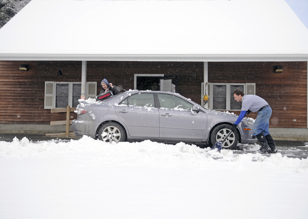
Kimble said the Waterville-Augusta area should expect to see 2 to 4 inches of snow. Unlike recent storms, he said, the snow is expected to be heavy and wet. He said western areas should expect higher totals, such as Lewiston, which could see 6 inches of snow. He said closer to the New Hampshire line, the expectations are closer to 10 inches or a foot, including interior sections of York County.
“We’re not expecting as much in Waterville, but you should at least see some,” he said.
Kimble said the snow was expected to start around midnight and last until sometime Saturday afternoon. He said the wet, heavy snow is caused by moisture in the snowflakes and how they’re formed in the atmosphere; the more water content in the snow, the stickier it becomes.
“In general, late spring storms tend to be a wetter type of snow,” he said.
Waterville Public Works Director Mark Turner said the storm had been downgraded over the past few days into the more manageable 2-to-4-inch range. He said his crews, material and equipment were all ready for the snow, and he said they hope they won’t have to do too much plowing, as that can cause damage to roads and lawns in early spring as daytime temperature rises above freezing. The storm is expected to dissipate just as rapidly as it came and the temperature in central Maine is expected to climb into the upper 40s on Sunday.
“We rely more on materials and temperatures if we can,” he said, meaning city crews will lay down salt and count on rebounding temperature to take care of most of the snow. He said if plowing was needed, they would be careful with how they did it.
“Hopefully, things melt away pretty quickly,” he said.
Turner said if more snow than what is projected were to fall, the heavy and wet conditions could be problematic. However, given the low projections, Turner thought taking care of the snow wouldn’t be a problem.
“We should be able to scrape it off pretty good with minimal damage and pretty good effectiveness I think,” he said
The storm will add to snowfall totals already well above average. Kimble said so far, Waterville has recorded a total of 94.6 inches of snow. While he said it’s not uncommon for the area to total 100 inches, the average is usually closer to 70 inches. Kimble said he expects the precipitation to remain as snow in the region and did not expect high wind or sleet or freezing rain.
Kimble said as of Friday morning, the storm already had moved into New Hampshire, and the Waterville-Augusta area was on the edge of the storm’s reach.
While the snow will be wet and heavy, Kimble didn’t expect it to cause many power outages in central Maine, based on the lower snowfall expectations. Heavier snow often can be problematic for tree limbs and power lines, but the worst of it is expected outside the region.
Higher-terrain areas between Nashua and Keene in New Hampshire could get 12 to 18 inches of snow, The Associated Press reported. Such snowfall is more likely to damage trees and cause power outages.
Enough warm air might invade the coastline to change the snow there to sleet or freezing rain. The mix line is expected to approach from the east and may make it a few miles inland.
Ted Talbot, spokesman for the Maine Department of Transportation, said state officials were watching the forecast closely, and he echoed Turner’s sentiments that the snow totals were declining. However, Talbot said no matter what the actual accumulation is, “we will have the same type of approach.”
“We will be out just as soon as the precipitation starts to fall in each region,” Talbot said Friday afternoon. He said there were pre-storm meetings for the department today, and he fully expected crews to be out for the duration of the storm and the cleanup effort.
Talbot said unlike the storm in mid-March, this storm would not bring blizzardlike conditions with it.
“We don’t expect whiteout conditions,” Talbot said, which meant crews could keep up with the storm and keep the roads passable. “There are no expectations of advising people to stay off the roads. That being said, we would like people to use common sense. While the calendar may say spring, Mother Nature may have different ideas.”
Colin Ellis — 861-9253
cellis@centralmaine.com
Twitter: @colinoellis
Send questions/comments to the editors.

Success. Please wait for the page to reload. If the page does not reload within 5 seconds, please refresh the page.
Enter your email and password to access comments.
Hi, to comment on stories you must . This profile is in addition to your subscription and website login.
Already have a commenting profile? .
Invalid username/password.
Please check your email to confirm and complete your registration.
Only subscribers are eligible to post comments. Please subscribe or login first for digital access. Here’s why.
Use the form below to reset your password. When you've submitted your account email, we will send an email with a reset code.