


The first major snowstorm of February is taking aim at the state and central Maine, with weather forecasts predicting heavy snow in the afternoon Wednesday totaling up to 1 foot in some areas before ending early Thursday morning.
Meteorologist James Brown, of the National Weather Service in Gray, said central Mainers can expect a quick-moving storm that will dump 8 to 12 inches of snow on the region, beginning at midday and ending after midnight.
“Across the county it will vary, but we’re expecting the snow to be pretty heavy by 2 p.m.,” Brown said, adding that the snow will taper off around 8 p.m. and will continue to fall lightly until an hour or so past midnight. “It’s a fast storm,” he said.
Brown said the temperature will be in the mid-20s throughout the day Wednesday, and Thursday’s forecast calls for a return to nicer weather, with a high in the 20s and a mostly sunny sky.
Central Maine has had several snow events already this year. The region saw blizzard conditions for nearly 12 hours Jan. 4, and there was a foot of snow or more in many areas across the state.
As of Tuesday, a total of 39.6 inches of snow had fallen so far this season as recorded in Gardiner, according to the weather service. Of that, 17 inches had accumulated in 2018.
Public works departments throughout central Maine were mobilizing crews and preparing for a busy day Wednesday, and they are expecting to have to spend Thursday and likely the weekend cleaning up the roads and sidewalks and parking lots around the region.
Augusta Public Works director Lesley Jones said the storm is nothing out of the ordinary, and she’s trying to schedule her crew around the time when the storm will be at its heaviest.
“We’re trying to plan a crew that can stay later in the day, because there is the potential for intense snow later in the afternoon,” Jones said. “We’ll have to work later.”
Jones said if the storm just brings snow, crews will “work hard” Wednesday and get things cleaned up Thursday. She said they’d be hauling snow Thursday or Sunday night, depending on the magnitude of the storm.
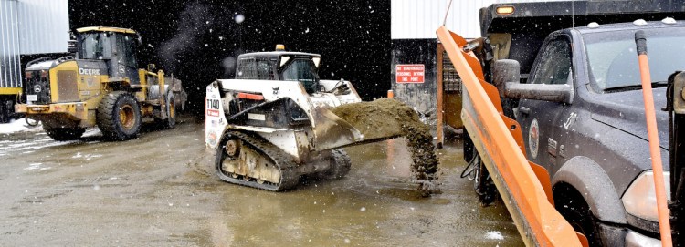
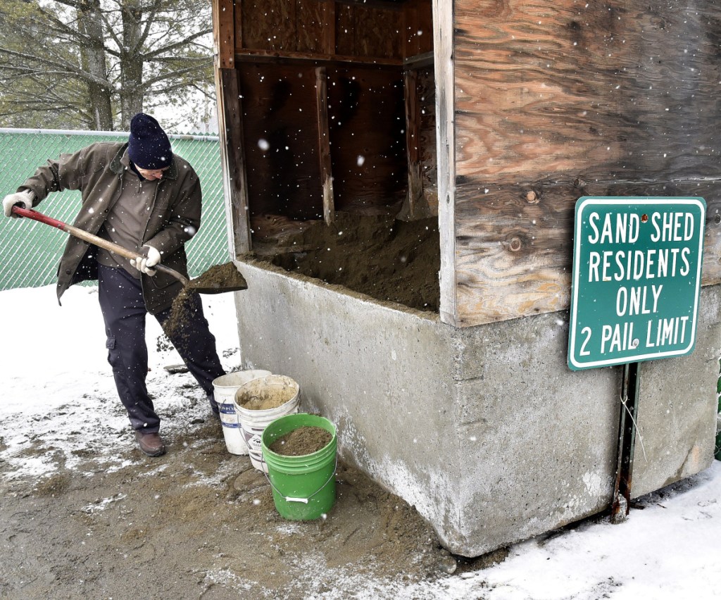
“We’ve had a steady stream of sand and salt trucks these last few days,” Jones said of the city’s supply of road treatment materials. “We’re just trying to get our guys some rest.”
In Gardiner, Tony LaPlante and his crew are loading trucks with salt and sand and will be plowing snow as much as possible Wednesday.
Mark Turner, the director of Public Works in Waterville, hoped Wednesday’s storm would be purely snow and would not involve any mixed precipitation, such as freezing rain — because that’s when the plow truck drivers have the most trouble.
Additionally, with all of the rain and ice the area has received, the city is close to running low on sand and salt.
“We’re in pretty good shape right now,” he said. “If we continue to get the freezing rain, that’s going to eat through our supply.”
That was the case for the public works crew in Winslow, as well.
“We have used a lot of sand and salt for this time of year,” Paul Fongemie, the department’s director, said Tuesday. “We’re going through our budget more quickly than we’d like.”
Fongemie said the crews will be doing a balancing act by trying to use little enough salt Wednesday so that they don’t run out of supplies before the weekend, when more snow is predicted for the region.
Salt and sand concerns aside, both Turner and Fongemie said their crews are rested and ready for the storm ahead.
“We’re ready for anything,” Turner said.
Staff writer Emily Higginbotham contributed reporting.
Jason Pafundi — 621-5663
Twitter: @jasonpafundiKJ
Send questions/comments to the editors.

Success. Please wait for the page to reload. If the page does not reload within 5 seconds, please refresh the page.
Enter your email and password to access comments.
Hi, to comment on stories you must . This profile is in addition to your subscription and website login.
Already have a commenting profile? .
Invalid username/password.
Please check your email to confirm and complete your registration.
Only subscribers are eligible to post comments. Please subscribe or login first for digital access. Here’s why.
Use the form below to reset your password. When you've submitted your account email, we will send an email with a reset code.