

CAPE CANAVERAL, Fla. — Despite a serious cooling problem, the newest U.S. weather satellite has produced a sharp snapshot of Earth.
The National Oceanic and Atmospheric Administration released the GOES-17 satellite’s first image Thursday. It shows the Western Hemisphere in detail from 22,000 miles up.
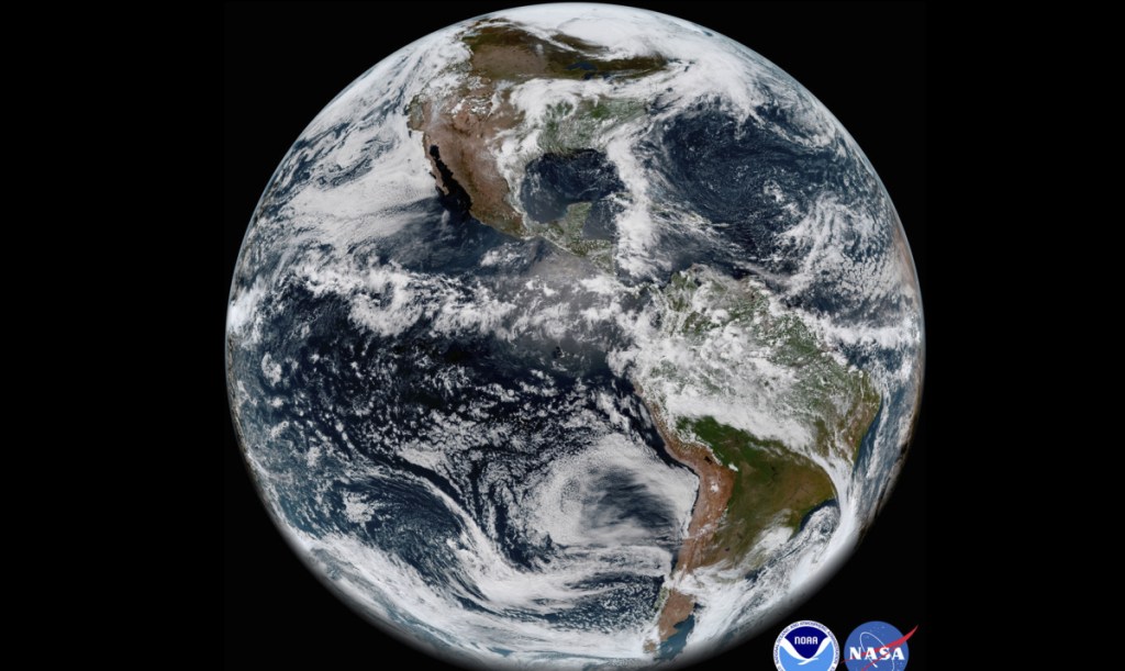
Last week, NOAA reported that critical infrared sensors in the satellite’s main instrument were not staying cold enough. The picture taken May 20 and released Thursday relied mostly on the few unaffected channels in the visible light and near infrared.
NASA launched GOES-17 in March. The problem with the satellite’s advanced imager cropped up during routine testing several weeks after liftoff.
An identical imager, also made by the Florida-based Harris Corp., is working fine on the 2016-launched GOES-16.
Send questions/comments to the editors.

Success. Please wait for the page to reload. If the page does not reload within 5 seconds, please refresh the page.
Enter your email and password to access comments.
Hi, to comment on stories you must . This profile is in addition to your subscription and website login.
Already have a commenting profile? .
Invalid username/password.
Please check your email to confirm and complete your registration.
Only subscribers are eligible to post comments. Please subscribe or login first for digital access. Here’s why.
Use the form below to reset your password. When you've submitted your account email, we will send an email with a reset code.