

DELCAMBRE, La. — Laura roared toward landfall in southwestern Louisiana near the Texas border as a menacing Category 4 hurricane early Thursday, pushing ocean water topped with waves on to a low-lying coast that forecasters said would be inundated with “unsurvivable” storm surge as much as 20 feet deep.
Winds gusted above hurricane force to 91 mph at a coastal monitoring station while Laura was still offshore, and forecasters said even stronger winds were coming that could rip apart buildings, level trees and toss vehicles like toys.
Authorities implored coastal residents of Texas and Louisiana to evacuate, but not everyone did before howling winds began buffeting trees back and forth in an area that was devastated by Rita in 2005.
The storm grew nearly 87% in power in just 24 hours to a size the National Hurricane Center called “extremely dangerous.” Drawing energy from the warm Gulf of Mexico, the system was on track to arrive early Thursday during high tide as the most powerful hurricane to strike the U.S. so far this year.
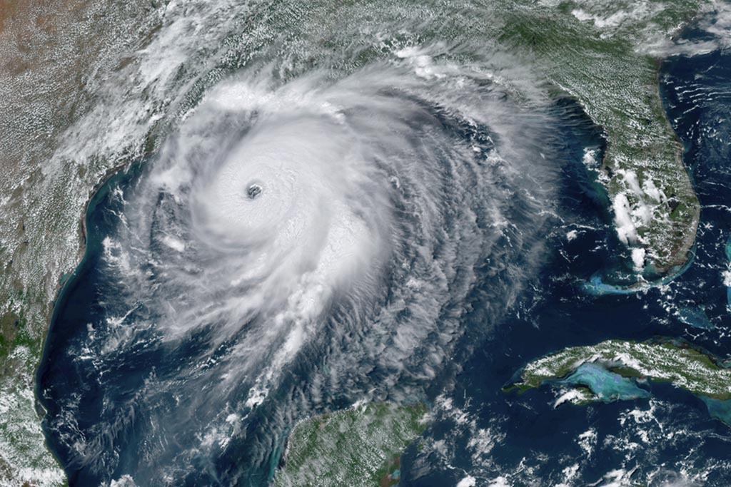
This satellite image taken at 2:40 p.m. EDT Wednesday shows Hurricane Laura over the Gulf of Mexico. Laura strengthened Wednesday into “an extremely dangerous Category 4 hurricane,” the National Hurricane Center said, and was expected to strike Wednesday night into Thursday morning along the Louisiana-Texas border. NOAA via AP
“It looks like it’s in full beast mode, which is not what you want to see if you’re in its way,” University of Miami hurricane researcher Brian McNoldy said.
Hurricane-force winds extending 60 miles from the storm’s center neared the coast, forecasters said, and bands of heavy rain fell 30 miles from the beach in Lake Charles.
Late Wednesday, Laura was churning about 60 miles south of Lake Charles and moving north-northwest at 15 mph.
Maximum sustained winds increased to 150 mph before nightfall, and forecasters said up to 15 inches of rain could fall. Forecasters issued a string of tornado warnings as the storm pushed on to land, but there were no immediate reports of damage. Thousands of homes and businesses were without power.
One major Louisiana highway already had standing water as Laura’s outer bands moved ashore with tropical storm-force winds. Thousands of sandbags lined roadways in tiny Lafitte, and winds picked up as shoppers earlier Wednesday rushed into a grocery store in low-lying Delcambre.
Trent Savoie, 31, said he was staying put. “With four kids and 100 farm animals, it’s just hard to move out,” he said.

Port Arthur, Texas, firefighters watch a sea wall at sunset as they wait for Hurricane Laura to make landfall Wednesday. Associated Press/Eric Gay
Texas Gov. Greg Abbott and Louisiana Gov. John Bel Edwards fretted that the dire predictions were not resonating despite authorities putting more than 500,000 coastal residents under mandatory evacuation orders.
Officials said at least 150 people refused pleas to leave and planned to weather the storm in everything from elevated homes to recreational vehicles in coastal Cameron Parish, which could be completely covered by ocean water.
“It’s a very sad situation,” said Ashley Buller, assistant director of emergency preparedness. “We did everything we could to encourage them to leave.”
Edwards activated the state’s entire National Guard. In Lake Charles, Guard members drove school buses around neighborhoods, offering to pick up families. Across the state line in Port Arthur, Texas, few stragglers boarded evacuation buses, and city officials announced that two C-130 transport planes offered the last chance to leave.
Abbott warned that people who fail to get out of harm’s way could be cut off from help long after the storm hit.
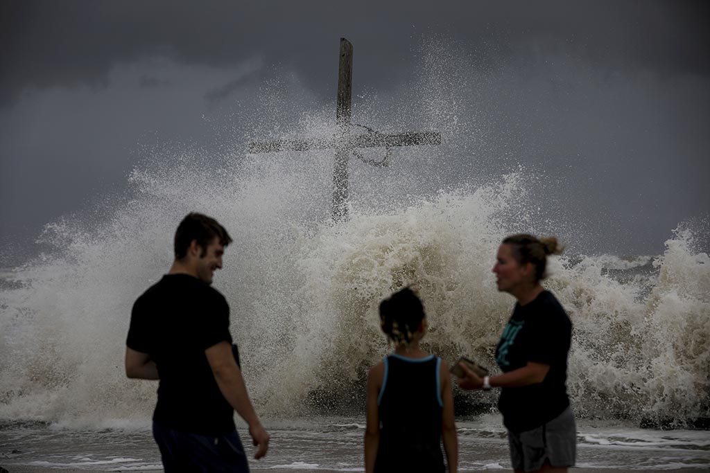
Waves wash ashore as the outer bands of Hurricane Laura bring winds and rain Wednesday in High Island, Texas. Jon Shapley/Houston Chronicle via AP
A Category 4 hurricane can render wide areas uninhabitable for weeks or months and knock out power for just as long. The threat of such devastation posed a new disaster-relief challenge for a government already straining under the coronavirus pandemic. The parts of Louisiana that were under evacuation orders included areas turning up high rates of positive COVID-19 tests.
The National Hurricane Center kept raising its estimate of Laura’s storm surge, from 10 feet just days ago to twice that size — a height that forecasters said would be especially deadly.
By Wednesday night, Laura was churning about 90 miles south of Lake Charles and moving north-northwest at 15 mph.
On Twitter, President Trump urged coastal residents to heed officials. Hurricane warnings were issued from San Luis Pass, Texas, to Intracoastal City, Louisiana, and reached inland for 200 miles. Storm surge warnings extended from Freeport, Texas, to the mouth of the Mississippi River.
For some, the decision to leave home left them with no place to stay. Wary of opening mass shelters during a pandemic, Texas officials instead put evacuees in hotels, but Austin stopped taking arrivals before dawn because officials said they ran out of rooms. Other evacuees called the state’s 211 information line and were directed to Ennis, outside Dallas, only to be told after driving hundreds of miles no hotels or vouchers were available.
Taniquia Ned and her sisters showed up without money to rent a room, saying the family had burned through its savings after losing jobs because of the coronavirus. “The COVID-19 is just totally wiping us out,” said Shalonda Joseph, 43, a teacher in Port Arthur.

People line up to board buses to evacuate Lake Charles, La., on Wednesday, Aug. 26, 2020, as Hurricane Laura approaches. Associated Press/Gerald Herbert
Edwards lamented that the impending storm meant suspension of community testing for COVID-19 at a crucial time — as elementary and secondary schools in Louisiana open and students return to college campuses.
Forecasters said storm surge topped by waves could submerge entire towns. Water was already rising in the small Louisiana community of Holly Beach in the imperiled Cameron Parish.
Laura was expected to cause widespread flash flooding in states far from the coast. Flood watches were issued for much of Arkansas, and forecasters said heavy rainfall could arrive by Friday in parts of Missouri, Tennessee and Kentucky. Laura is so powerful that it’s expected to become a tropical storm again once it reaches the Atlantic Ocean, potentially threatening the Northeast.
Becky Clements, 56, evacuated from Lake Charles after hearing that it could take a direct hit. She and her family found an Airbnb hundreds of miles inland. Almost 15 years have passed since Hurricane Rita destroyed the city.
“The devastation afterward in our town and that whole corner of the state was just awful,” Clements recalled. “Whole communities were washed away, never to exist again.”
The hurricane also threatened a center of the U.S. energy industry as the majority of Gulf oil and natural gas production shut down. Consumers are unlikely to see big price hikes, however, because the pandemic has decimated demand for fuel.
Laura closed in on the U.S. after killing nearly two dozen people on the island of Hispaniola, including 20 in Haiti and three in the Dominican Republic, where it knocked out power and caused intense flooding.
Laura will be the seventh named storm to strike the U.S. this year, setting a new record for U.S. landfalls by the end of August. The old record was six in 1886 and 1916, according to Colorado State University hurricane researcher Phil Klotzbach.
Send questions/comments to the editors.

Success. Please wait for the page to reload. If the page does not reload within 5 seconds, please refresh the page.
Enter your email and password to access comments.
Hi, to comment on stories you must . This profile is in addition to your subscription and website login.
Already have a commenting profile? .
Invalid username/password.
Please check your email to confirm and complete your registration.
Only subscribers are eligible to post comments. Please subscribe or login first for digital access. Here’s why.
Use the form below to reset your password. When you've submitted your account email, we will send an email with a reset code.