


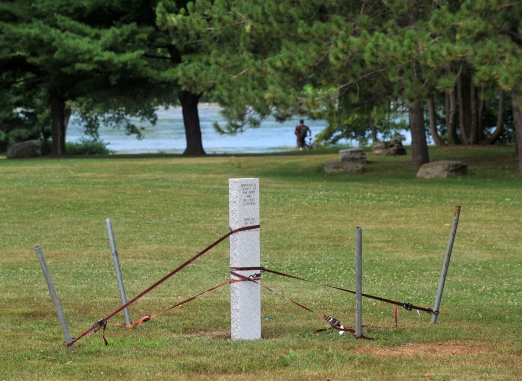
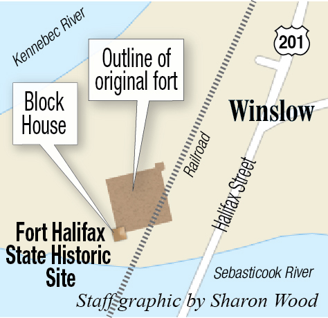
Visitors to Winslow’s Fort Halifax will now have a better idea of how the structure appeared when it was built in 1754. Supporters of the historical site want those visitors to know it was more than just the one blockhouse that stands on the grounds today.
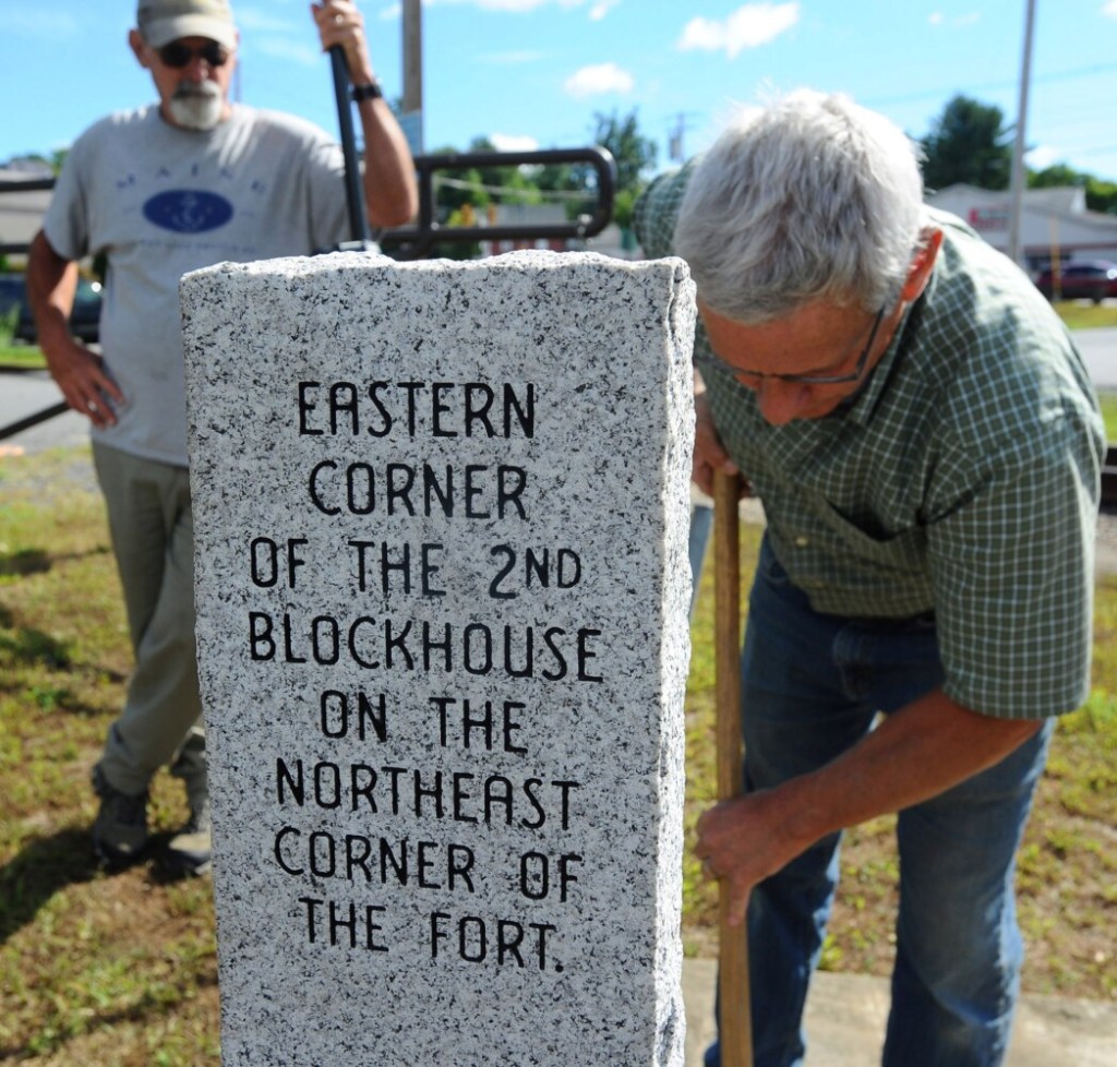
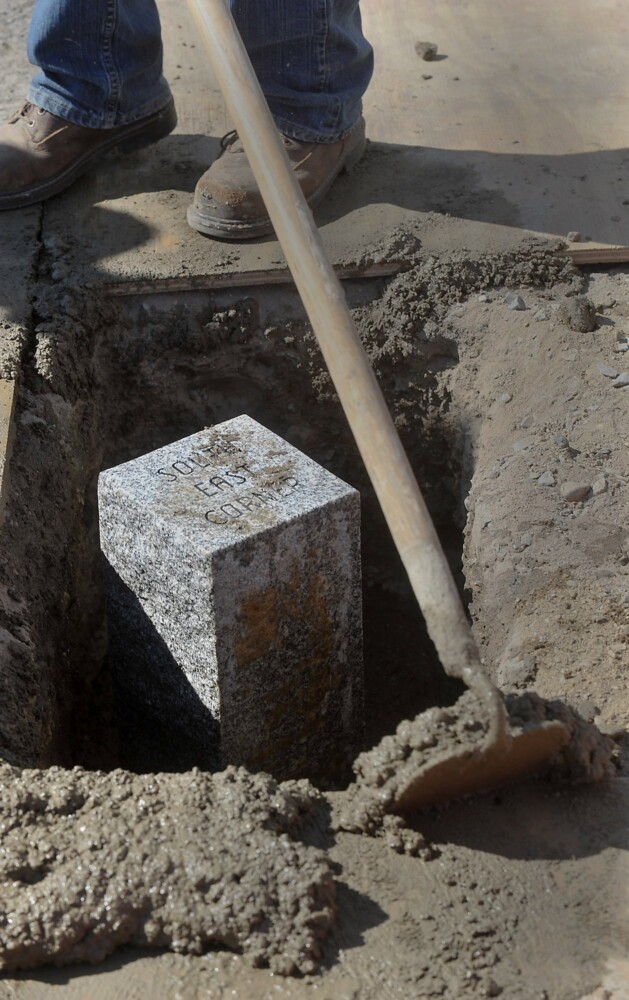
Detailed marking stones for the original corners of Fort Halifax were placed in the ground Wednesday, completing a collaborative effort from the town of Winslow, Winslow Parks and Recreation, Broken Stone Surveyors, Provost Monuments and the Friends of Fort Halifax.
Elery Keene, vice president and secretary of the Friends of Fort Halifax, said the project cost $2,652.
“It’s going to make it possible for people who visit the location to see that Fort Halifax was more than just one blockhouse, and I think that’s important,” Keene said. “We’ve been wanting to have something like this happen for a long time.”

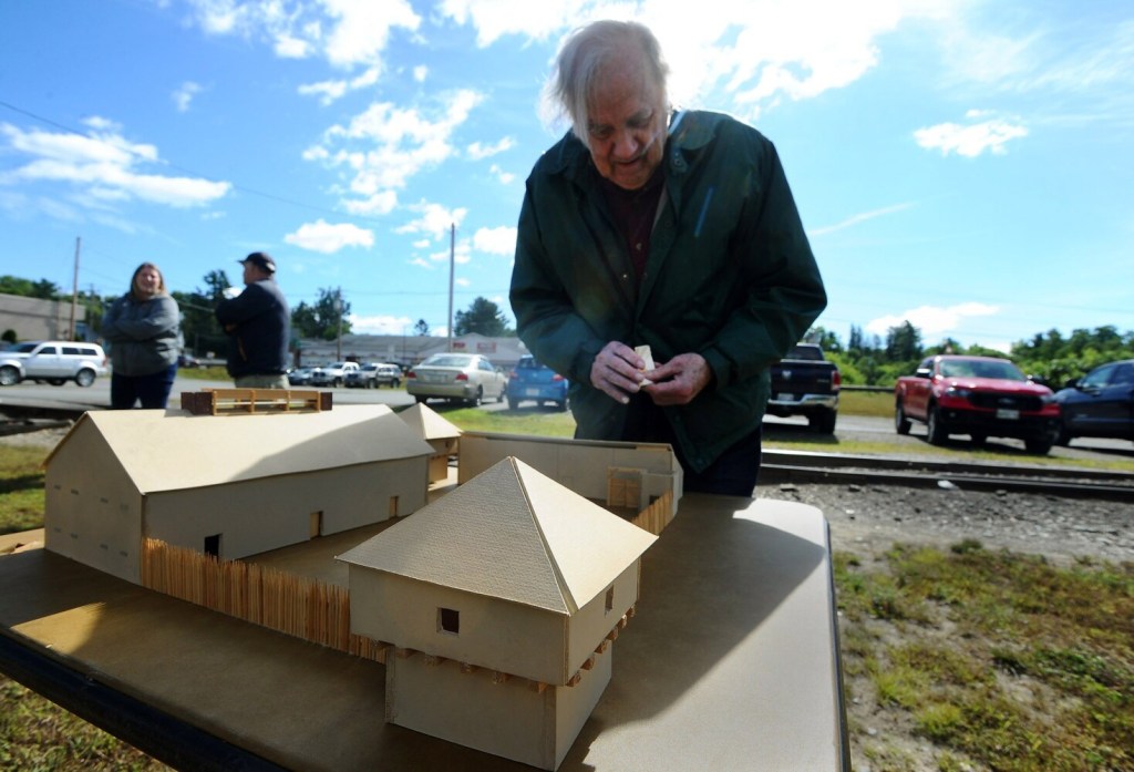
Elery Keene, on Wednesday at Fort Halifax Park, assembles a scale model of Fort Halifax that he made from cardboard and balsa wood. Keene joined others at Fort Halifax Park in Winslow to observe and participate in the installation of three stone corner markers that were placed in the ground to mark the corners of the original fort complex built between 1754 and 1755. Rich Abrahamson/Morning Sentinel Buy this Photo
A National Historic Landmark listed on the National Register of Historic Places and the oldest blockhouse in the United States, Fort Halifax, just off U.S. Route 201, was built by English settlers in 1754. It formerly served as a Massachusetts Bay Colony outpost along the Kennebec and Sebasticook rivers.
Amanda McCaslin, Winslow’s parks and rec director is involved with field trips for local schools, often dressing up to educate the kids. Adding the corners, she said, “brings the history alive.”
“When you think of Winslow, you think of the blockhouse,” McCaslin said. “A group of people over the last 20 years have made that park a beautiful place. By putting these monuments in, it really gives a visual for folks.”
Last fall, Linda Lambert and the members of the Friends of Fort Halifax brought the idea to the town’s attention. Information for the exact placement of the corners came from historical sources, including three maps of the structure from different times.
Lambert, a seventh-grade teacher at Winslow Junior High School, said that she and others bring kids to the fort to measure it and try to recreate it. Without the corners marked, that was hard to do.
“At one point, the Friends of Fort Halifax had a dream of making it an educational site,” Lambert said. “I mentioned that I do that with the students and would love to have the corners, and Ray Caron took it from there.”
Caron, chair of the Winslow Town Council, deflected praise, wanting others to speak for the story.
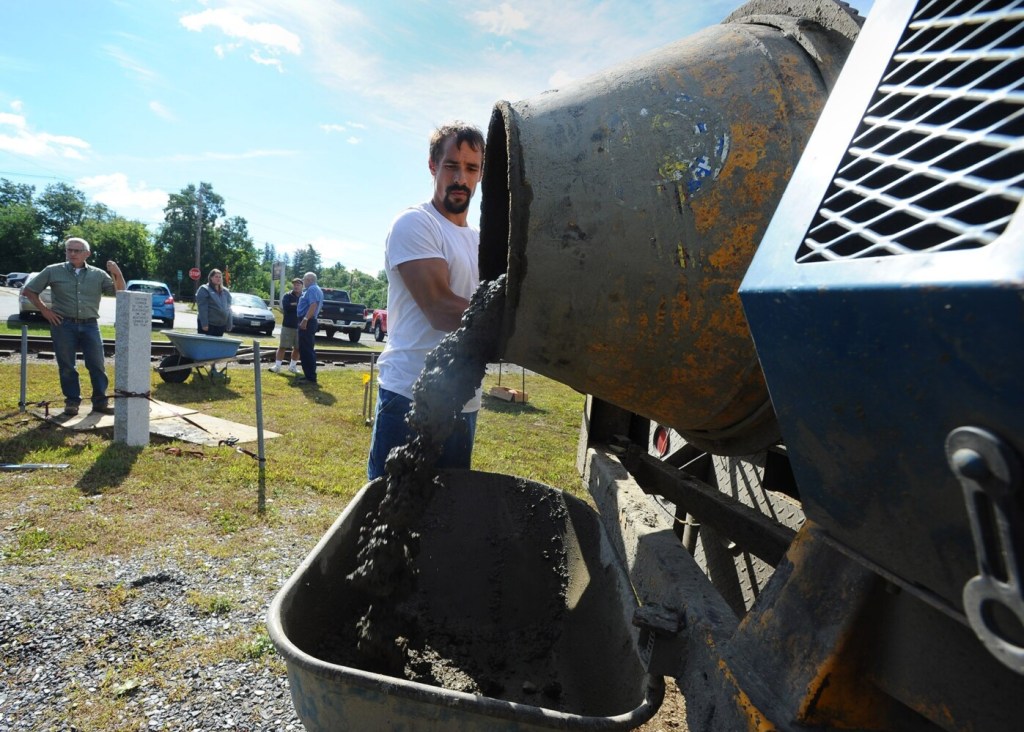
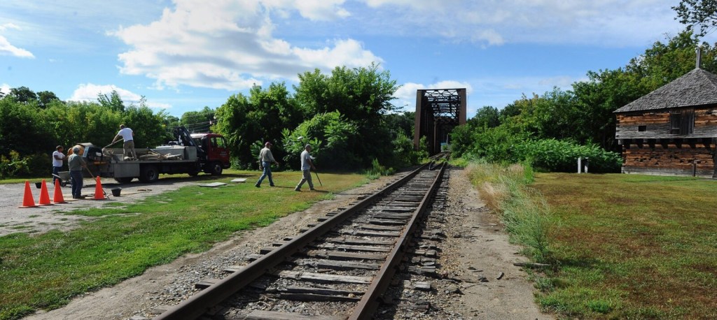
The project, financed by the Friends of Fort Halifax, was completed Wednesday. Provost Monuments dug the holes for the stones Monday. The stones were engraved Tuesday and were placed Wednesday morning by town employees and group members.
With no Fort Halifax Days this year due to the coronavirus pandemic, the project offered a different but positive experience.
“It’s what founded this community,” Winslow interim Town Manager Paul Fongemie said. “Fort Halifax was here long before the town of Winslow was. It’s the history of the town.”

Albert Spencer of Provost Monuments prepares concrete for the installation of stone corner markers that were placed in the ground to mark the corners of the original fort complex built between 1754 and 1755. One of the markers is shown at the left. The work was completed Wednesday at Fort Halifax Park in Winslow. Rich Abrahamson/Morning Sentinel Buy this Photo
Bob Knowlton of Broken Stone Surveyors conducted research for the stone placement. He worked with archaeologist Leon Crammer. The maps used include a recent project by Winslow resident Ernie Baker, developed in 2019. Another oft-referenced map is one by Timothy Paine from 1852.
Knowlton and surveyor Frank Siviski worked on the project together. The site was flooded in 1987, and Crammer worked on the repairs. He determined where the corners were onsite with Knowlton and Siviski.
“We went out and surveyed everything that was there, all the utilities, building railroads, parking, whatever was there,” Knowlton said. “In the course of doing that, we found some granite monuments that appeared to be close to where the original corners were.”
Ernie Baker, a longtime member of the Friends of Fort Halifax, provided the maps to help determine where the corners were.
“We just wanted to outline the fort with some permanent markers, just an outline of the original fort,” Baker said. “The whole outline of the layout there of the fort, to give some idea of what it looked like.”
Send questions/comments to the editors.

Success. Please wait for the page to reload. If the page does not reload within 5 seconds, please refresh the page.
Enter your email and password to access comments.
Hi, to comment on stories you must . This profile is in addition to your subscription and website login.
Already have a commenting profile? .
Invalid username/password.
Please check your email to confirm and complete your registration.
Only subscribers are eligible to post comments. Please subscribe or login first for digital access. Here’s why.
Use the form below to reset your password. When you've submitted your account email, we will send an email with a reset code.