

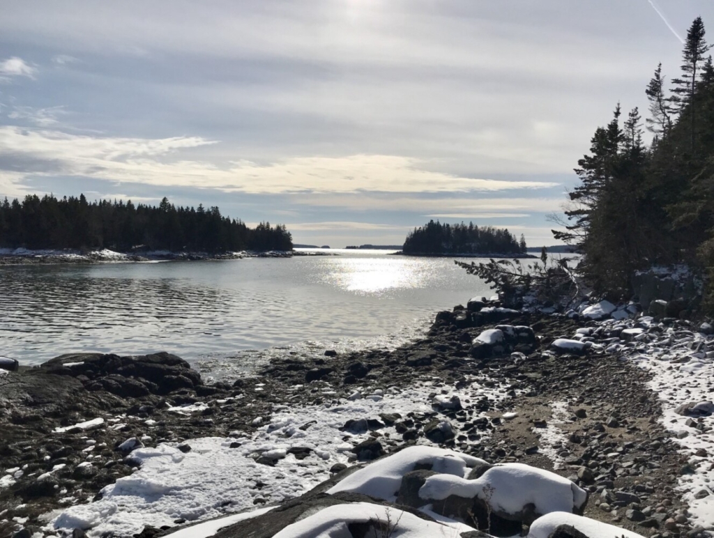
A view of Narrows and Hog islands in the afternoon light of a winter’s day at the Frank E. Woodworth Preserve in Downeast Maine. Carey Kish photo
After a good half-hour of sauntering through the powdery snow beneath a canopy of shadowy spruce, the narrow path gave way to spacious blue skies over the deep green waters of Alaska Cove. Quite confident I wasn’t in Alaska, but rather firmly in Maine at one of the prettiest spots anywhere along the Downeast coast, I paused for a long while to admire the view eastward over Pleasant Bay to Mary Look Point and Cape Split on the Addison Peninsula.
After several visits to the Frank E. Woodworth Preserve in Harrington, no one I’ve talked with can do more than speculate about the curious name “Alaska Cove.” Perhaps it was derived from the native Abenaki, or given by some Maine fisherman who’d spent time working the seas off the state of Alaska, hard to say. The Aleut idiom for Alaska is Alyeska, meaning “great land” or “the object toward which the action of the sea is directed,” both of which could certainly apply to this remote and beautiful place.
Owned and managed by the Maine Coast Heritage Trust, the Frank E. Woodworth Preserve encompasses 127 acres on Willard Point at the southern end of Ripley Neck, the 3-acre Hog Island to the south, and Peter and George islands, each about a quarter-acre in size, to the east.
Frank Woodworth was a local fisherman who lived in this area as well as on Narrows Island, which lies just southeast of Willard Point. Woodworth was a longtime friend of the Joseph Parsons and George Milmine families, owners and stewards of the property for nearly 100 years. In the 1980s, the Milmines protected much of the point with conservation easements, and in 2007, the Maine Coast Heritage Trust purchased the land.
A 2.5-mile lollipop loop leads hikers through the mossy-green woods, which are dominated by a mature growth of red spruce, white birch, balsam fir and northern white cedar. Some of the spruce are over 100 feet tall and two feet or more in diameter. The wildlife-rich preserve is home to several dozen bird species, including bald eagles, and there are deer aplenty plus moose, foxes, porcupines, red squirrels and snowshoe hares.
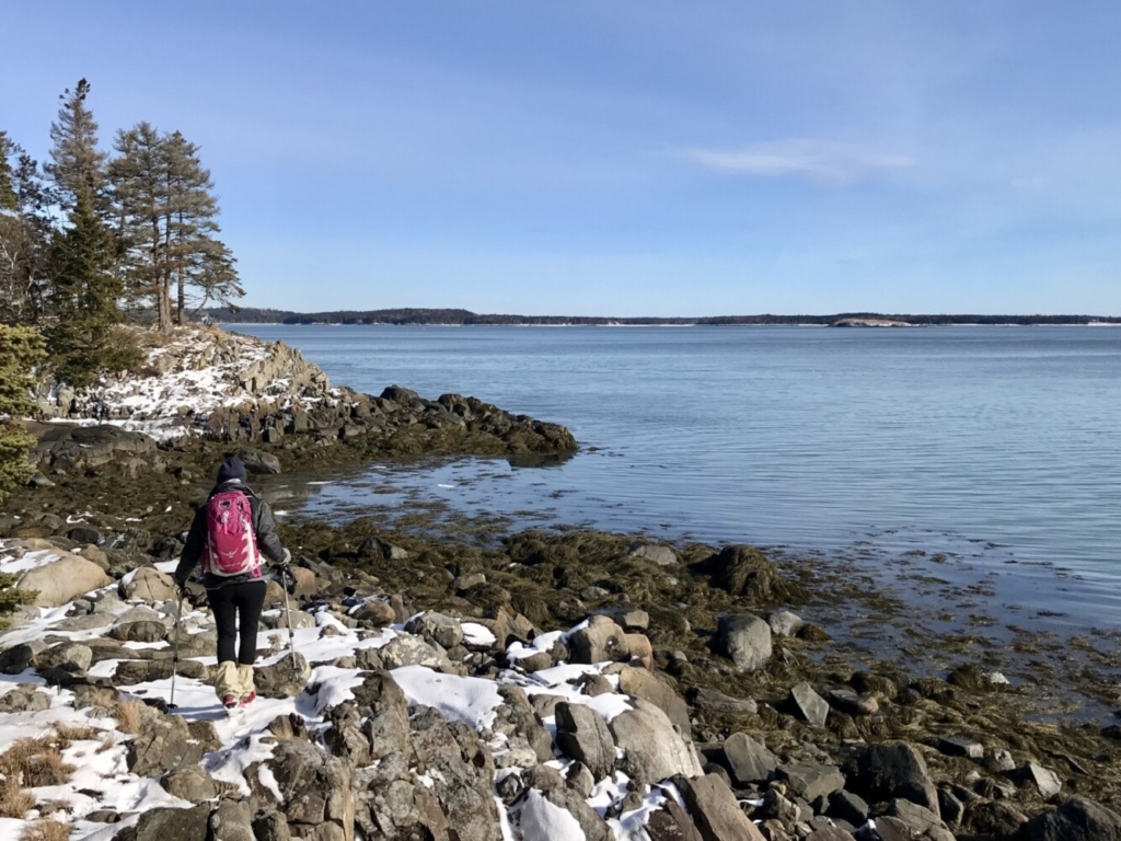
A hiker enjoys the view over Pleasant Bay to the Addison Peninsula at the Frank E. Woodworth Preserve in Harrington. Carey Kish photo
From Alaska Cove, important as a waterfowl feeding area and productive clam flats, the trail wends southwest to a point immediately opposite George Island and Peter Island. Both tiny islands are accessible at low tide and worth some time exploring. Do be alert to the tides, however, to avoid becoming stranded. Upper Birch and Lower Birch islands are in view as you look north up Pleasant Bay to the mouth of the Pleasant River.
The trail continues to hug the shoreline, with several more access points that offer views to Narrows Island, then Hog Island and eventually Bar Island, where Nash Island Light comes into sight far to the south. Ahead, just before turning inland, there’s a short spur trail leading to a promenade overlooking Fisherman’s Cove; across the cove you’ll see a dock and structures of an old saltwater farm. A wonderful spot to linger for a while, the vista south and west looks out past Hen Island to Strout Island and then Dyer Island in Pleasant Bay and well beyond.
In the 1880s, Point Ripley at the southwest end of Ripley Neck was developed as a summer community for “rusticators,” city dwellers from away who came to the Maine coast for the period from July Fourth to Labor Day, delivered by steamer from Boston. These were economic boom times for the region, with Harrington a shipbuilding hub and Cherryfield a logging town. In the 1890s, a hotel was built at Point Ripley and a local ferry carried people and goods to and from Addison. Little remains today but the rich history of a bygone era.
The Frank E. Woodworth Preserve is open all year and makes an especially nice snowshoe trek in winter. The trailhead is eight miles south of U.S. Route 1 on Marshville Road, with the last mile of the drive to the small parking area (space for two or three cars) on gravel. Note: On my last winter visit, the final half-mile wasn’t plowed, thereby adding a mile round-trip to the hike. So, if there’s snow when you go, plan accordingly.
Visit the Maine Coast Heritage Trust online at mcht.org for more info and a trail map for the Woodworth Preserve and dozens of others the organization maintains along the sinuous coastline from Casco Bay to Passamaquoddy Bay.
Carey Kish of Mt. Desert Island is the author of AMC’s Best Day Hikes Along the Maine Coast and author/editor of the AMC Maine Mountain Guide. Follow Carey’s adventures on Facebook @Carey Kish
Send questions/comments to the editors.

Success. Please wait for the page to reload. If the page does not reload within 5 seconds, please refresh the page.
Enter your email and password to access comments.
Hi, to comment on stories you must . This profile is in addition to your subscription and website login.
Already have a commenting profile? .
Invalid username/password.
Please check your email to confirm and complete your registration.
Only subscribers are eligible to post comments. Please subscribe or login first for digital access. Here’s why.
Use the form below to reset your password. When you've submitted your account email, we will send an email with a reset code.