

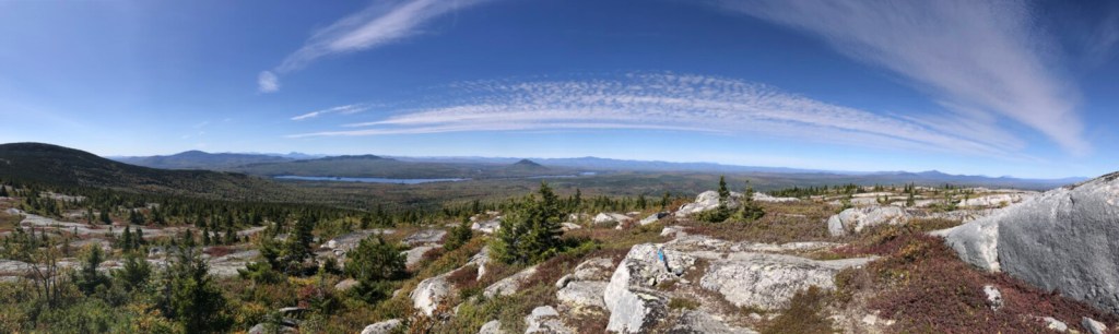


Moxie Bald Mountain rises to 2,630 feet in the wild country of Bald Mountain Township in Somerset County, the highest point along the Appalachian Trail between the Kennebec River and Monson. Burned mostly bare by forest fires over the years, Moxie Bald’s extensive open granite ledges reward hikers with extraordinary views in every direction.
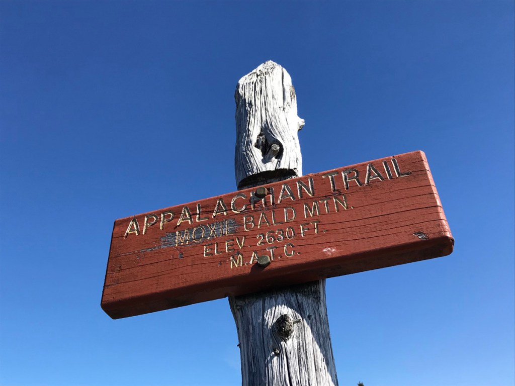
A small trail sign and the metal footings of the old 1919 fire lookout tower mark the top of Moxie Bald. The tower, one of 144 that once stood guard over Maine’s forests, was removed in 1994. From this vantage point – across the blue waters of Moxie Pond – Pleasant Pond Mountain and Mosquito Mountain stand tall, as does Moxie Mountain southwest of the pond.
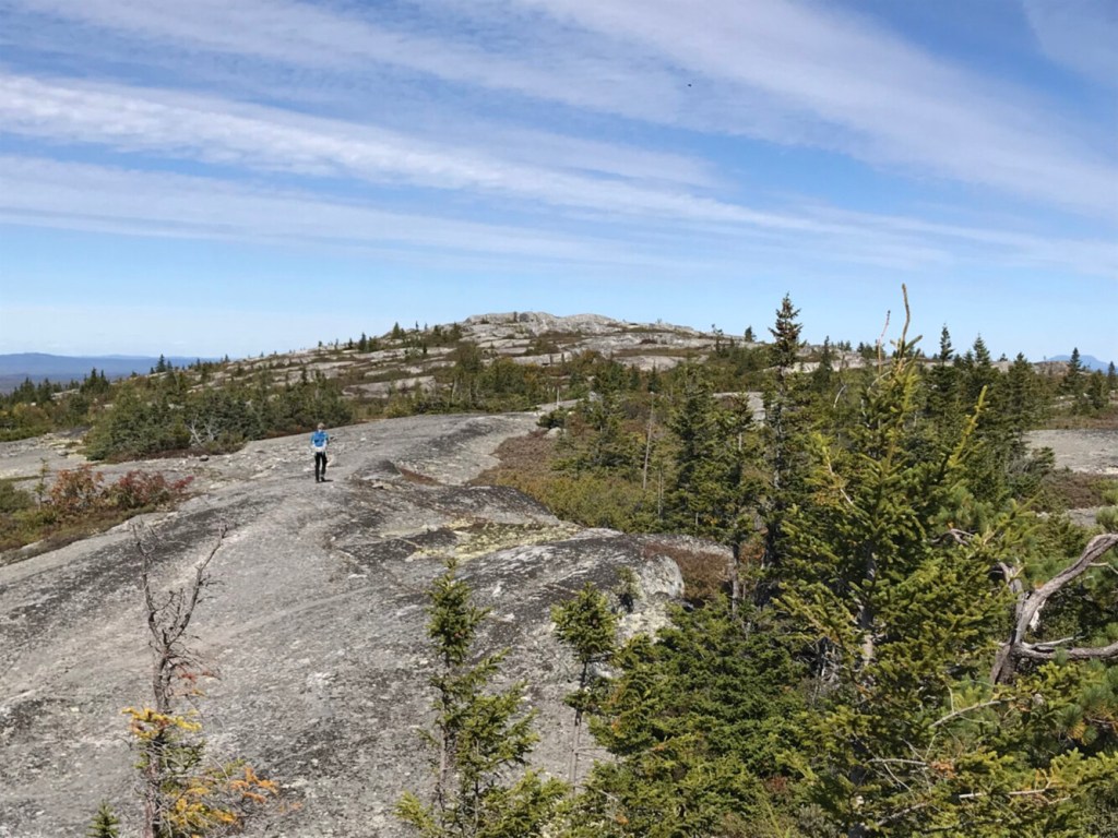
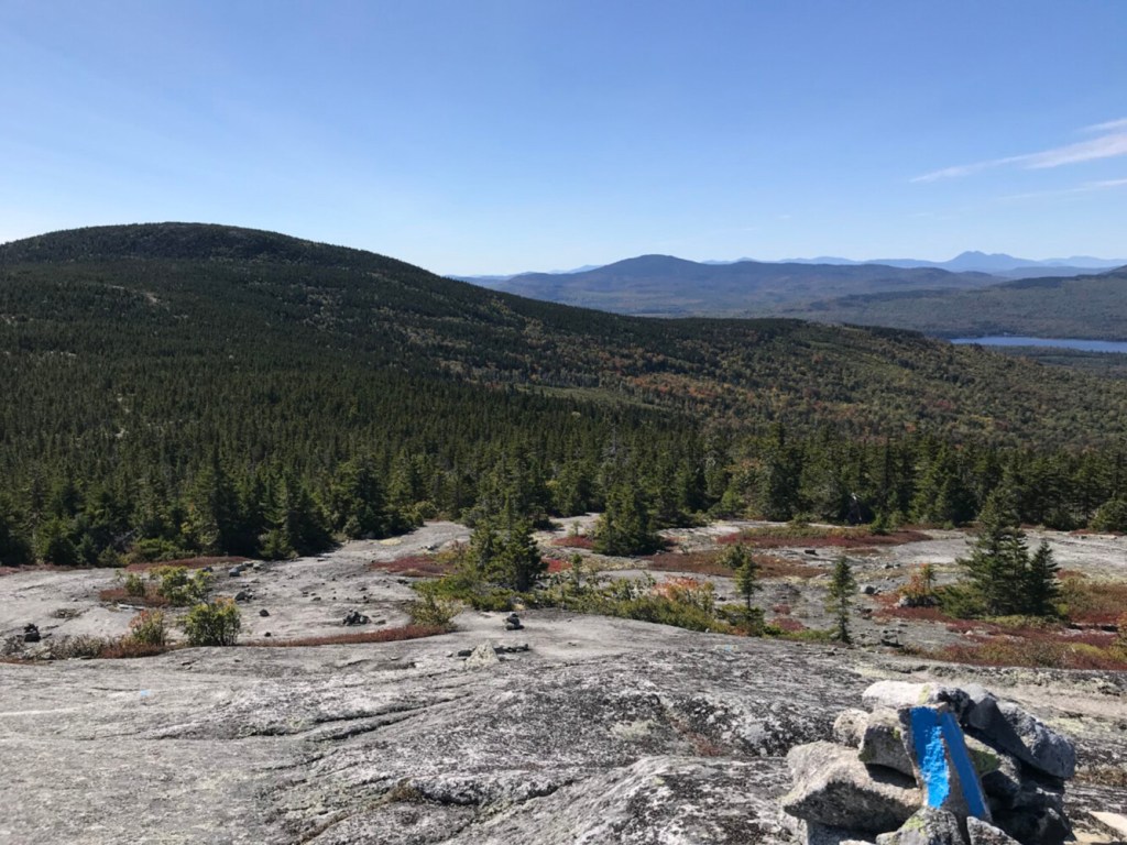
A mile and a half to the north via the AT and a blue-blazed side trail is the 2,350-foot north peak of Moxie Bald Mountain, a lightly visited gem that features even more open bedrock terrain. You’re likely to have the place to yourself while you enjoy the view that ranges from the High Peaks Region and the Canadian border around Jackman to Moosehead Lake and across the 100-Mile Wilderness to Katahdin.
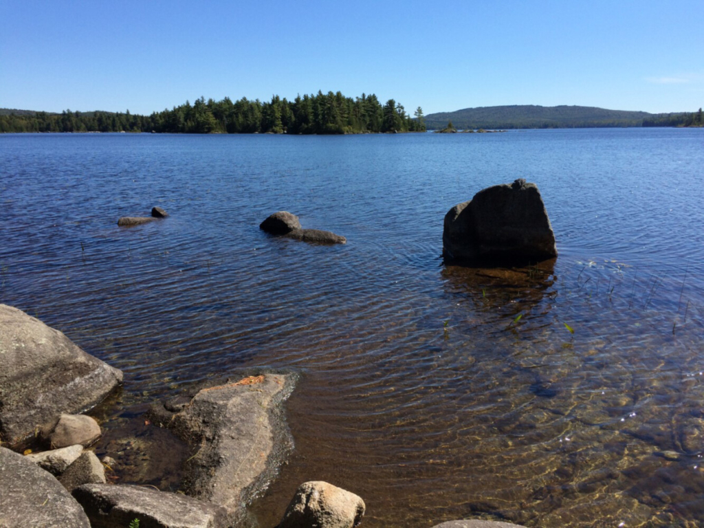
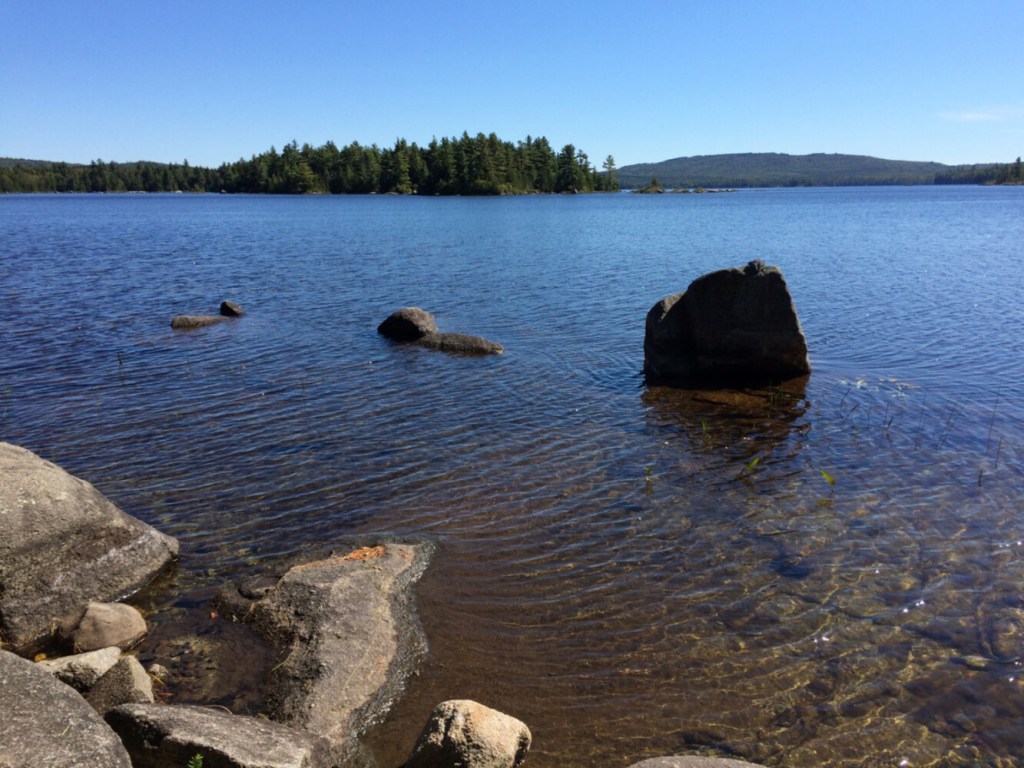
Pristine Bald Mountain Pond as viewed from the Appalachian Trail leanto site on the north shore. Photo by Carey Kish
To the east of sprawling Moxie Bald Mountain is Bald Mountain Pond, a pristine 1,200-acre expanse that has, incredibly, remained undeveloped over time except for just two leased camps. Popular with anglers for its trout fishery, hikers on the AT have enjoyed the place too, camping at the log lean-to on the pond’s north shore.
The Maine Appalachian Trail Land Trust, among others in the conservation community, has long considered Bald Mountain Pond as the highest priority conservation project along the entire 282-mile Maine AT corridor. The MATLT’s mission is to acquire and protect land around the AT, and over the last 20 years, the group has worked to buffer the AT with thousands of critical acres on Mount Abraham, Saddleback, White Cap, the Crockers and Mount Redington, so it’s little wonder that the Moxie Bald area was in their sights.
“Moxie Bald and Bald Mountain Pond, it’s the whole package, undeveloped and unspoiled,” said Simon Rucker, MATLT’s executive director. “You’ve got the ecological significance, the AT, you can hike, fish, canoe and camp.”
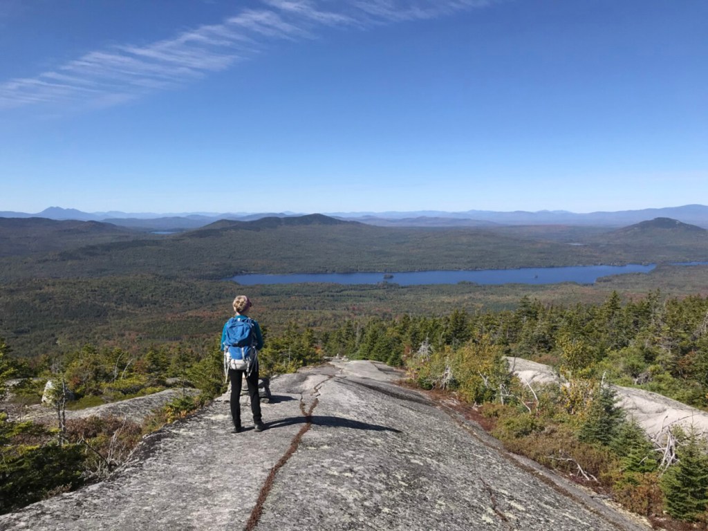
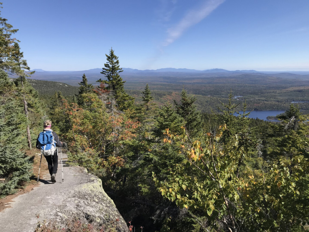
Bald Mountain Pond as seen from the summit ledges atop Moxie Bald Mountain. Photo by Carey Kish
Bald Mountain Pond has Arctic char, as known as blue-backed trout, which are native only to Alaska and Maine, and here they’re found only in 14 ponds, according to Rucker. There’s prime Canada lynx habitat and wetlands for inland waterfowl and wading birds. Classified as a “Mid-elevation Bald,” Moxie Bald is home to rare and fragile Alpine and sub-Alpine vegetation. There’s also a large area of old growth spruce and fir forest.
“All of these things are why it’s worth conserving,” Rucker said.
Lo and behold, it was just about a year ago that the Trust for Public Land announced it had purchased more than 2,600 acres around Bald Mountain Pond and on the south ridge of Moxie Bald Mountain from Weyerhaeuser, the forest products company. TPL worked with the State of Maine, the Maine Appalachian Trail Land Trust, Poland Spring, the National Park Service, the U.S. Fish and Wildlife Service and a handful of other partners to acquire the needed funds to make the conservation deal a reality.
The NPS now owns and manages the additional land on Moxie Bald, while the MATLT owns and manages the land around Bald Mountain Pond. The Maine Dept. of Inland Fisheries and Wildlife is responsible the public boat launch at the south end of the pond, where there is road access from the south at Route 16 in Moscow.
Day hikers can reach Moxie Bald Mountain via the AT from Troutdale Road at the south end of Moxie Pond, a moderate 5-mile hike (one-way) that gains about 1,650 feet. Add another 3 miles round-trip if you want to tackle the north peak. Backpackers can make it a one- or two-night in-and-out trek by staying at the AT shelters at Bald Mountain Brook and Bald Mountain Pond. Or you might just want to hike the entire 34-mile AT section from Caratunk to Monson, a fabulous three- to four-day journey.
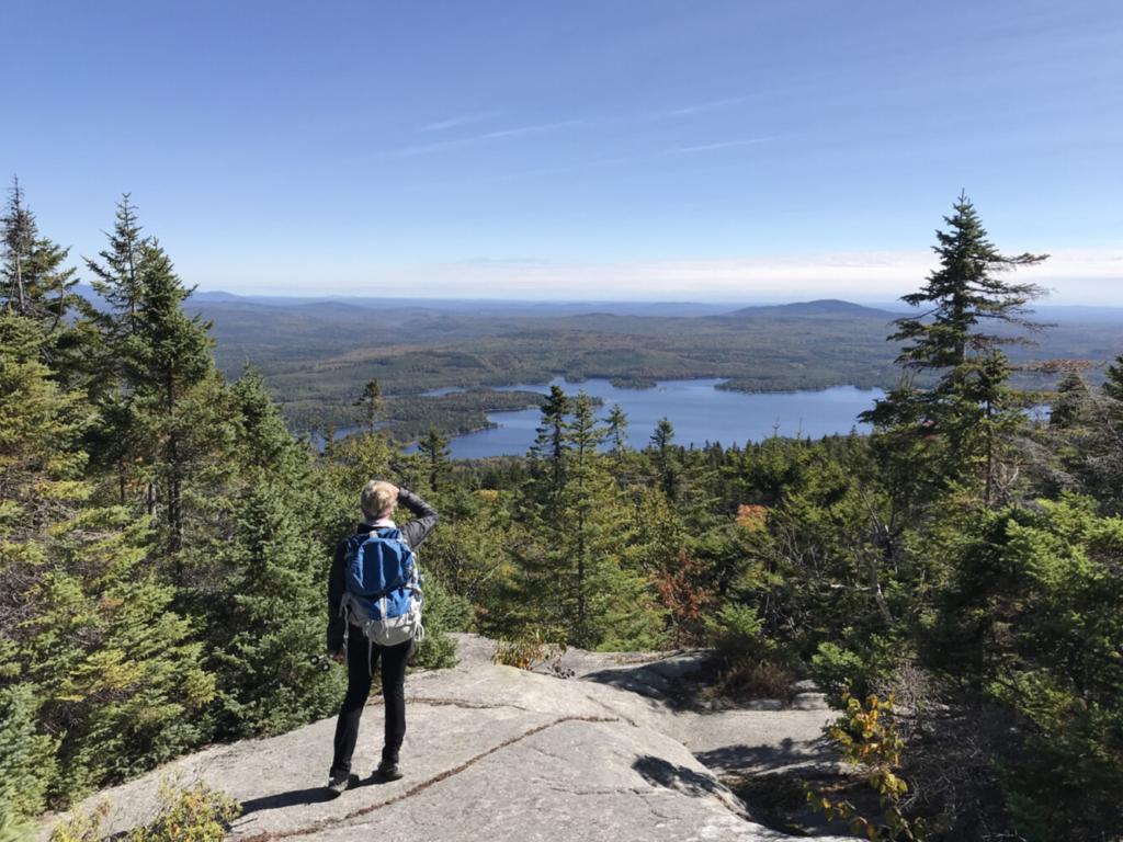
The view north from Moxie Bald Mountain’s summit ledges extends over the 100-Mile Wilderness to Katahdin. Photo by Carey Kish
However you choose to adventure on Moxie Bald, enjoy the big views and remember to tip your hiking cap to the conservationists for their amazing work in preserving this precious place.
Carey Kish of Mount Desert Island is the author of AMC’s Best Day Hikes Along the Maine Coast and editor of the AMC Maine Mountain Guide. Follow Carey’s adventures on Facebook @CareyKish
Send questions/comments to the editors.

Success. Please wait for the page to reload. If the page does not reload within 5 seconds, please refresh the page.
Enter your email and password to access comments.
Hi, to comment on stories you must . This profile is in addition to your subscription and website login.
Already have a commenting profile? .
Invalid username/password.
Please check your email to confirm and complete your registration.
Only subscribers are eligible to post comments. Please subscribe or login first for digital access. Here’s why.
Use the form below to reset your password. When you've submitted your account email, we will send an email with a reset code.