

Sometimes it is the name that entices you. Years ago, we were scanning a map of the Allagash region and there it was, a teardrop of water called Frozen Ocean. Road trip in order. Recently, we made another unique name come alive with a three-hour exploration of Brave Boat Harbor in York, contained within the Rachel Carson National Wildlife Refuge.
Our usual paddling mantra is “canoes for inland waters, sea kayaks for ocean waters.” This outing is an exception to that rule. Tidal Chauncey Creek leads a mile out to a protected harbor connected to the open Atlantic by a 100-yard wide opening.
You will have to time your outing within the period between 90 minutes before high tide and two hours after high tide. We arrived an hour before that and there was no Chauncey Creek, just a narrow ribbon of mud leading east into marsh grasses and wind-sculpted trees. As water started to pour into the channel, we carried our canoe down to the water from the Chauncey Creek Road causeway and readied to head to the sea. A pair of kayakers and two paddleboarders sat alongside us waiting for two more inches of water so we could start our journey. My wife remarked that it must have been like this at the Oklahoma Land Rush in April of 1889, when 50,000 dreamers excitedly waited at the border for the official word to surge forward. A snowy egret probed the shallows a few yards to our right as we waited.
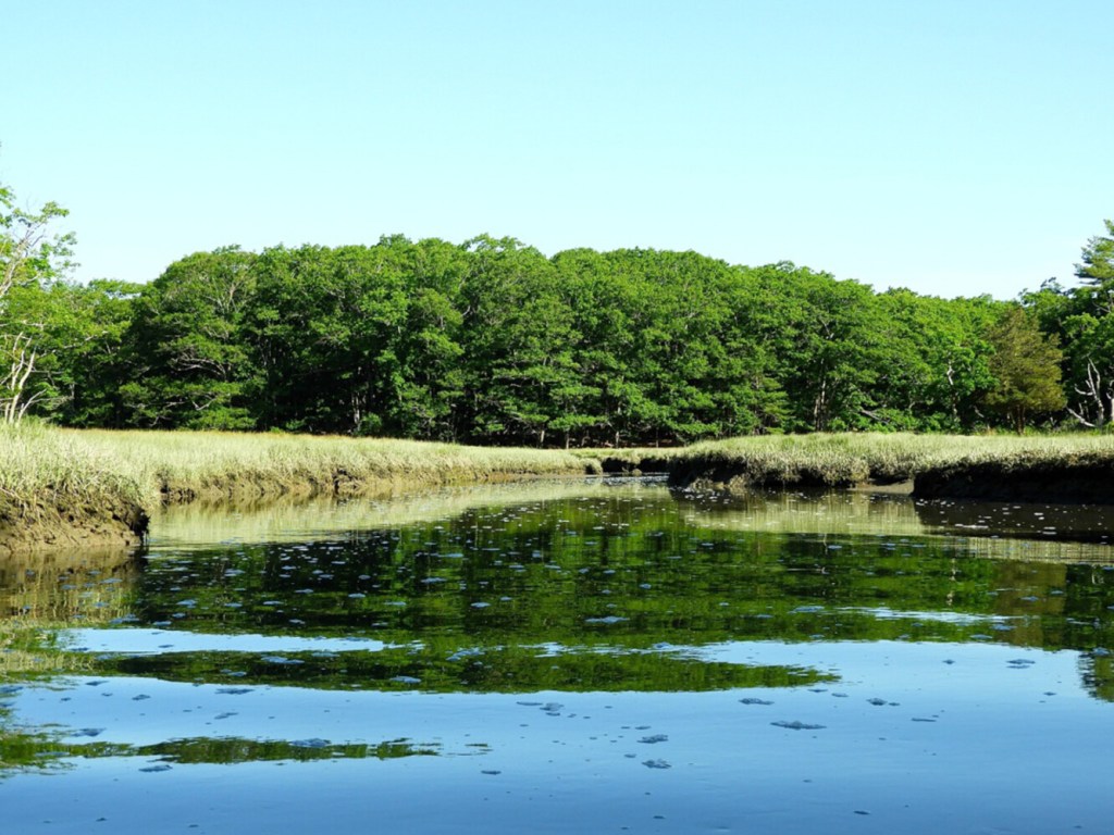
Most of the water filling the creek comes from Brave Boat Harbor, and some from the opening through the causeway. The current was stiff as we followed the twisting channel toward the harbor. We rounded a tight bend and saw a bald eagle perched on the end of a pine branch looking out to where we were going.
It did not take long before we could smell the intoxicating aroma of the open sea, and hear the ever increasing crescendo of tumbling surf. Even on this calm day, the sound of the sea meeting America was impressive. Gulls and cormorants crisscrossed the airspace above us as we entered the turquoise waters of the starfish-shaped harbor.
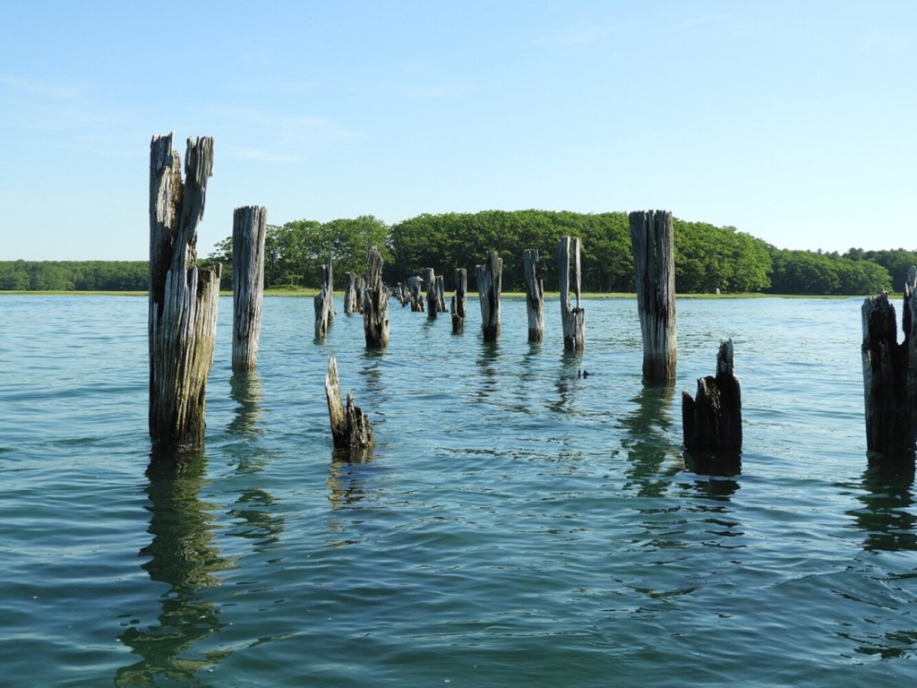
A long line of weathered posts bisected the harbor ahead of us; the rotting pilings of the Portsmouth, Kittery and York Street Railway line that served locals and summer tourists alike for over 25 years, ending service in 1923 due to the increasing affordability of the automobile. The flattened green marsh grasses glistened in the morning sun. Long ago, this vast expanse of grass was harvested as salt hay. We marveled that this area of busy economic and transportation activity had reverted back to wilderness as the decades moved on and economies and lifestyles evolved.
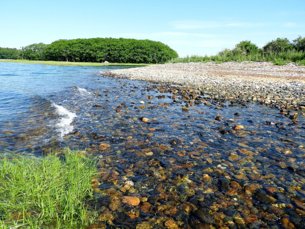
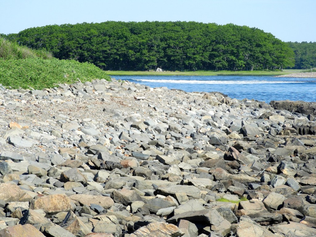
We paddled a few hundred yards further east, and pulled our canoe up onto a protected cobble beach on the right. We walked around the corner of Sea Point to a couple of flat oceanside ledges to watch the breakers roll in. From this vantage point, it became clear why this was called Brave Boat Harbor. The shallows east of the harbor mouth are an extremely difficult place to safely navigate a boat though.
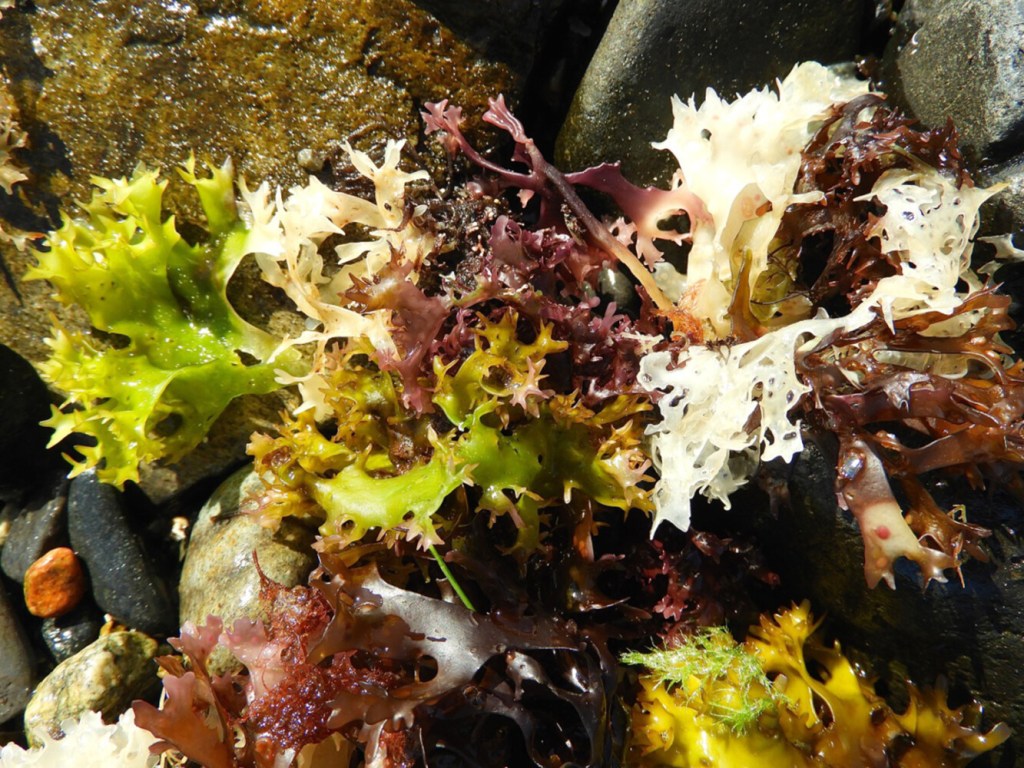
Although nesting season is over for most waterfowl, keep in mind this is a wildlife refuge. Steer clear of all waterfowl swimming in the harbor with their young ones. We landed on a small beach near the harbor mouth to swim, scanning the shoreline to make sure we were clear of any wildlife. Thick necklaces of freshly deposited Irish moss lined the shoreline. Multiple colors mixed together in a rich tapestry, reminding us of Hawaiian leis.
The tide had turned, and it was time to head back. There are lots of options for the drive home. Near the causeway, the Chauncey Creek Lobster Pier offers an open-air deck hanging out over the clear waters of the Chauncey Creek river. Up the road in Kennebunkport sits the largest collection of electric trolleys in the world at the Seashore Trolley Museum. One of the cars in the collection made daily runs across Brave Boat Harbor a hundred years ago.
Consult the DeLorme Maine Atlas and Gazetteer (map No. 1) for help in getting to the primitive boat launch at the junction of Chauncey Creek Road and Seapoint Road a mile east of Kittery Point. This is also the trailhead for the 1.8-mile Cutts Island loop trail. There is room to park on the side of the road.
Michael Perry is the former director of the L.L. Bean Outdoor Discovery Schools, and founder of Dreams Unlimited, specializing in inspiring outdoor slide programs for civic groups, businesses, and schools. Contact: michaelj_perry@comcast.net
Copy the Story LinkSend questions/comments to the editors.

Success. Please wait for the page to reload. If the page does not reload within 5 seconds, please refresh the page.
Enter your email and password to access comments.
Hi, to comment on stories you must . This profile is in addition to your subscription and website login.
Already have a commenting profile? .
Invalid username/password.
Please check your email to confirm and complete your registration.
Only subscribers are eligible to post comments. Please subscribe or login first for digital access. Here’s why.
Use the form below to reset your password. When you've submitted your account email, we will send an email with a reset code.