

High heat and humidity returned to Maine on Thursday and will increase through Friday, prompting warnings from forecasters. The good news? It won’t last long.
Heat value indexes — or the “feels like” temperature — were near 90 degrees Thursday afternoon and will climb into the mid-90s to low 100s on Friday. A cold front will bring some relief from the heat and humidity later in the day, but a round of thunderstorms is likely in the afternoon.
The National Weather Service has issued a heat advisory for Androscoggin, Cumberland, Sagadahoc and York counties that will be in effect from 10 a.m. to 8 p.m. Friday.
“The heat and humidity go up a notch (Thursday) but will peak during the day on Friday,” said Jerry Combs, a meteorologist with the weather service office in Gray.
On Friday, the “feels like” temperature in the Portland and Lewiston regions will likely top out in the mid- to upper 90s, but the heat will be slightly less oppressive in the Augusta area, Combs said. In York County, though, some towns could see temperatures top 100 degrees.
“During the day on Friday, a frontal boundary will approach, bringing a chance of showers and thunderstorms from late morning through early evening,” Combs said. “Some of those could be strong to severe during that time frame.”
The air quality for Friday is predicted to be good for most of the state, and no alerts or advisories have been issued, according to the Maine Department of Environmental Protection. The DEP says the Midcoast and southern coast, as well as higher elevations, will have moderate air quality Friday, suggesting that people sensitive to poor air reduce exertion outdoors.
The weather service and state officials both say that people should avoid going outside during the hottest hours Friday, especially if they are sensitive to extreme temperatures.
“Extreme heat and humidity can be dangerous, especially for our most vulnerable residents,” Pete Rogers, director of the Maine Emergency Management Agency, said in a statement. “We urge Mainers and visitors to take precautions — stay hydrated, limit outdoor activity during peak hours, and check on neighbors, especially older adults. Taking simple steps can make a big difference in staying safe and healthy during these weather conditions.”
The agency has a list of cooling centers available on its website and urges people without internet access to call 211 to find the cooling center close to them.
Cooling centers open Friday include the Portland Public Library’s Monument Square location, the Family Ice Arena and Falmouth Memorial Library in Falmouth, the Hubbard Free Library in Hallowell, the Gray and Scarborough public libraries, and the lobby of the Lisbon Police Department.
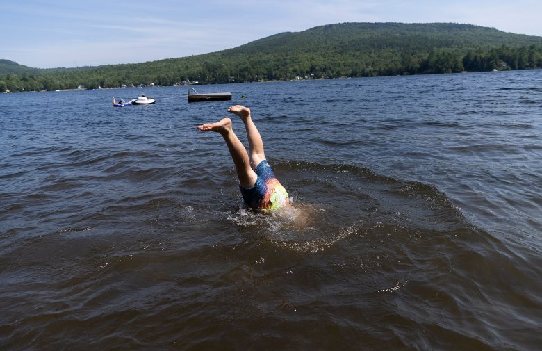
Portland officials are also urging people to take advantage of the Deering Oaks Ravine and the splash pads at Peppermint Park, Payson Park and the Stone Street playground to stay cool.
Experts say everyone should take precautions in extreme heat — which is the leading cause of weather-related deaths, according to the World Health Organization — but those with preexisting health conditions, children and older adults should take extra care.
The Maine Center for Disease Control and Prevention recommends a number of steps to protect yourself and others, including using air conditioning at home or going to a cooling center or other public places that have it.
Those who have to go outside should try to stay out of the sun as much as possible, take frequent breaks, and wear loose, lightweight clothing, a hat and sunscreen. When possible, people should shift outdoor activities to the cooler morning or evening hours.
The CDC also recommends drinking more fluids than usual and avoiding alcohol, caffeine and sugary drinks.
Officials say it is also important to seek medical care for anyone who is experiencing symptoms like muscle cramps, very heavy sweating, shortness of breath, dizziness, headaches, confusion, weakness or nausea.
Combs, from the weather service, said temperatures over the weekend will be warm, but not as hot as Friday. Temperatures for much of the state will reach the mid-80s on Saturday, then drop a little on Sunday. There will be more chances for showers and storm going into Sunday, he said.


We invite you to add your comments. We encourage a thoughtful exchange of ideas and information on this website. By joining the conversation, you are agreeing to our commenting policy and terms of use. More information is found on our FAQs. You can update your screen name on the member's center.
Comments are managed by our staff during regular business hours Monday through Friday as well as limited hours on Saturday and Sunday. Comments held for moderation outside of those hours may take longer to approve.
Join the Conversation
Please sign into your CentralMaine.com account to participate in conversations below. If you do not have an account, you can register or subscribe. Questions? Please see our FAQs.