
BETHEL REGION
Grafton Notch Scenic Byway
Distance: 21 miles (Bethel to Upton)
Highlights: Sweeping mountain views, cascading waterfalls, and scenic hiking pull-offs make this route a standout. In spring, keep an eye out for moose descending from the mountains as you approach the notch.
Evan’s Notch Road (Route 113)
Distance: 25 miles (Gilead to Fryeburg)
Highlights: A less-traveled drive along the Maine-New Hampshire border, this route winds through the White Mountain National Forest. Expect dense forests, striking mountain backdrops, and a serene, off-the-beaten-path atmosphere.
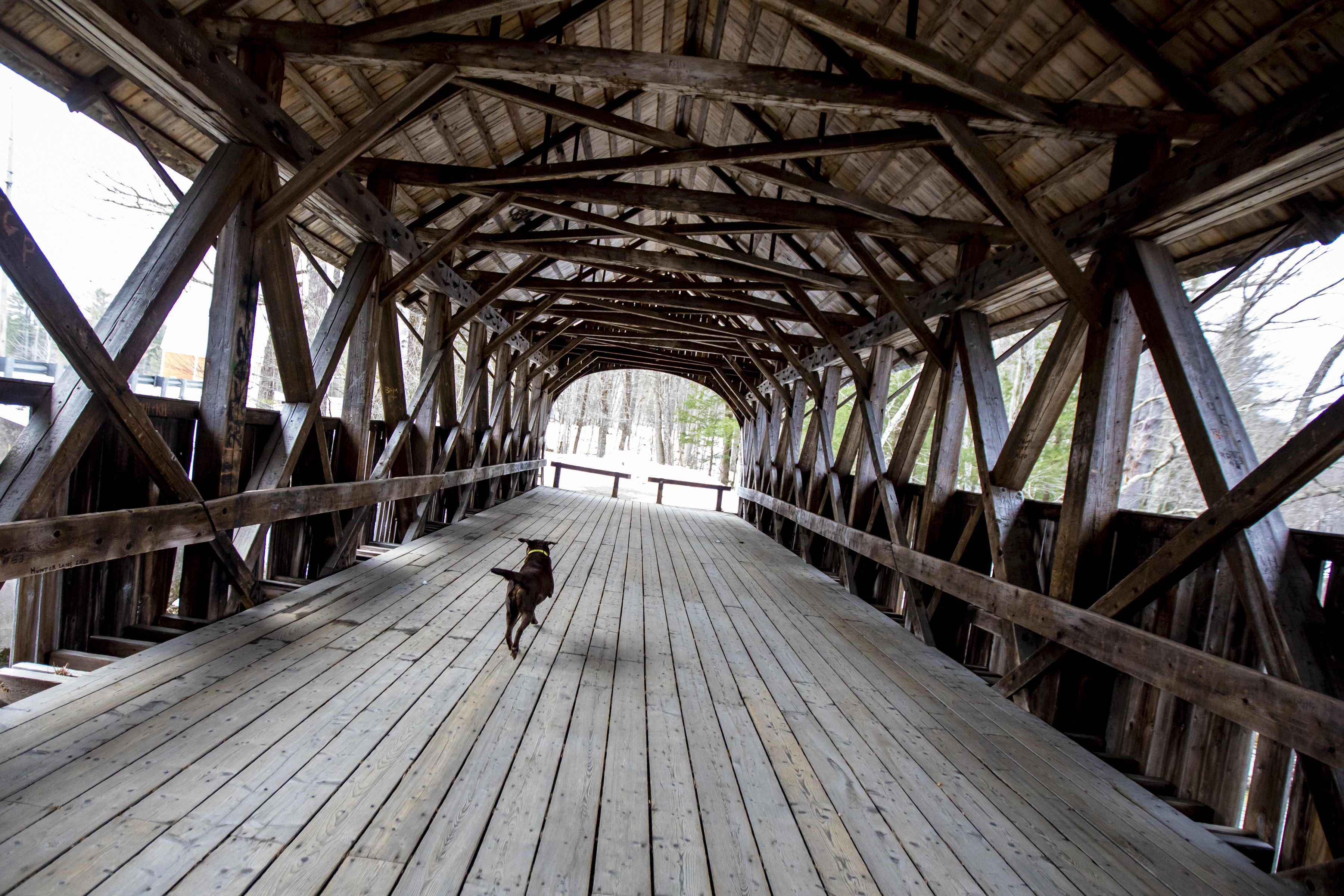
Newry’s Sunday River Covered Bridge
Distance: 8 miles (Bethel to Newry)
Highlights: This historic bridge, built in 1872 and added to the National Registry of Historic Places in 1970, is one of only 22 remaining Paddleford Truss bridges in the U.S. Nearby, you’ll find the Sunday River Ski Resort and Lower Sunday River Schoolhouse.
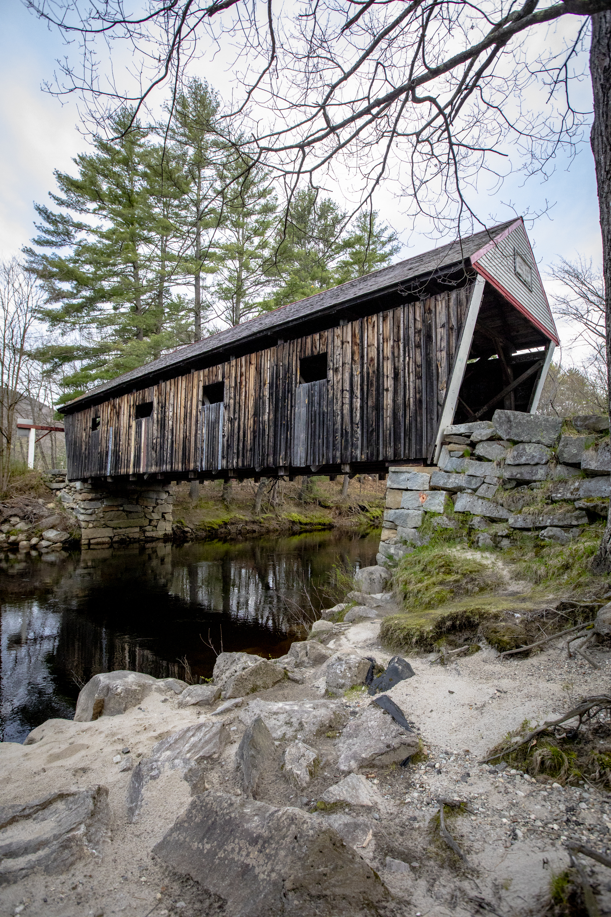
Andover’s Lovejoy Covered Bridge
Distance: 22 miles (Bethel to Lovejoy Bridge)
Highlights: Andover’s 1867 Lovejoy Bridge on Covered Bridge Road is off Route 5. Continue to Andover center for a bite at Mills Market and further along, a pretty view off South Arm Road.
RUMFORD REGION
Route 17 — Rumford to Oquossoc
Winding through the mountains of western Maine, Route 17 offers sweeping views of the peaks and valleys of Franklin County. Along this route are several scenic turnoffs, including the Height of Land overlook, with a view of Mooselookmeguntic Lake. Closer to Rumford, the route follows the Swift River, passing Coos Canyon. If you’re lucky, you may see a moose along the road.
Rangeley Lakes National Scenic Byway
The premier scenic drive around Rumford is the Rangeley Lakes National Scenic Byway (approximately 35-50 miles), which starts on Route 17 on the Roxbury Road in Mexico, takes Route 17 North to Oquossoc, then Route 4 to Rangeley and Madrid.
This drive features the breathtaking Height of Land, one of the most stunning overlooks in New England. With magnificent views of Mooselookmeguntic and Richardson Lakes, and the White Mountains.
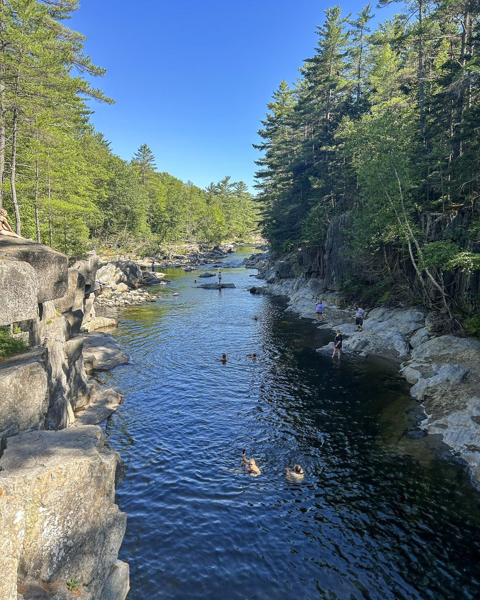
Coos Canyon (Byron)
This is a scenic 500-yard gorge on the Swift River, featuring a 15-foot waterfall, unique rock formations and popular natural swimming holes.
Known for its accessibility off Route 17, it is a premier Maine destination for gold panning, picnicking and cliff jumping, with nearby Coos Canyon Campground & Cabins offering accommodation.
Rumford Community Forest trails
Drive to the Rumford Community Forest at 161 Isthmus Road for panoramic views of the Tumbledown-Jackson Range. Located on an unnamed 1,374-foot hill on the north side of Rumford, the Rumford Community Forest, owned by Inland Woods + Trails, also offers three trails that opened in 2025.
The Scotty Brook Trail is a 0.2-mile ADA-accessible loop trail starting from the parking lot. It is well built and features a gravel surface, switchbacks and extensive bench cuts. It winds through the forest and passes near Scotty Brook. Sometimes you can hear the rush of water in the brook as you walk.
Heading north from the parking area, the Rumford Adventure Trail is a more traditional hiking trail. It forms a lollipop loop through relatively young forest and has easy grades. It is unblazed, but is marked with directional arrows at significant turns. From the trailhead and back, it’s about 1.1 miles in total.
Branching off from the Rumford Adventure Trail, shortly before its loop portion, is the Porcupine Ridge Trail. From the trailhead, the distance to the viewpoint is 1.2 miles. The path climbs easily through mostly hardwood forest to a point near the summit of the hill.
Along the way, it crosses an old logging road (now a snowmobile trail) and passes an old cellar hole. Above the logging road crossing, it does get a little bit steeper, but is still quite easy going. At the end of the trail is a picnic table and viewpoint north toward the Tumbledown-Jackson Range and beyond.
RANGELEY REGION
Route 4 — Rangeley to New Vineyard
This drive takes you past the small communities of New Vineyard, Strong and Phillips. There are multiple short hikes you can take along this road including the Cascade Stream Gorge Trail in Sandy River Plantation and the Smalls Falls trail in Township E. The route goes straight through Rangeley with an overlook of Rangeley Lake and Bald Mountain right outside of town.
Route 27 — Carrabassett Valley to Stratton
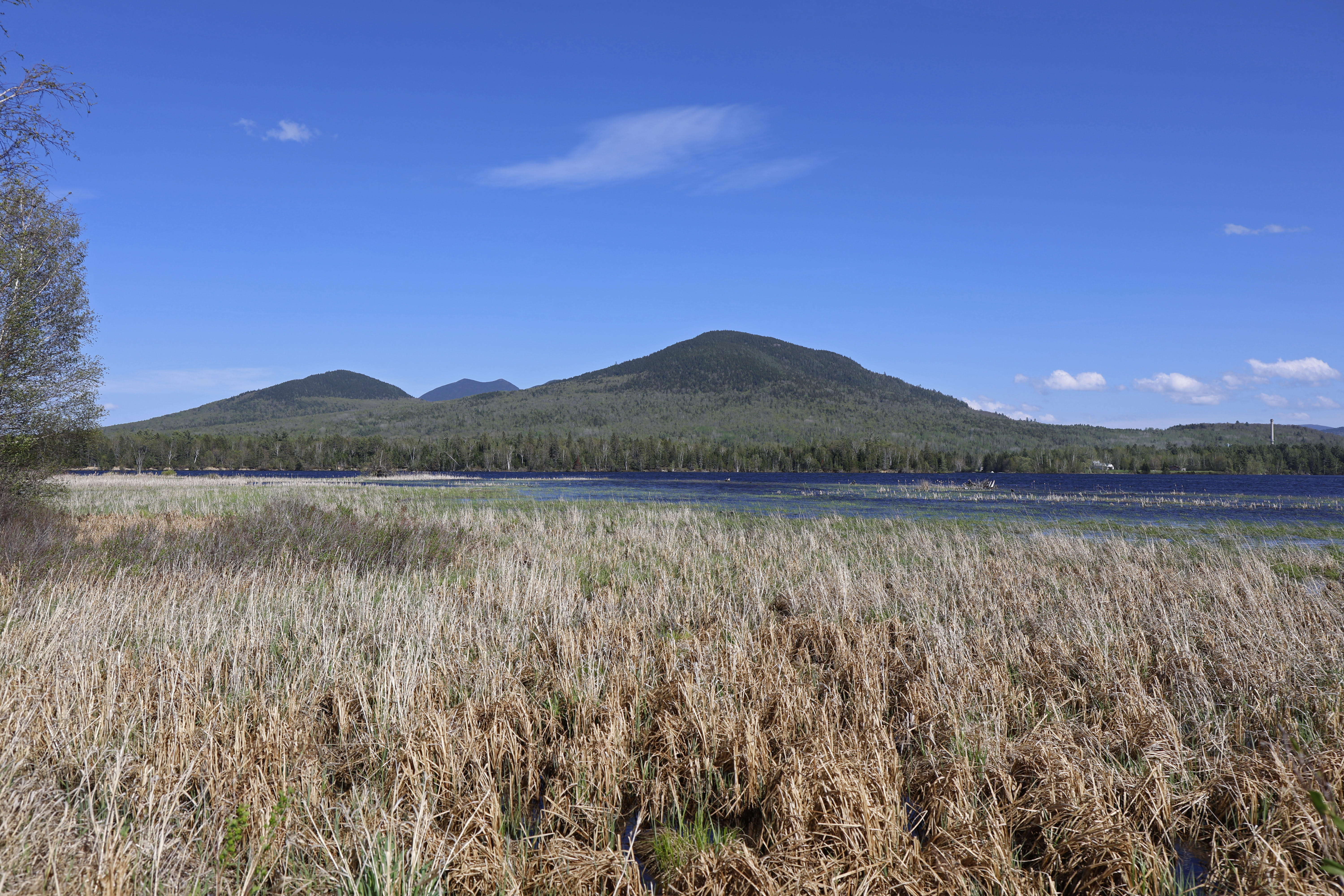
Following the Carrabassett River for much of the way, this route weaves through the woods of Western Maine. It is the primary road to access Sugarloaf Mountain and and the Bigelow Preserve, 36,000 acres of forest east of Stratton. In Stratton, a turnoff allows you to get out and take in a view of Flaggstaff Lake with a backdrop of Bigelow Mountain.
FARMINGTON/LIVERMORE REGION
Route 156 from Jay through Livermore to Wilton
This is the most accessible scenic drive in the area, following the Androscoggin River valley past open farmland and low mountain views. The stretch is especially strong in early morning or late afternoon light, with multiple informal pull-offs along the river and fields.
Wilson Lake loop
This drive in Wilton offers a shorter, quieter drive with consistent water views. Shoreline roads pass small coves and residential stretches, making it a good evening option or an easy add-on to a Route 156 drive. There is parking at the head of the lake that offers a very nice view of the lake and sunset.
From Farmington, Route 4 north toward Strong and Phillips
This route shifts quickly into a more rugged landscape. The Sandy River valley tightens and the mountains become more prominent, giving the drive a foothills feel within 20-30 minutes of town. For a different look, Route 133 toward Wayne trades rivers for rolling hills and clustered lakes.
We invite you to add your comments. We encourage a thoughtful exchange of ideas and information on this website. By joining the conversation, you are agreeing to our commenting policy and terms of use. More information is found on our FAQs. You can update your screen name on the member's center.
Comments are managed by our staff during regular business hours Monday through Friday as well as limited hours on Saturday and Sunday. Comments held for moderation outside of those hours may take longer to approve.
Join the Conversation
Please sign into your CentralMaine.com account to participate in conversations below. If you do not have an account, you can subscribe here. Questions? Please see our FAQs.