


YORK — Since the regional effort began a decade ago to build Mt. Agamenticus in York into more of an outdoor recreation area, more and more people have discovered it to enjoy birding, mountain biking, hiking, hunting and simply as a place to watch the setting sun.
A birding platform was built to enhance the annual spring and fall hawk migration. The old ski lodge was turned into a natural history center. In 2011 the trees at the top were cleared to create diverse wildlife habitat and, at the same time, open up one incredible view at the top of this 692-foot mountain.
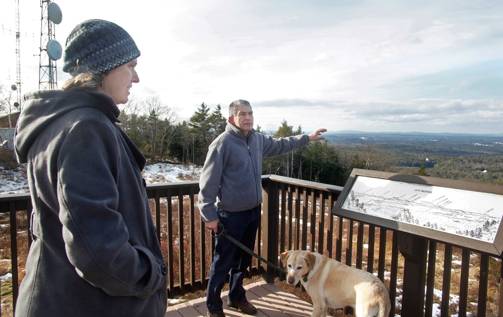
Now up to 40,000 people visit Mt. Agamenticus annually, according to Robin Kerr, the site’s conservation coordinator. And next on tap: a mile-long trail allowing universal access to those with mobility disabilities around the summit.
Last week work began on a $98,000 handicapped accessible trail that will extend 1,100 feet, allowing visitors who use wheelchairs or canes access to the summit views of the White Mountain Presidential Range in the northwest and of the southern Maine coastline from Scarborough south to the Isle of Shoals.
“Not everyone liked that view being opened up when the trees were cut, but for those who can’t hike far, it’s great, it’s beautiful and an inspiring place,” said Dan Gardoqui, director of the nearby outdoor learning center, White Pine Programs.
“Mt. A. is vital to the region. It’s been getting more and more traffic, and is only growing in popularity. I’ve lived down the road for 12 years and watched this massive change in the amount of users.”
Gardoqui leads outdoor programs on the Mt. Agamenticus conservation land, and spends time there himself, mountain biking, hiking and tracking animals. He sees all kinds of outdoor groups using the land here.
“There is a crazy group of mountain bikers. They go every Wednesday night, all year long. They’ll be there tonight with spikes on their tires and headlamps on their helmets,” Gardoqui said. “Then there are the people who watch the sunrise every Sunday morning. The place gets a ton of use.”
The Mt. Agamenticus conservation area currently offers 40 miles of trails. But more than two-thirds are rough, rocky, ideal for mountain biking or rugged hiking, but not easy for all.
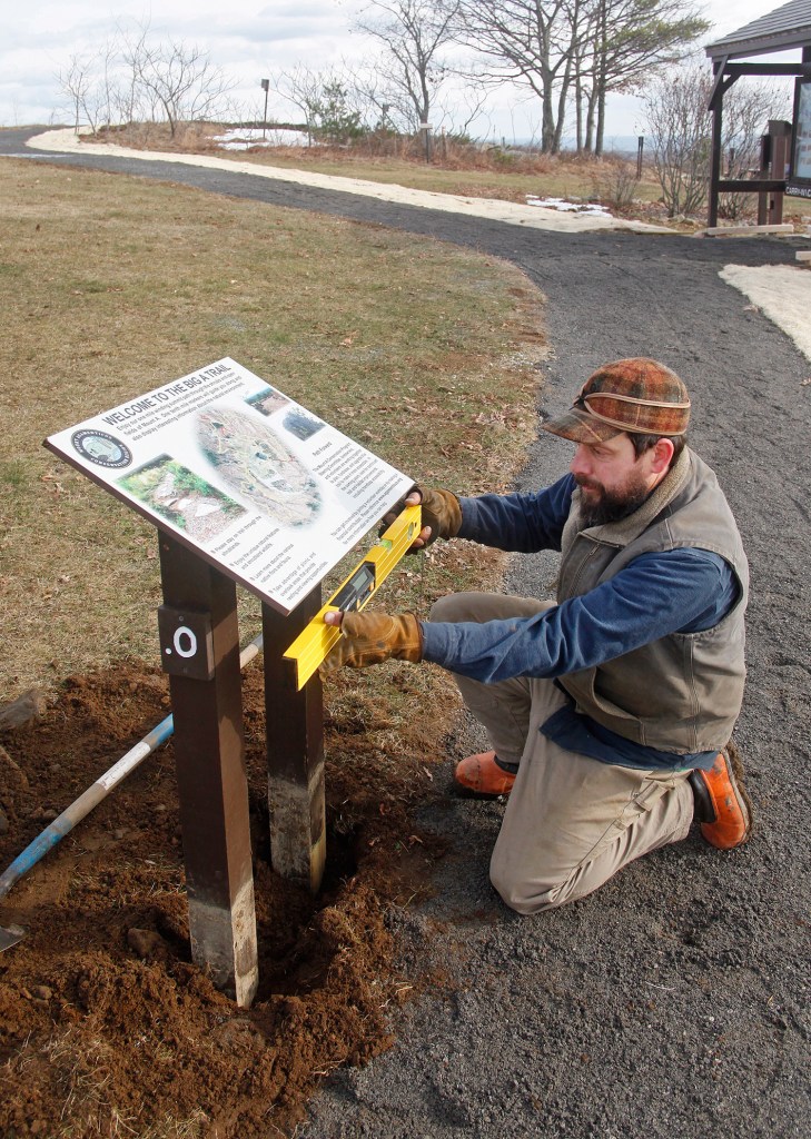
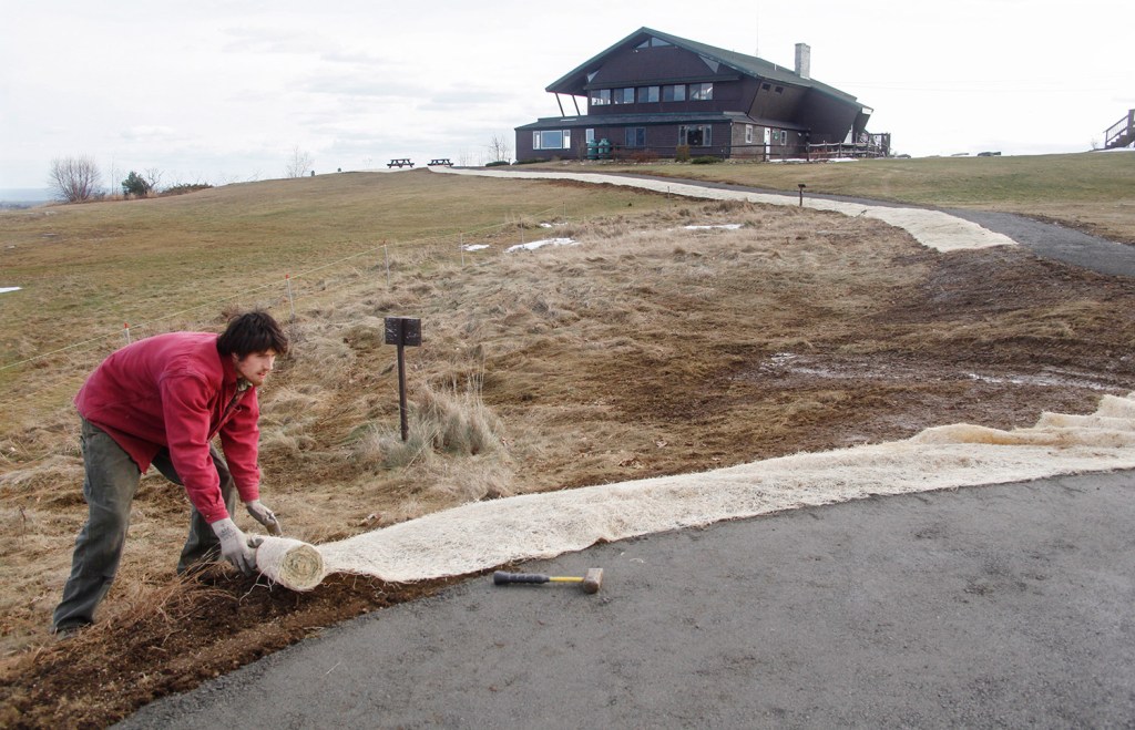
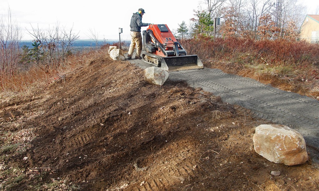
The new Big A Trail eventually will extend a full mile around the summit. It will continue as a wide, flat more-accessible trail to those who have mobility disabilities. It will cost roughly $340,000 when it is completed, Kerr said.
Later phases of the trail will lead down toward the woods and fields, where some think is where this mountain gets good.
The Mt. Agamenticus region is unique as one of the few remaining large tracts of undeveloped woodland in coastal New England. It has the highest concentration of vernal pools – as many as 40 per square mile – according to the state.
Once you step away from the summit and into the woods, the only sounds are wind, small critters and leaves underfoot.
“What I say to the trail crews at least once a year is, ‘Listen. Do you hear that? Listen.’ And when they say, no they don’t hear anything, I say, ‘That’s the point,'” said trail steward Roger Clements.
Wildlife abounds here, with critters such as deer, turkey, turtles, salamanders, hawks, bobcats and, last winter, at least one snowy owl.
Kerr said the wildlife habitat created when the trees were cut down and back – exposing the 360-degree view – has welcomed more wildlife.
“Early successional forest habitat was in decline in the Northeast. As old farms grew up or were paved over, this middle stage is in decline. And a lot of species depend on the shrub land, like New England cottontail rabbits, and the species of turtles we have here,” Kerr said.
Now the Big A Trail will bring this wild area into better view for more people.
The first phase of the project, paid for with $61,000 from the town of York, is the cornerstone of this new, more accessible trail.
Another $240,000 will be raised to extend the Big A Trail and make it a full mile, Kerr said.
“The nice part about this is from the parking lot a visitor (with mobility disabilities) can go to the kiosk and access restrooms, and travel around to see the seashore to the southeast and the White Mountains to the northwest, and the sunset at the west,” Clements said. “It’s a rare opportunity, especially here in southern Maine.”
The mountain’s history is unusual and varied.
During World War II the summit housed a military barrack, and from 1964 to 1974 it was a ski area – complete with a chair lift, T-bar, rope tow and lodge. Remnants of the lift remain and the lodge, now the Learning Lodge, still stands.
Today the land is owned and managed by a coalition of partners, including the towns of York and South Berwick, the York Water District, the state, The Nature Conservancy and area land trusts. Kerr said the wildlife and habitat here are just as varied.
“We often see turtles on the summit,” Kerr said. “Isn’t that incredible? They climb a long way. The shrub area now allows them places to nest.”
Copy the Story LinkSend questions/comments to the editors.

Success. Please wait for the page to reload. If the page does not reload within 5 seconds, please refresh the page.
Enter your email and password to access comments.
Hi, to comment on stories you must . This profile is in addition to your subscription and website login.
Already have a commenting profile? .
Invalid username/password.
Please check your email to confirm and complete your registration.
Only subscribers are eligible to post comments. Please subscribe or login first for digital access. Here’s why.
Use the form below to reset your password. When you've submitted your account email, we will send an email with a reset code.