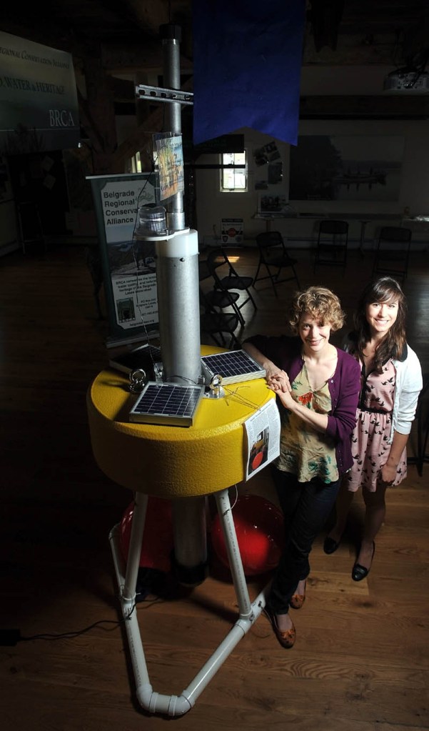
BELGRADE — On Thursday, environmental scientists in the area and around the world will begin to gain a much better understanding of how Great Pond works.
The improvement will come with the deployment of a high-tech, $20,000 buoy, the first of its kind in Maine, in the pond, armed with sensors that will begin sending a continuous data stream describing real-time lake conditions to a global network of scientists.
“It’s really about this long-term monitoring and being able to predict when something may happen,” Denise Bruesewitz, professor of environmental studies at Colby College, said.
From a monitoring computer, Bruesewitz said, she will receive readings on temperature, oxygen levels, phytoplankton activity and light levels every 15 minutes.
The buoy, which is currently on display to the public at the Maine Lakes Resource Center in Belgrade, has sensors placed every 10 feet along black cables that will dangle into the water, sending back readings from a variety of depths.
Bruesewitz said it will be anchored by mooring lines near Hoyt’s Island at Deep Hole, which, at 70 feet, is the deepest spot of the lake.
Getting information this way is vastly superior to current methods, Bruesewitz said, which involve people traveling out to the lake in a boat and taking a single reading.
“In the past it’s been a snapshot of data, like a photograph,” she said. “We’re going to have a thing like a film.”
The buoy will allow Great Pond to be part of the Global Lake Ecological Observatory Network, in which scientists from all around the world share lake data to help identify regional and global trends.
Right now, the network includes similar buoys on about 50 different lakes, she said, with the number growing rapidly.
As more lakes are included in the network, the data will be more useful for global and regional questions. For example, scientists could predict the effect of a certain type of land development, based on information from a series of lakes that have undergone similar development.
One recent use of the network, she said, was to track the impact of Hurricane Irene in 2011, which passed over three or four lakes that contained buoys armed with sensors. The data gathered gave never-before-seen insight into how a hurricane impacts a lake, she said.
The buoy will also help to analyze local as well as global problems.
Bruesewitz said the local community will be better able to predict things like harmful algae blooms, which occur when algae are presented with increased levels of nutrients in the water, allowing them to multiply unchecked.
The blooms can wreak havoc on the lake’s ecosystem, Bruesewitz said, in part because when the algae dies, it sinks to the bottom of the lake and decomposes, a process that removes oxygen from the lake’s lower levels. When the water becomes hypoxic, meaning very low oxygen levels, large populations of fish can suffocate and die.
The sensors will allow an unprecedented understanding of that process, which will help people to understand, for example, exactly what threshold of oxygen depletion will lead to a bloom.
The data could also be helpful in tracking the impact of milfoil on the lake, she said, particularly if the presence of the invasive weed becomes more widespread.
Bruesewitz said that, as technology advances, different, more advanced sensors could be deployed on the buoy, which would allow scientists to answer different questions.
The buoy has been designed to be large and stable, she said, and to minimize the wear and tear on the sensors.
Bruesewitz said that a grant proposal has been sent to the National Science Foundation that would fund a series of four or five buoys across the state.
Matt Hongoltz-Hetling — 861-9287
mhhetling@centralmaine.com
Send questions/comments to the editors.


Comments are no longer available on this story