


AUGUSTA — An anticipated development boom centered at the intersection of Route 3 and Church Hill Road, expected to be fueled by the opening of Cushnoc Crossing Bridge in 2004, never quite materialized.
And officials suspect the city’s efforts to promote the highest and best use of the area by encouraging the creation of planned neighborhoods with the complex rules of the Riggs Brook Village zoning district, which were meant to encourage a high-quality mix of residential and commercial uses, instead have stymied development there.
Additional Images
So city councilors are considering scrapping much of the then-ballyhooed Riggs Brook Village zoning district created in 2001 in favor of more conventional, easier-to-understand zoning rules.
Councilors on Thursday spoke favorably about what Development Director Matt Nazar described as a “significant reworking” of the Riggs Brook Village zoning district, recommended by the Planning Board, which he said “is effectively a reworking of the existing district, putting it into a format far more similar to the format of the existing zoning districts and eliminating or modifying some of the confusing aspects of the district. This would be a complete repeal and replace of the district.”
Mayor David Rollins said the six pages of proposed new rules for the district seem a lot easier to work with than what he described as the archaic, 14 pages of rules in place now.
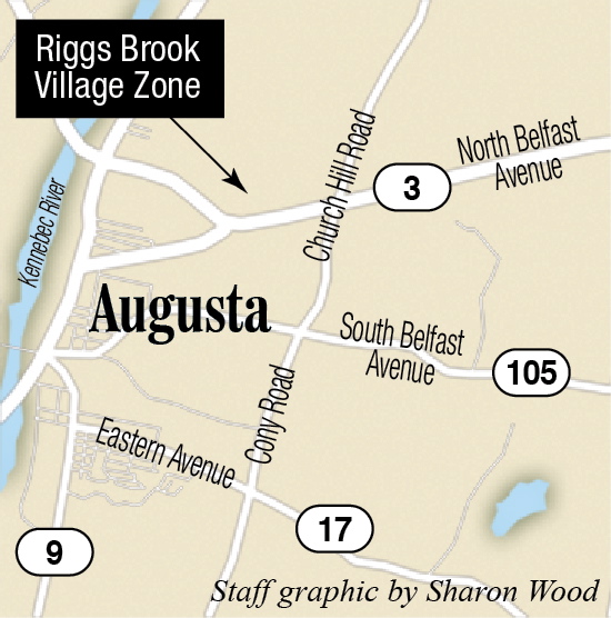
The district extends nearly a mile in each direction from the intersection of Route 3 and Church Hill Road and as far as South Belfast Avenue to the south.
City Manager William Bridgeo said when the city’s third road bridge over the Kennebec River, the Cushnoc Crossing Bridge, was planned and built, city officials set specific zoning rules in areas near the bridge at the intersections of Route 3 with Church Hill Road, Riverside Drive and West River Road. He said city officials and the Augusta Board of Trade, which owns about 50 acres of land in that part of the city, anticipated the area would see significant development and zoned the area seeking to have the land there used for the highest and best purposes.
Bridgeo and Nazar, however, said the expected development boom in the area hasn’t taken place. Nazar said some aspects of the current zoning are confusing and parts of it have been a “serious impediment on a number of projects.” So a Planning Board subcommittee reworked the Riggs Brook Village zone.
Nazar said significant changes include replacement of the four quadrants the district was divided into, each having slightly different uses and rules, with a single district and set of rules; reduction in allowed lot sizes, but still requiring what Nazar said are significant road frontage requirements; removal of building design requirements for additions to existing buildings, which Nazar said has been a serious impediment on a number of projects, while still holding new buildings to building design standards; and removal of rules favoring subdivision lots in larger planned mixed-use developments over individual lot-splitting and development because, Nazar said, “Unfortunately, that type of development style is simply not employed by most developers in Maine, leaving the penalty for not developing this way as a serious impediment to any development.”
David Smith, who was involved in creating the Riggs Village district, said at the time it was created there were concerns development in the city had gotten out of control and existing ordinances, which have in the time since been strengthened, didn’t address it. He said they also wanted to protect the scenic vista in the area around Route 3. However, he said the rules that emerged went too far.
“We wanted to create an area where you could have mixed uses, residential … and light manufacturing even, but do it in a manner where everything was compatible,” Smith said. “And we wanted to protect that vista, so some of the protections we adopted were to protect that vista. The way the final product came out, though, in my opinion, was too restrictive. We had a democratic process, and that’s what we ended up with.”
Ward 4 Councilor Mark O’Brien said he’s in favor of the rezoning but warned development is not likely to take place in that area until public utilities such as water and sewer lines are extended to serve the area.
Smith, vice president of the Greater Augusta Utility District, agreed, and said the district “is ready to do what it can to fund a study to look at what it’s going to take to get water and sewer out there. And we hope the city will do the same.”
The rezoning proposal is expected to go to councilors for the first of two required readings at their business meeting next week.
Keith Edwards — 621-5647
kedwards@centralmaine.com
Twitter: @kedwardskj
Copy the Story LinkSend questions/comments to the editors.

Success. Please wait for the page to reload. If the page does not reload within 5 seconds, please refresh the page.
Enter your email and password to access comments.
Hi, to comment on stories you must . This profile is in addition to your subscription and website login.
Already have a commenting profile? .
Invalid username/password.
Please check your email to confirm and complete your registration.
Only subscribers are eligible to post comments. Please subscribe or login first for digital access. Here’s why.
Use the form below to reset your password. When you've submitted your account email, we will send an email with a reset code.