


When Jacob Underwood, of Cornville, saw a photo of a farm in a collection of vintage aerial photographs posted online recently, he was swept back in time to his days as a boy putting up loose hay in the barn.
The photo, taken in 1963, was of the former Moody farm, which his mother and stepfather bought in 1983 on Moodytown Road in Cornville.
Additional Images
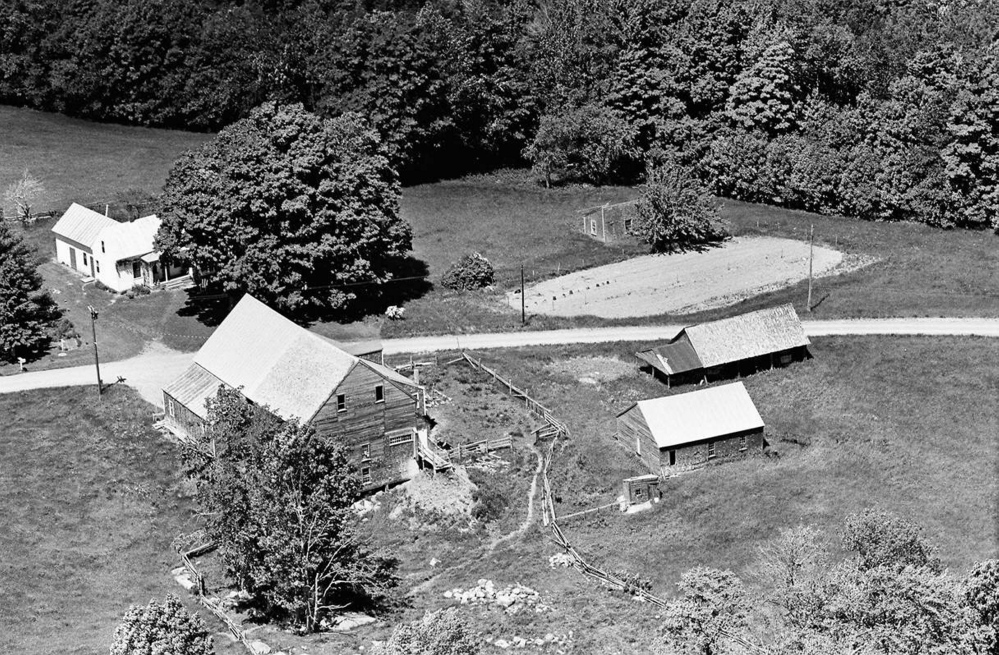
“All of the buildings were standing at that time,” said Underwood, 42. “These grand old New England farms are getting rare these days but used to be so common, and they are beloved by us today, which is why finding old photographs like this (is) so valuable to us. They are a window to our heritage.”
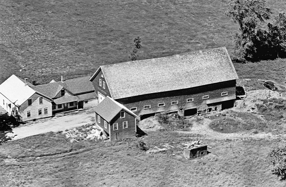
The Cornville farm photo on Facebook is among 3,200 aerial photographs of Somerset County farms and rural towns that were posted on social media sites in January, said Lance Roper, director of social media at Vintage Aerial, which claims ownership of an estimated 25 million pictures from 41 states taken from small airplanes over the past half century.
Thousands of photos of farms, rural homesteads and small-town stores are available for public viewing now for the first time, Roper said. The collection shows the history of Maine in the early 1960s.
Visitors to the Vintage Aerial website can interact with the photos by leaving comments and anecdotes, tagging locations and sharing on social media sites. The online pictures have watermarks — the company sells copies of the pictures, at prices that are in the $189 range.
The use of social media to distribute the photos also helps the company learn exact locations of the places shown, like connecting the dots across rural Maine. The location information will be added to the online photographs and will serve as an added browsing tool, he said.
“Most of these photos have never been seen before,” Roper said. “The people who view them will likely experience a flood of memories and emotions as they see important places as they were in the 1960s. It’s not very common that these sorts of collections are made available without having to pay for them.”
Framed photos also are available to buy.
Roper said his company is a small group of people who created Vintage Aerial to share their passion for preserving the heritage of rural America and documenting a time in American history when life revolved around rural communities and small farms.
Roper said Vintage Aerial is structured as a business, but it uses that model as a funding source to continue digitizing massive collections of analog film. Vintage Aerial’s work in Maine is part of a greater plan to make about 850,000 additional photos viewable in other areas across the nation by summer.
There are photo reels from all 16 counties in Maine, including 4,600 photos from Kennebec County and about 2,000 from Franklin County.
Vintage Aerial, based in Maumee, Ohio, is conducting a crowdsourcing campaign for visitors to add location information and stories about the photographs that they’ve found. The data will be used to enhance the site’s functionality, allowing visitors to search for photos by address and keyword.
“We’re not asking people to buy anything. We’re just asking people to come to the website and look at photos,” Roper said. “If they see something they recognize, we want them to tell us about it.”
Roper said a company called State Aerial Farm Statistics, of Toledo, Ohio, hired pilots beginning in 1952 to photograph farms and rural homes in particular areas. The photography mission was followed by a fleet of door-to-door sales people who peddled framed prints and oil paintings of those photos. As the business grew, more and more photographs were taken, and eventually, the company had 16 million photographs from 41 states.
“State Aerial had the foresight to save the analog film, a practice that wasn’t always shared by others in the industry at the time,” Roper said. “Thankfully, they did. Their collection is one of the largest single-subject analog film libraries in existence.”
Today, Roper said, Vintage Aerial has a license agreement with State Aerial to use the photos and has acquired other collections and licenses to account for its 25 million images.
Underwood, 42, said the picture he found was taken in 1963, when the farm was still owned by the Moody family — hence Moodytown Road.
After his parents bought the farm 33 years ago, “I used to help put up hay in that big barn,” he said.
“Since the Moodys were some of the last to switch from horse to tractor power, there were many pieces of horse-drawn equipment still in the sheds. All of the old hay equipment was still in place and usable then — old, loose hay-loading tongs, pulleys and tracks — all human-powered by ropes and pulleys.”
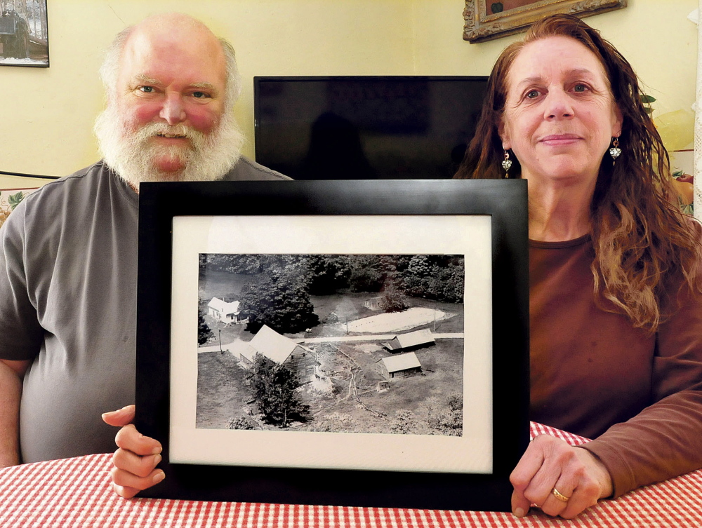
Underwood’s mother, Janet, 64, and her husband, Rene Burdet, Underwood’s stepfather, moved to Cornville because there was plenty of timber to cut and space to homestead and raise their children. Burdet, 53, is still a logger.
“We came here basically to raise animals and kids and vegetables. Basically we raised five kids here,” Burdet said.
“We were kind of homesteading at the time, too,” Janet added. “We were pretty much self-sustainable here.”
The couple said all of the outbuildings, including a huge hay and cattle barn, carriage house, chicken coop and garage, are gone, fallen to time or torn down because of disrepair. The large barn collapsed over just a few days in 2008, much to Janet’s dismay. She cried because she “loved that barn.”
The house in which they live, built in the 1800s, is still in good shape, they said.
The Burdets have a copy of the Vintage Aerial photo that they bought for about $50 from one of the traveling salesmen a couple of years ago. They said there also is a photo of a farm their daughter Johanna and her husband, Jarret Haiss, bought recently on Warren Hill Road in Palmyra.
“I was really amazed when I found that photo,” Janet Burdet said. “I enjoy looking at it. I wish I had an even older one, too, because way back originally the road didn’t even go all the way from one end to the other here. It wasn’t really a road then.”
Underwood and his sister Deja Anton said they miss the old barn and a second maple that is shown in the old photo.
“Out front of the house were the two wedding trees, which were planted on a couple’s wedding,” Underwood said.
“These two trees were very old and massive then. Sometime around 1988, one of the trees died and fell. I remember my mother crying as the remains were cut up and hauled off. Thirty years later, the stump still remains, some four feet across.”
Doug Harlow — 612-2367
Twitter: @Doug_Harlow
Copy the Story LinkSend questions/comments to the editors.

Success. Please wait for the page to reload. If the page does not reload within 5 seconds, please refresh the page.
Enter your email and password to access comments.
Hi, to comment on stories you must . This profile is in addition to your subscription and website login.
Already have a commenting profile? .
Invalid username/password.
Please check your email to confirm and complete your registration.
Only subscribers are eligible to post comments. Please subscribe or login first for digital access. Here’s why.
Use the form below to reset your password. When you've submitted your account email, we will send an email with a reset code.