
It’s been a cold few days with temperatures near or below zero degrees during the morning and remaining in the teens throughout the day.
This pattern is about to undergo a big shift, and I am thinking it’s two weeks of above-average temperatures ahead. This of course means a loss of snow cover, melting pond ice and the feeling of spring in the middle of winter.
A few days of warmth in January is actually not uncommon. January thaws are the stuff of New England weather folklore. However, a 14-day stretch with little cold in between is certainly less common and will definitely be a reminder of a changing climate, even if this particular weather event isn’t related to an overall shifting pattern.
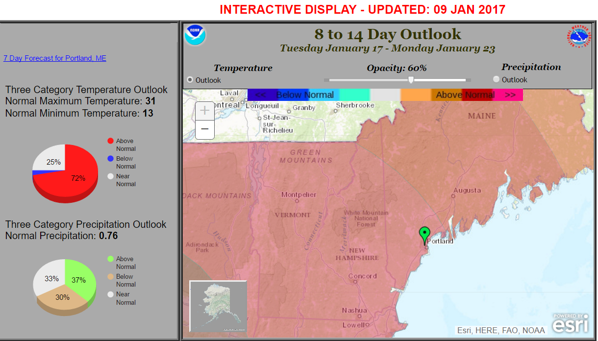
Temperatures during what is typically the coldest period of winter will average much warmer than we would expect. NOAA
As the warm air arrives later today, there could be a bit of snow or mixed precipitation. This will bring a coating to an inch at most and is not something of great concern. There could be some black ice with the precipitation as the road surfaces stay below freezing for some time after the temperature of the air has gone into the melting range.
If you are traveling this evening, be aware of changing road conditions. These situations where we don’t have a big storm can sometimes cause major issues on highways, especially before road crews take care of icy pavement.
Tomorrow starts with some rain with temperatures rising into the lower and even middle 40s by the time you are heading home from work or school. The warmth remains overnight Wednesday with temperatures above freezing at the coast and just below in the mountains. These roller-coaster temperatures could create more icing issues well inland. This is something to be aware of this week.
Temperatures won’t fall far under the 32-degree mark until later on Friday. Thereafter, although the average temperature will exceed 30-year normals over the next two weeks, there still can be two or three days of cold. This weekend, Saturday’s highs again stay in the lower to middle 20s, and as more warm air tries to move north late in the weekend, there might be more snow or mixed precipitation.
One of the consequences of the coming thaw will be a loss of snow cover, especially along the coast. I think the ski areas should be able to hold onto much of their bases as I am not expecting a lot of rain. Some bodies of water which were marginally safe may become unsafe by Friday, but then freeze again this weekend.
Look for updates here and on Twitter @growingwisdom.
Comments are not available on this story. Read more about why we allow commenting on some stories and not on others.
We believe it's important to offer commenting on certain stories as a benefit to our readers. At its best, our comments sections can be a productive platform for readers to engage with our journalism, offer thoughts on coverage and issues, and drive conversation in a respectful, solutions-based way. It's a form of open discourse that can be useful to our community, public officials, journalists and others.
We do not enable comments on everything — exceptions include most crime stories, and coverage involving personal tragedy or sensitive issues that invite personal attacks instead of thoughtful discussion.
You can read more here about our commenting policy and terms of use. More information is also found on our FAQs.
Show less