
Growing up in midcoast Maine, I spent countless hours exploring the Pemaquid Peninsula. Our family scrapbook is filled with photos of rock scrambling near the iconic lighthouse at Pemaquid Point, lobster dinners at Shaw’s Wharf and the Pemaquid Lobster Co-Op, and childhood salutes from atop Fort William Henry.
The return of spring and summer fills me with a desire to head back to these places from my youth and breathe in the sea air.
But there’s a lot more to the Pemaquid region than these few well-traveled, much-photographed sites. Much of the beautiful wilderness on the peninsula, from Waldoboro to John’s Bay, has been preserved by the tireless work of the Pemaquid Watershed Association, and their many members, volunteers and partners. PWA maintains more than eight miles of trails and 21/2 miles of shorefront for public access across nearly a dozen preserves – the newest of which gets its grand opening ceremony next month.
Each preserve has its own unique geography, sights and wildlife, which you can learn more about on the PWA website (pemaquidwatershed.org). These four are some of my favorites – ideal places to avoid the crowds and experience more of what the peninsula has to offer.
PEMAQUID POND PRESERVE
PWA’s newest preserve, on Turner Road in Bremen, officially opens June 10, but when I was in the area recently – on a beautiful spring day – I couldn’t resist the urge to get a sneak peek at the trails.
The nicely cut, mostly flat trail from the parking lot crosses a small bridge over a stream, then travels on a bit of Old Woodland Road, before turning toward the southeastern end of Pemaquid Pond. It’s a quick hike to the water; just under a half-mile from the trailhead, the path reaches a rocky outcropping on the pond’s shore. These rocks make a perfect spot for a picnic lunch or a launching point for the brave to kick off into the water for a swim. A southerly trail forms a slightly longer loop back through the woods, showing off a bit more of the shoreline before returning to the Old Woodland Road.
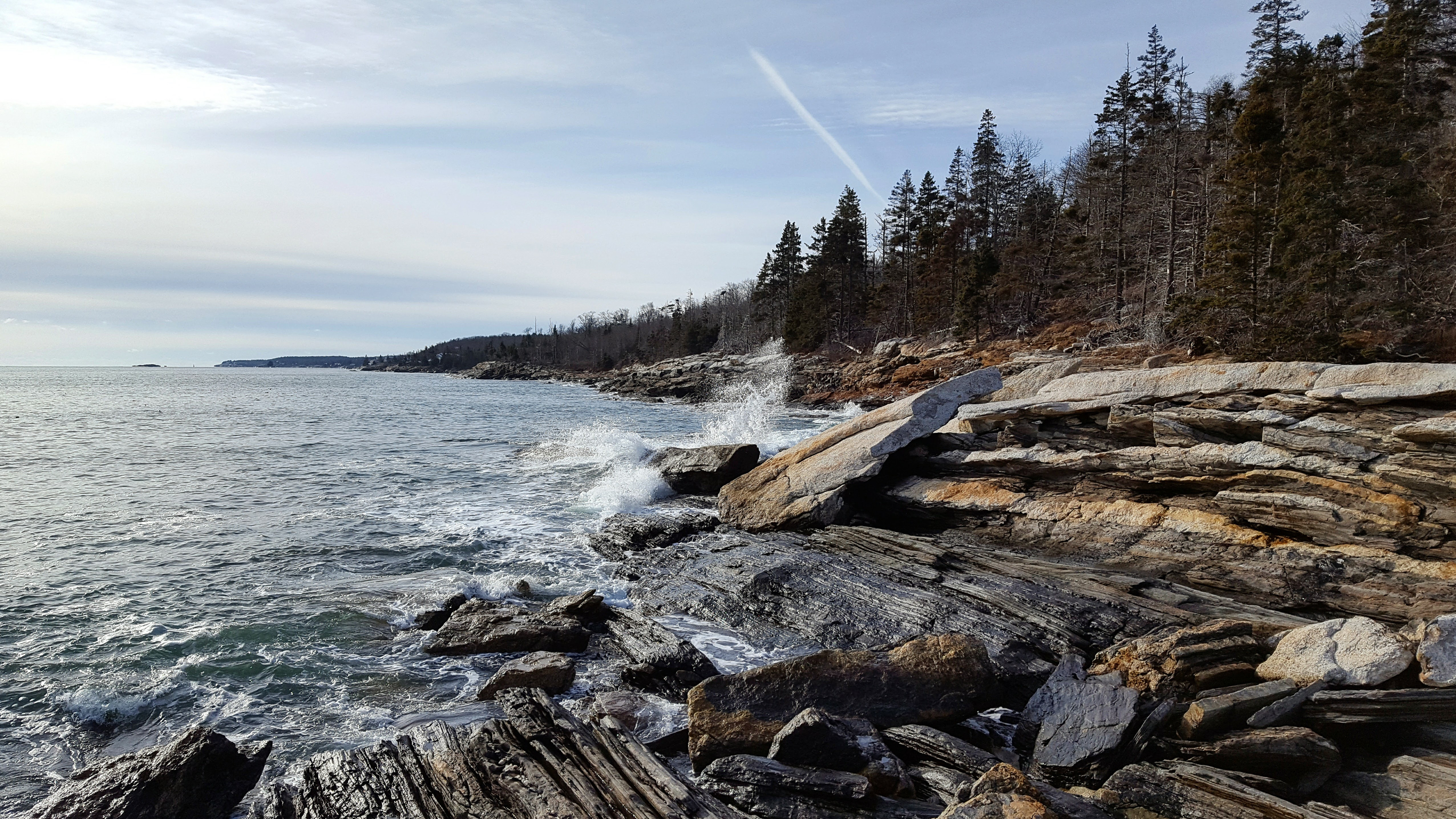
Laverna is one of Pemaquid Watershed Association’s largest preserves. Photo by Jake Christie
LAVERNA PRESERVE
At 130 acres, LaVerna is one of PWA’s largest preserves and offers some of the most striking scenery. The preserve’s 3,600 feet of protected shoreline on Muscongus Bay features varied woodlands, craggy rock ledges, and expansive views out to the south and east. It’s one of my favorite public accesses to the water in the entire state.
From the kiosk on Route 32, head down the Hoyt Trail – a right of way across private land, so please be respectful – for about a half-mile. You’ll cross a small bridge before entering the preserve proper, and then have a few choices for trails to reach the water. If you want the quickest route to the shore, head straight down the LaVerna trail and you’ll reach the rocks at Leighton Head, just over a mile from the parking lot.
If you’d like to enjoy more of what the preserve has to offer, I recommend a meandering counter-clockwise trip, turning off the main trail to Tibbetts Trail, then traveling along the shore until you return via the Ellis Trail. This loop clocks in at around three miles, and more than a half-mile of it is right on the rocky shore.
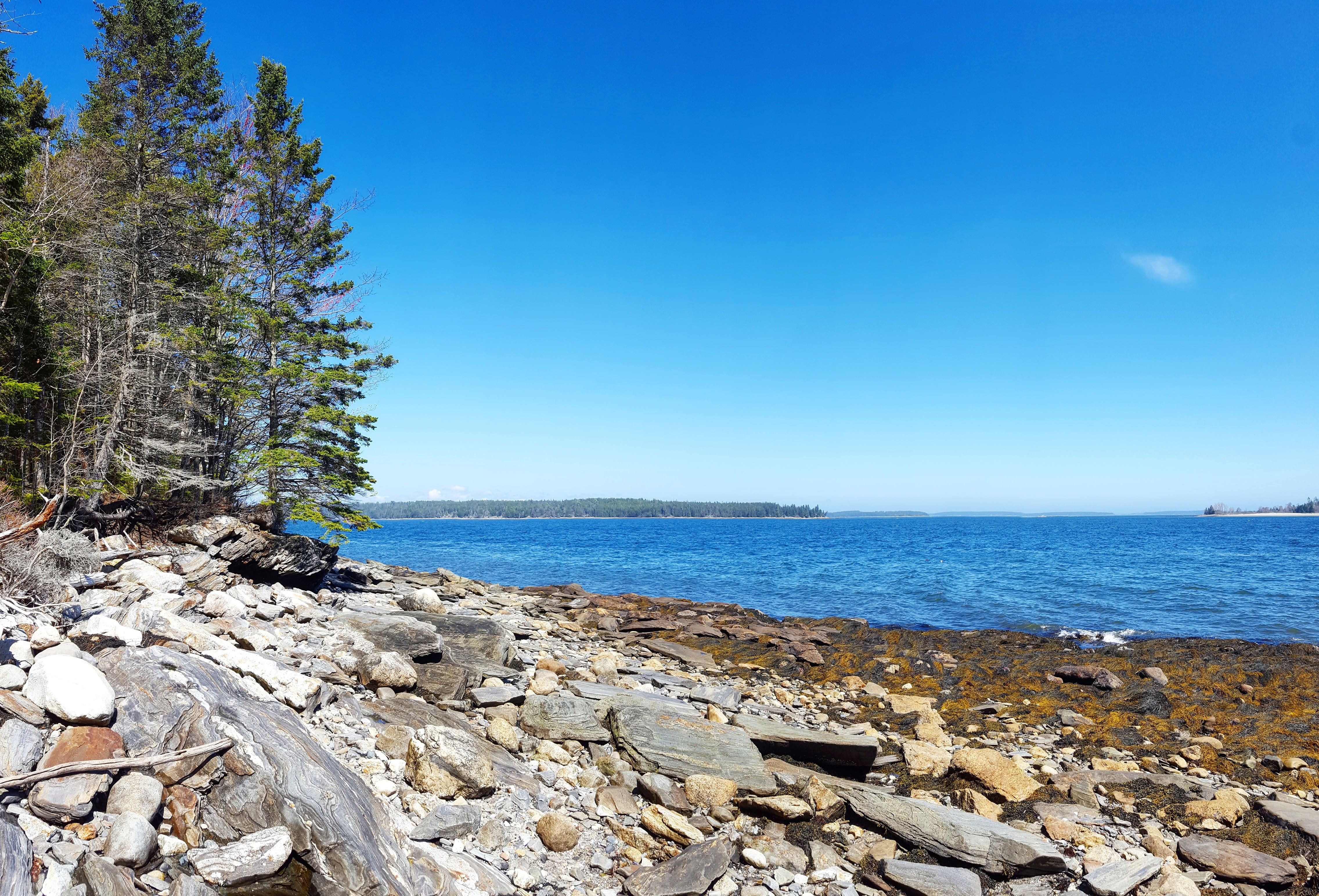
The 11-acre Bass Rock Preserve proves that good things can come in small packages. Photo by Jake Christie
BASS ROCK PRESERVE
While LaVerna is expansive, the 11-acre Bass Rock Preserve proves that good things can come in small packages. With its quick access to the water, unique geology and great views across the bay toward Friendship, Bass Rock is definitely worth a visit – especially with a little candy from the nearby Granite Hall Store to fuel your adventure.
Take Back Shore Road to reach the trailhead, about a mile from Round Pond Village. The short trail from the kiosk travels downhill through mixed hardwoods and conifers for 500 to 600 feet before depositing you on the banks of Muscongus Sound. To the right, a trail leads down to a stone beach, with some flat rocks to rest on while you enjoy lunch or a book. To the left, the trail passes a unique geologic mystery – a deep hole that I mistook for a well before realizing there were no manmade markings on it.
BEARCE ALLEN PRESERVE
Named after Allison Bearce Allen, who donated the land to PWA in 1991, this 40-acre preserve doesn’t feature any frontage on lakes, ponds or Muscongus Bay – but a fun and informative self-guided nature tour. The preserve’s secluded location makes it a stellar little getaway, especially for families looking to learn a little more about the area.
Follow the signs from Route 130 in Bristol to reach the well-marked trailhead, where the kiosk contains copies of the interpretive trail guide. The hilly one-mile loop trail winds through pine, birch, spruce, oak and maple, helpfully identified by 10 “name-that-tree” signs. More than 20 other signs provide information about the local wildlife, insects, flora and history. Over the last 200 years, this land has been used as a tannery, a grazing field and a timber farm. Today, thanks to the PWA and the Damariscotta River Association, it lives on in a form we can all enjoy.
Correction: This story was updated at 10:07 a.m. on May 21 to correct the spelling of the author’s name in the photo captions.
Jake Christie is a freelance writer living in Portland. Along with his brother, Josh, he writes about great Maine destinations for outdoors enthusiasts. Jake can be reached at:
Comments are no longer available on this story