FAYETTE — The lower water level of David Pond this year has spurred those with waterfront property and waterfront access there to organize in search of a solution.
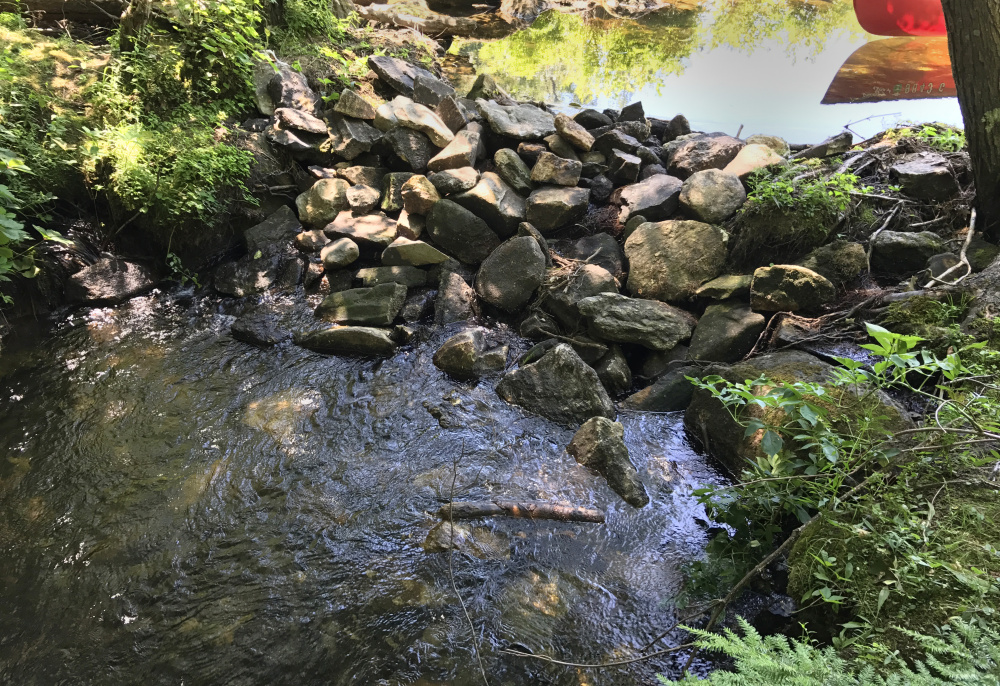
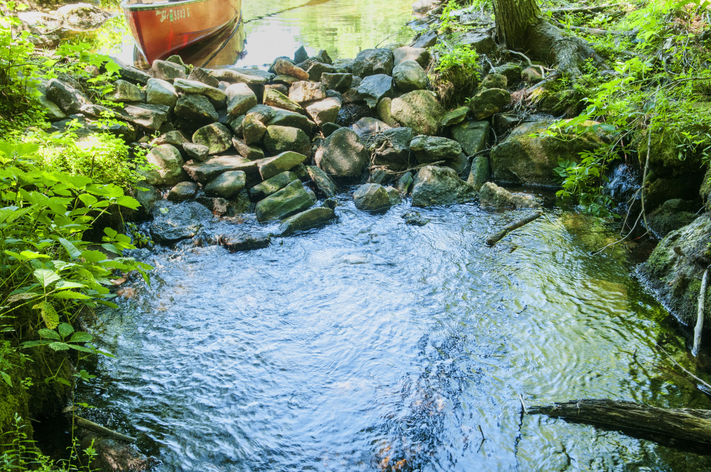
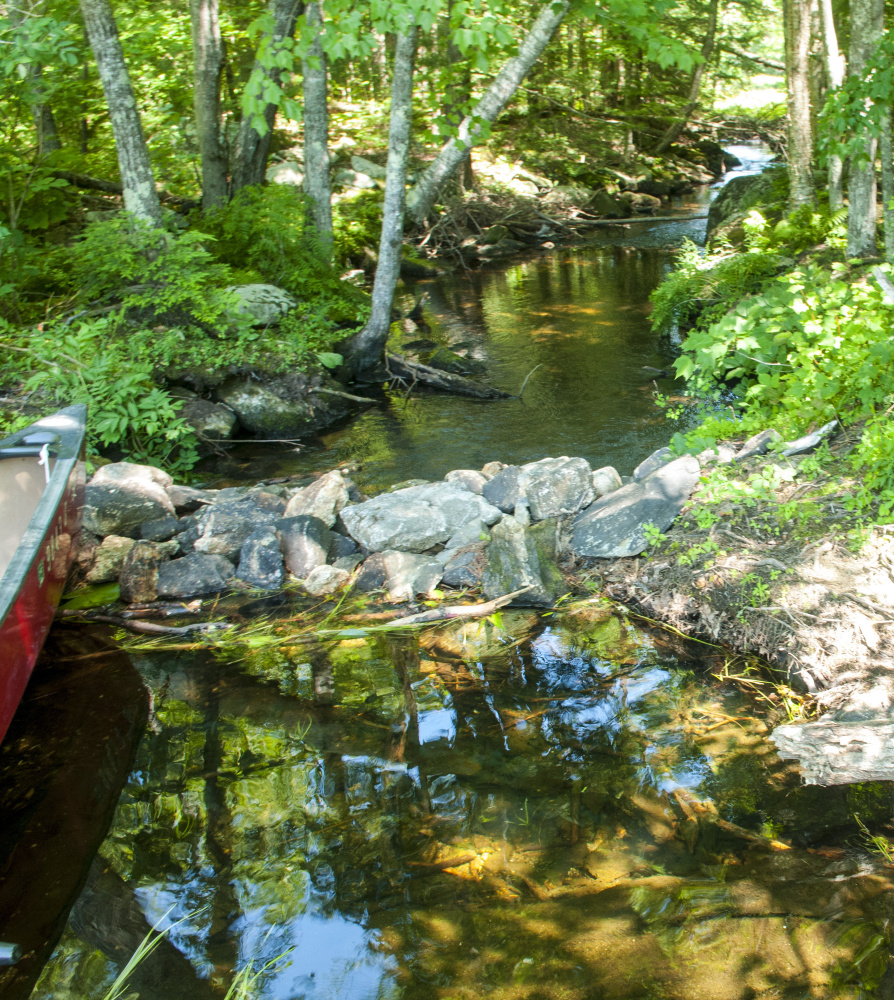
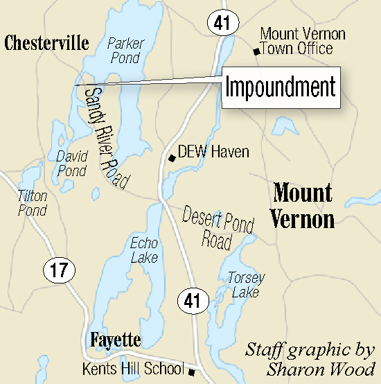
They say recent damage to a rock pile impoundment at the north end of the pond caused the water level to take a significant drop, and they cite concerns about the effect on “wildlife, recreation, ecology, and declining property values and the resulting losses to the town tax base,” in a website posting by Elizabeth Hicks.
“This impoundment has been there since the 1920s and maintained by people around the lake to keep the water level at its historic normal level,” Hicks said in an interview.
Hicks is one of eight people on a steering committee looking for a solution. “We don’t know how stable the current situation is,” she said. “We would like to move on it very quickly.”
Suggestions have included coming up with an interlocal agreement between town officials and property owners along the pond on the western edge of Kennebec County.
Neighboring Parker Pond, for instance, has an association that was formed to care for the pond and to own and maintain the dam at the outlet stream.
When Hicks and others brought their concerns to the Fayette Board of Selectmen, she said, they received sympathy but were told the board could do little because the impoundment was in neighboring Chesterville, which is in Franklin County.
Jon Beekman, chairman of the selectmen, said in an interview that it’s a “contentious issue” complicated by the fact that the dam structure is in Chesterville and privately owned. Beekman said selectmen provided the association members with meeting space last week at the Fayette Central School.
“We really have no authority to do anything except provide support in that way,” he said. “I live on a lake also, and water levels fluctuate, but the disadvantage David Pond has is it’s very shallow; so instead of a couple feet of rocky shoreline, it apparently turns into a mud flat in front of properties very quickly.”
Beekman thinks it will take some time and permits to resolve the issue, but “I think they’re on the right path.”
Hicks worries that the pond level could drop farther. “There is some concern that if it gets completely breached, there will be a lot of outflow, and it may affect Parker Pond as well,” she said. “We’re looking at what might be the path of least resistance. What we’d like first is a public hearing with the Department of Environmental Protection.” Members of the group have written to their local legislators for help as well.
The group is composed of about 50 people, Hicks said, with about 105 individuals on the mailing list.
The impoundment itself is on private property. One side is owned by Deborah Cayer, of Chesterville; and the other by Erika Diller, who lives in Vermont. The two are working with the group of concerned property owners, Cayer said on Friday.
Cayer said there are differing opinions about the water level of the pond, with some people preferring it higher than others.
“It’s been a little, ongoing dam war,” Cayer said. “What happens is the landowners are responsible, so we have to do some kind of remediation out there, but we’re not sure yet what that’s going to be.”
She said some people built up the dam to raise the water level and someone else came out and dismantled it, as well as part of a beaver dam, to lower the water.
“It’s all totally illegal,” she said. “There was a natural impoundment there, which has always been there for as long as I’ve been here, some 30 years.”
Her husband, William Dunham, recited figures from the US. Geological Survey showing that David Pond was recorded at 393 feet above sea level in 1912, then was recorded at 391 feet above sea level in 1966, 1989 as well as in June 2017. Now it’s lower than that.
David Pond receives water from Tilton and Basin ponds and sends it on to Parker Pond, all within the 30 Mile River Watershed.
The state has weighed in on the situation as well with a warning that an investigation is in progress “in regards to the dam structure discovered on David Pond.”
A July 7, 2017, letter to the town of Fayette from Dustin Dorr, an environmental specialist with the Bureau of Land Resources, says, “The Natural Resources Protection Act prohibits the placement or alteration of a structure within a protected natural resource, such as David Pond and its outlet stream, without first obtaining a permit from the Department of Environmental Protection.”
Dorr offered the landowners two options: remove the structure or seek a permit for a new, engineered dam.
Dunham said Friday neither he nor Cayer nor Diller favor an engineered dam.
On Wednesday, David Pond was quiet at midday, with a few people sunning on floats or swimming, buoyed by foam noodles near the shore. The clear water offered a view of the bottom, which is surprisingly free of weeds, for the most part.
The pontoon boats were at their moorings, and only an occasional canoe made ripples alongside the turtles, fry, bass, and hungry birds.
Arum, flowering pickerel weed and white and yellow water lilies crowded the surface of the water near the low impoundment of rocks, which is framed by old sandbags, boards and downed trees.
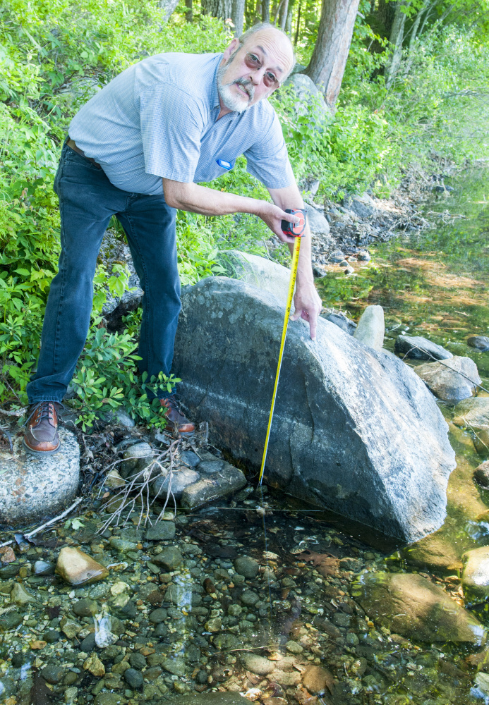
John J. Andrews pointed to the large lakeshore area once owned by his aunt, Lauretta O’Brien. Now he and two sisters have homes there. Andrews shows a large rock on his shoreline. Three inches of the rock are exposed above the water in early spring. Now, in early August, more than 18 inches sit dry.
Andrews said it dropped about a foot in less than a 24-hour period. He wrote a story about his family’s history on the pond that also appears on the website from the group.
Misty Beck, president of the Basin David Tilton Ponds Association, said the group at its 2015 annual meeting adopted a resolution saying that it would not take any position on the David Pond water level issue.
“It’s incredibly divisive,” Beck said. “I’ve probably lost a lot of friends over this issue.”
She said her personal position has changed as a result of her research and observation. “I’m strongly opposed to taking any action to create an impoundment,” she said. “I was out in my kayak doing invasive plant patrol and found an old fire pit ring that was underwater during last year’s drought. People had been lighting bonfires on a beach level that had been flooded.”
She said she would like to see the energy expended on the water level issue redirected to such action as helping to improve water quality, maintaining shorelines, preventing soil erosion and runoff and respecting required distance from shore when using power boats.
Betty Adams — 621-5631
Twitter: @betadams
Send questions/comments to the editors.





Comments are no longer available on this story