
After a mild slug of air during the middle of this week things are going to turn colder as we head into the weekend. You might have noticed some major fires out on the West Coast and that warmth and dry weather is connected to our upcoming cold and here’s why. The upper-level jet stream, which drives weather systems and air masses, takes on various configurations over the years.
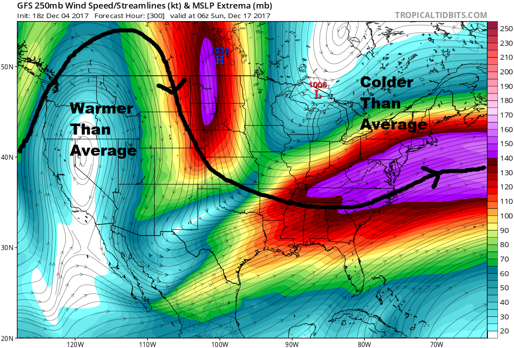
A ridge out West will keep fire danger very high, but it will be cold here in the East. Tropical Tidbits
When the jet stream bulges farther north we call it a ridge and when it dips farther south we call it a trough. Ridges and troughs meander across the country in somewhat regular fashion, but sometimes they can become stuck for weeks at a time. During the upcoming 10-day period it looks as though a trough will be stuck here in the eastern United States with that ridge remaining persistent out West. This will keep average temperatures cold in our area but hold milder and dryer weather across the West Coast.
Troughs are conducive to storm development. The exact location of a trough, its depth and its orientation all play a role in whether or not storms form. A shift of just 100 miles can mean the difference between a storm occurring out over the ocean or inland. These storms form as pieces of atmospheric energy at 18,000 feet or higher.
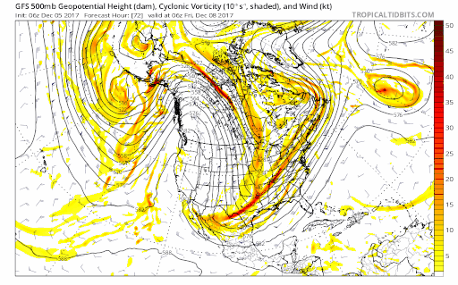
Energy in the upper atmosphere can be a catalyst for storm development. Tropical Tidbits
As we get into this weekend, several storm systems will be trying to develop along the boundary between cold and warm air on the right side of the trough. Forecasting exactly when the storms will form and just how close to the coast they will come is difficult enough a couple of days ahead, but it’s even harder five or seven days out.
There’s no doubt the temperatures are going to be slightly below average during the next 10 days. But how much precipitation we see is uncertain. Back in 1985, Portland was very cold in December but didn’t have unusual amounts of snow. And Boston saw less than average snowfall. As storms moved into New England the rain-snow line was closer to greater Portland, giving us heavier, wetter snow for the larger storms.
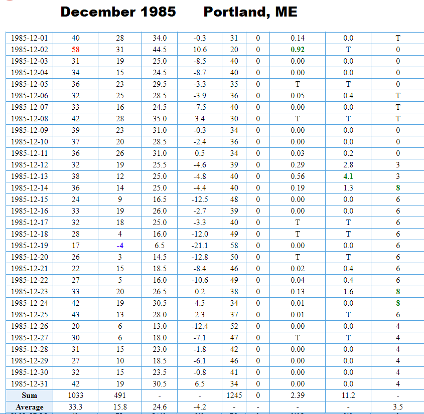
December 1985 was cold and somewhat snowy.
We have been dry for the past six weeks. When we get into these dry patterns and they continue through the first part of the winter it can mean less than average precipitation including lower snowfall totals.
On the model below, notice there are areas of precipitation moving up along the coastline later this weekend and into early next week. A shift of just 100 miles west would mean there would be some significant rain and or snow for southern New England, but the storms could also stay offshore and keep us dry.
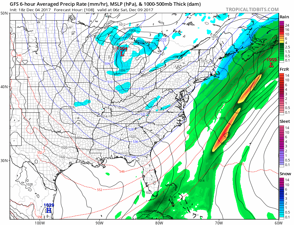
Precipitation will threaten the area this weekend and into next week. Tropical Tidbits
Complicating matters, the models have not been consistent. At times a few days ago it looked like we might see some significant snow this weekend, but it now appears that may have to wait until sometime next week.
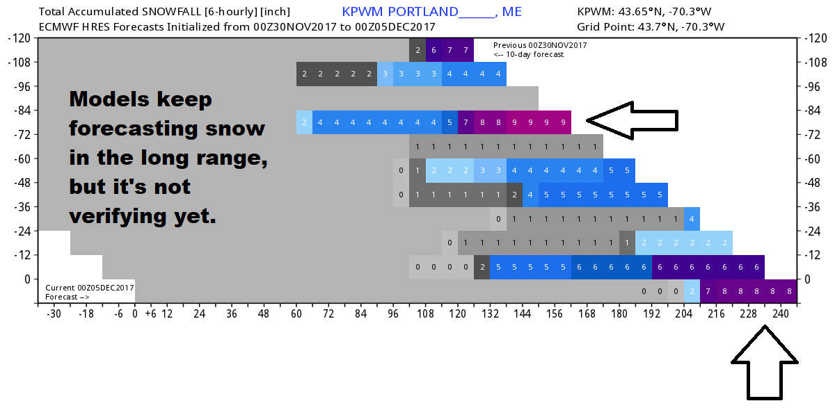
The European model has been forecasting snow, but the forecast hasn’t been verified. WeatherBell
Here’s the bottom line: We are definitely going to turn colder and be on the edge for possible snow, but it’s just a bit early to say definitively whether our world will be turning white anytime soon.
Comments are no longer available on this story