
Friday’s hazy sun and high humidity seems so long ago.
But don’t stop reading now. Even in a pattern that doesn’t scream summer, we will luck out with some sunny and warm days, starting later this week.
Monday went down as the coldest June 4 on record in Portland, with a high of only 51 degrees. There are nine total June days that have been colder in Portland, since 1940. Coincidentally, last June had some cool weather around this time as well. The high on June 6 was 53 degrees.
June gloom happens, but to this extent is a bit extreme.
But is there a pattern shakeup coming?
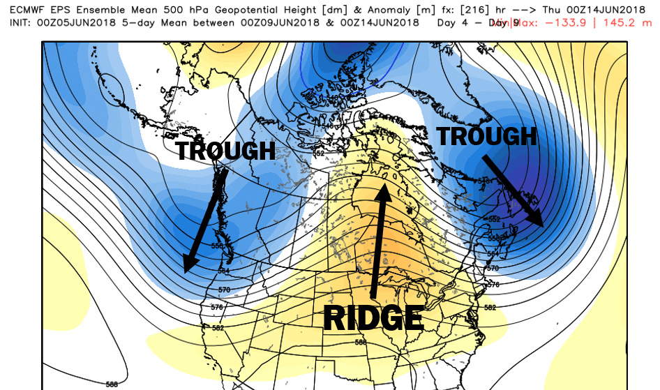
Big picture, not really: Ridging is expected in the middle of the nation and a trough will be nearby, centered just to our north over the Maritimes. But don’t stop reading now. Even in a pattern that doesn’t scream summer, we will luck out with some sunny and warm days, starting later this week.
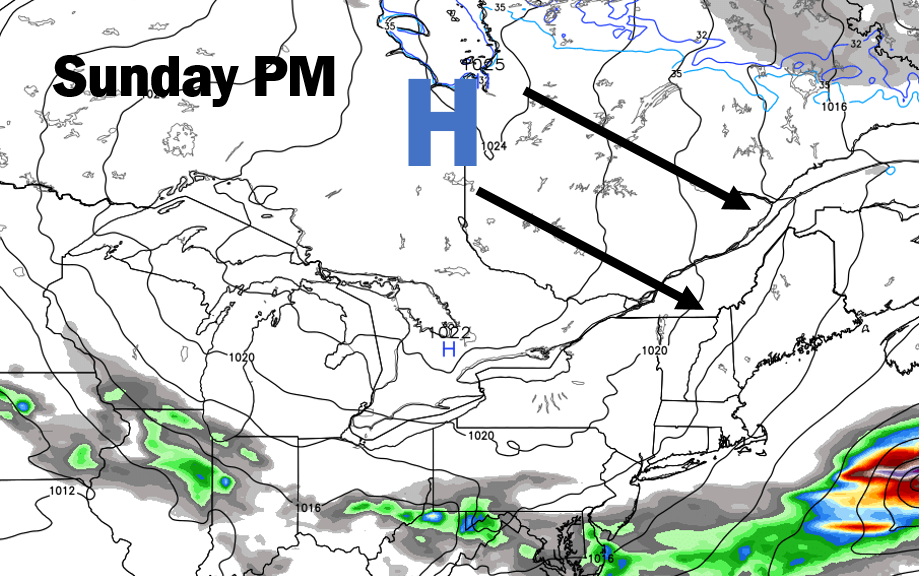
However, it does seem our nice weather will continue to come by way of Canada.
We’ve seen this play out a few times in recent weeks. High pressure over Ontario wedges southeast, bringing us sunny, warm days and dry, cool nights. This keeps the heat and humidity locked to the south most of the time.
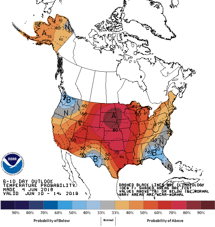
Averaging it all out, the Climate Prediction Center’s call for Sunday through Thursday of next week is slightly above average here. You can see the big time warmth will be locked up in the middle of the country.
Comments are no longer available on this story