
If you’re thinking it’s been a humid summer, you’re spot on.
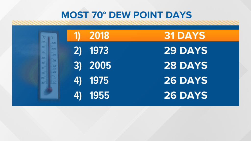
In fact, it’s the most humid summer since the late 1940s, based on dew point records at the Portland Jetport.
Keith Carson and I spent a while sifting through the data. Temperature and precipitation observations are much easier to find. Historical records of dew points, which correlate to how humid or dry the air feels, are not as frequently used. Nonetheless, we added up the numbers and it turns out prior to this year, the year 1973 was probably the most humid summer — at least by our measure — counting days when the dew point hit 70 degrees, or when it feels oppressive.
The humidity is gone, at least for a couple of days.
A sprawling high pressure area is building in. With it will come much more comfortable air. Temperatures will remain near or even above the average; in the 70s Thursday and low 80s Friday.
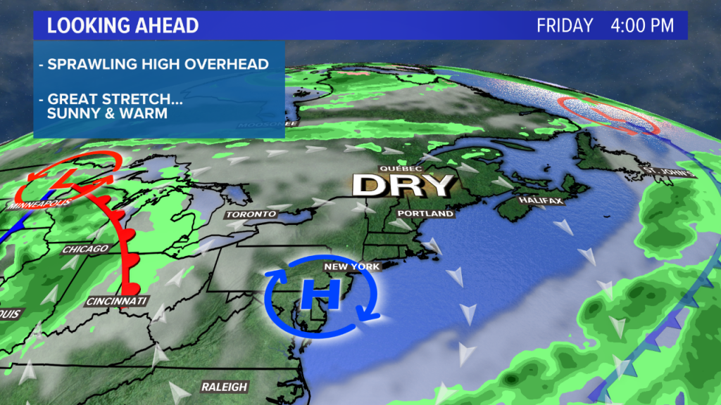
The weekend looks nice as well.
However, during the weekend, warmer and more humid air will attempt to move in. This airmass change will come with more clouds, particularly Sunday.
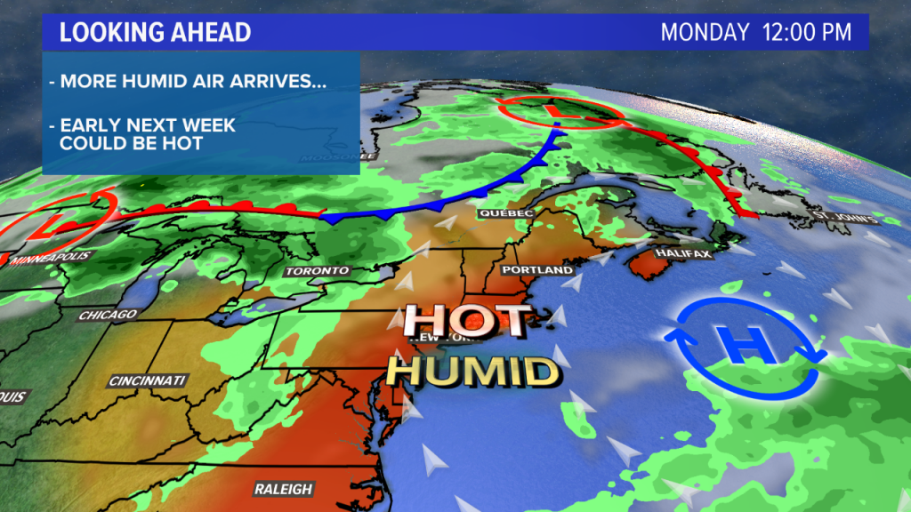
The airmass itself will be toasty, certainly capable of highs in the upper 80s to near 90 if we have full sunshine early next week. However, with a front in the area, we’ll have to keep an eye on cloud cover and potential showers or storms.
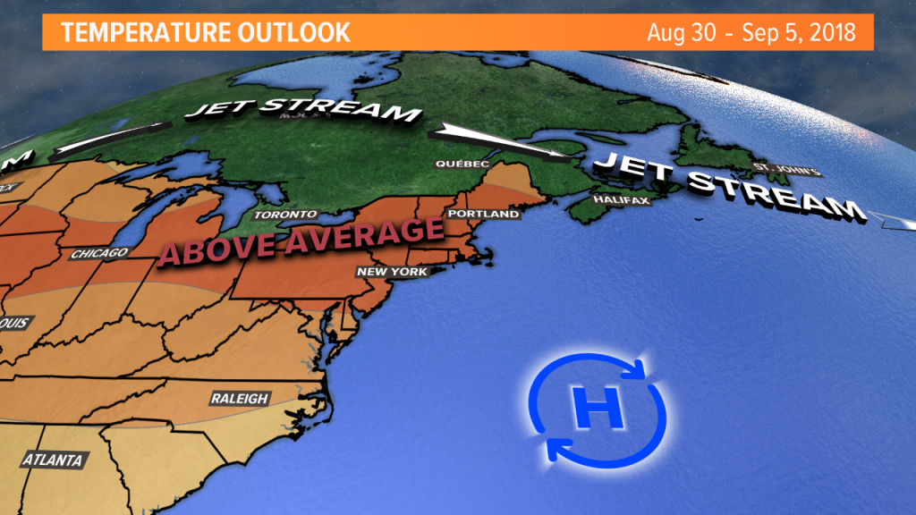
Long-range, it looks like the warmth will persist into the beginning of September. The Climate Prediction Center’s 1 to 2 week forecast is for above average temperatures; average highs are in the mid 70s.
Comments are no longer available on this story