
Cold air damming: It’s one of my least favorite things to forecast any time of the year. It can be painful just looking at a temperature map of the Northeast on a day like today. It’s in the 70s as close as Connecticut, but clouds, rain and a northeast wind keep us locked in the 40s and 50s.

This type of set-up happens much more frequently in the spring, when the ocean is still cool, but the airmass attempting to build in is warm.
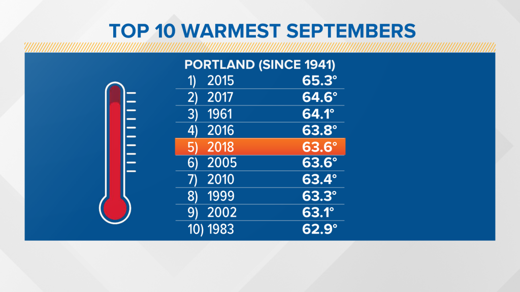
It’s worth noting that September 2018 goes down as the fifth warmest on record in Portland, tying the year 2005. Reliable temperature records have been kept since 1941 — not a remarkably long period — but enough to note that five of the top ten warmest Septembers have occurred in the last decade.
While it’s cool outside now, there are signs we’re not done with warmth yet.
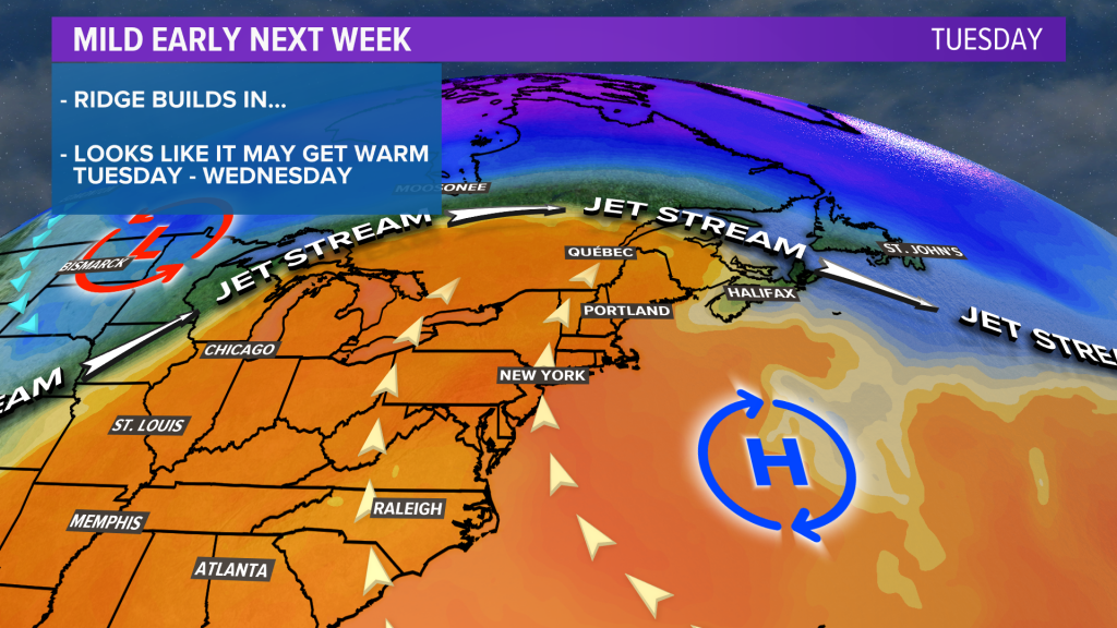
Skipping ahead to this weekend, warmth is possible on Sunday, and it may turn even warmer next week. An upper-level ridge will push the jet stream north of us Tuesday and Wednesday. With sunshine and the right wind direction (west or southwest), we’ll easily hit the 70s and could even touch 80 degrees.
On the flip side of this ridge, winter may be making an appearance though. Cold and potentially the season’s first snow is possible in Montana and the Dakotas, while we’re in the warmth.
We’ll keep an eye on this over the next several days, but if you like mild weather, next week may have some to offer.
Comments are no longer available on this story