
A bigger storm is heading our way for the weekend. It’ll be a coastal storm, and it may bring all types of precipitation.
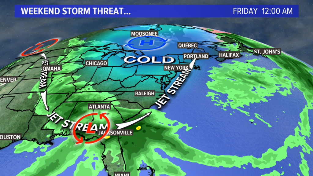
Thursday and Friday will be dry, but cold. The lingering cold will be key as the storm moves in.
By Friday, the storm will be riding along the jetstream, heading north. It’ll be loaded with moisture, in part from the remnants of eastern Pacific Hurricane Willa, in part from the Gulf of Mexico.
The exact track is still unknown, but it looks like we’ll see at least some impact from it, beginning Saturday midday or afternoon, peaking Saturday evening and night, lasting into Sunday morning.
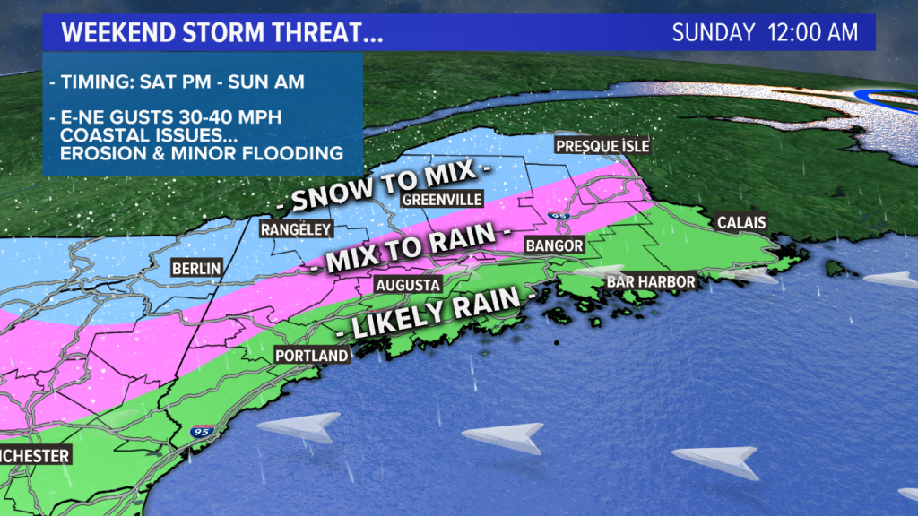
It’s likely going to be cold enough for snow or a wintry mix to start out inland, especially in higher elevations. Farther north and with elevation, the period of snow or mix will be prolonged. Any mixed precipitation should be brief or minimal near the coast.
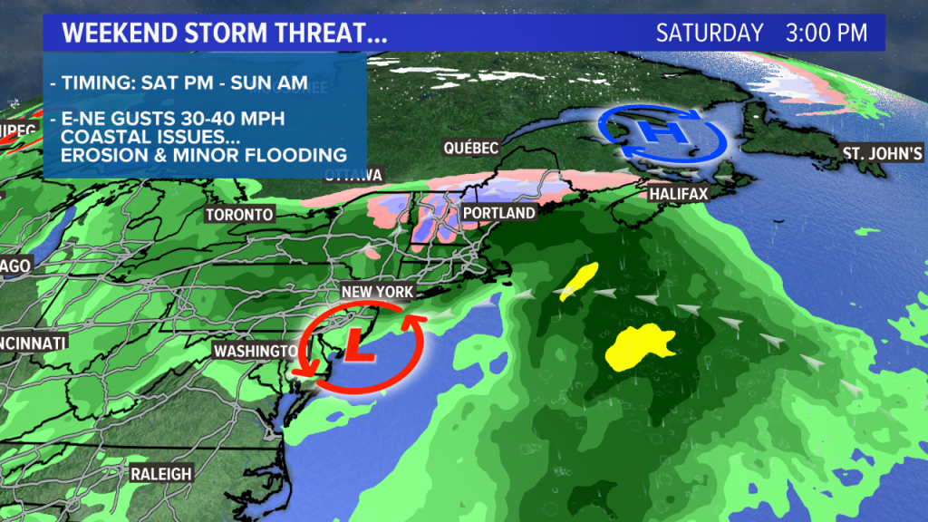
In addition to the snow and rain, a gusty onshore wind out of the east and northeast will present issues for the coast. Tides are running astronomically high, so beach erosion and minor coastal flooding is possible.
Over the next day or two we’ll start to home in on the exact timing and amounts, but right now, plan on a storm with rain and/or snow starting Saturday afternoon.
Comments are no longer available on this story