AUGUSTA — Warmer than average temperature through the rest of the week and rain Friday will be good weather for melting snow, but emergency management officials don’t see this as an equation to cause major flooding in the Kennebec River.
“We’d need several inches of rain on top of snow pack to cause some problems,” said Tom Hawley, National Weather Service hydrologist. “It doesn’t appear that we’ll get that.”
A quarter inch of rain is expected Friday around Kennebec County, according to the National Weather Service, and the temperature could reach the 40s into Saturday.
“The risk of a full river breakup is unlikely,” said Nick Stasulis, chief of hydrologic surveillance for U.S. Geological Service.
Stasulis explained that ice in rivers breaks up in stages. Right now, the Kennebec River is a fairly flat surface of snow and ice, he said, and as water levels rise, the water will lift the ice and separate it away from the shore. Dark spots on the ice or open water will be visible on the banks, he said. This is when water will come above the ice sheet and crack it, breaking it up.
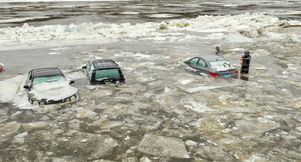
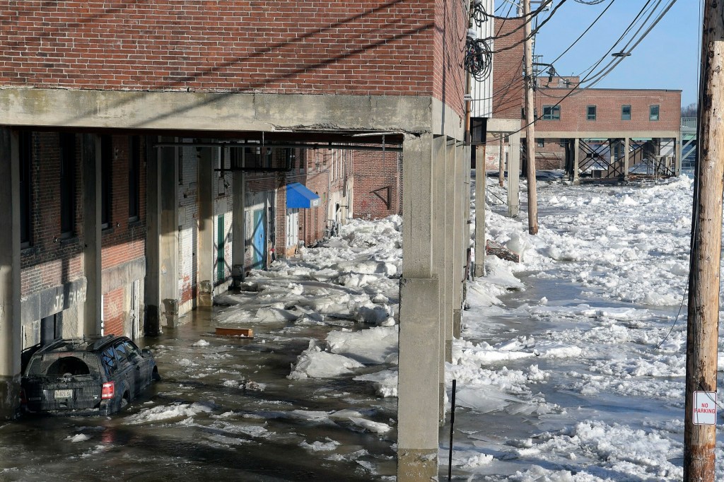
If ice sheets break up suddenly, it can cause ice jams, and that is when there is potential for flooding. Last year, an unexpected ice jam caused flooding in downtown Hallowell.
Sean Goodwin, Kennebec County Emergency Management Agency director, said there is potential for flooding if there is a lot of rain north of Kennebec County.
Significant rainfall at Moosehead Lake, which is the head of the Kennebec River, could cause flooding in the region as streams and tributaries drain into the river. The National Weather Service predicts a quarter inch of rain to fall in the Moosehead Lake region.
Heavier rain in Kennebec County would only cause localized flooding, Goodwin said.
More than likely, officials agree that this forecast will create good conditions for gradual melting.
“Lately, things have been great,” Goodwin said. “Warm days and cool nights are great for a slow thaw.”
The River Flow Advisory Commission is still on guard, however. It met last week, determining that the potential for flooding this season is above average.
Susan Faloon, Maine Emergency Management Agency public information officer, said the Coast Guard is planning ice breaking missions later in the month, including on the Kennebec River, in order to prevent ice jams from happening.
The Maine Cooperative Snow Survey collects measurements across the state in order to analyze depth and density of snowpack. The more dense the snow, Stasulis said, the less capability it has for holding water.
“The snowpack isn’t particularly dense,” he said.
According to this week’s survey map produced by the cooperative, the equivalent water content in the snowpack around Augusta is 4-6 inches.
The Emergency Management Agency uses the National Weather Service as a weather authority and said Mainers can sign up for emergency weather alerts.
The public can sign up for alerts from USGS about water data conditions by visiting water.usgs.gov/waternow/ and maps.waterdata.usgs.gov/mapper/wateralert/.
The National Weather Service declared this week — March 11-15 — Flood Awareness Week.
Abigail Austin — 621-5631
aaustin@centralmaine.com
Twitter: @AbigailAustinKJ
Send questions/comments to the editors.


Comments are no longer available on this story