
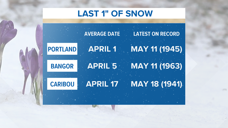
Mainers make a point of acting as if no type of weather can surprise them. A high of 48 F on the 4th of July? “September is beautiful, bub. Don’t rush things.” Snow on your Halloween decorations? “Shouldn’t have put them up so early, guy.”
But when I started posting about some snow on Tuesday May 14th, I detected a chink in the armor. People seem genuinely shocked, and they should be. Those who act like they’ve seen this before either live in The County or are spinning a yarn.
Either way, it is what it is, so let’s take a closer look.
This system is basically just a compact little nor’easter. What makes it unique is that it will take a perfect offshore track to drag in some cooler air AND it will be coming into an already below-average air mass. That’s probably the real linchpin here.
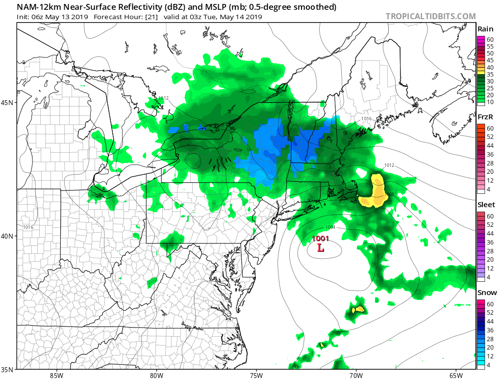
So most of us had cold rain Monday night as the atmosphere cooled from the daytime.
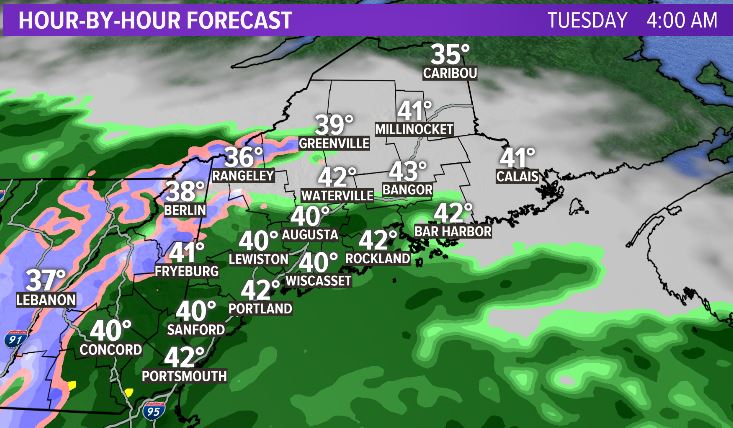
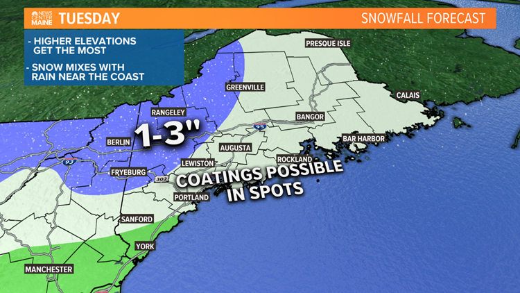
But by the morning on Tuesday enough cold air should wrap in to give us snow that is crashing toward the coast.
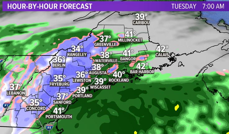
That sticks around for a few hours before retreating back into the mountains.
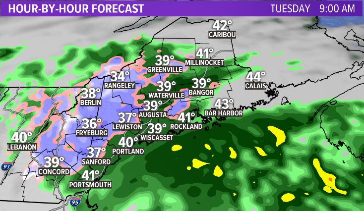
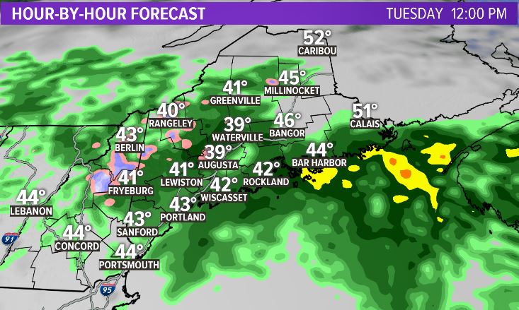
The biggest question mark in my mind is if the snow will get to the coastline. My sense is that it WILL in a technical sense; there will be snowflakes all the way to the coast at some point. But it WON’T be an impactful sense; it won’t accumulate and it won’t have any real effect except on the mental state of coastal residents.
Back into the the mountains and foothills though, it will stick.
I wish I could say the rest of the week was a 70 F + ‘blowtorch,’ but meteorologists only lie by mistake….
https://www.instagram.com/keithcarsonweather/
Comments are no longer available on this story