
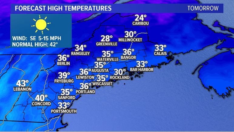
Ah … sunshine and calm conditions at last. What’s that, though? It’s only going to be in the mid-30s?
That’s right! It’ll be a relatively chilly day on Monday to kick off the week. Beautiful and bright, though.
Clouds roll in overnight Monday into Tuesday. Temperatures bottom out below freezing in most locations.
As warm air moves in, we start off with flakes that quickly transition to rain at the coastline. Inland, the transition is a little more delayed.
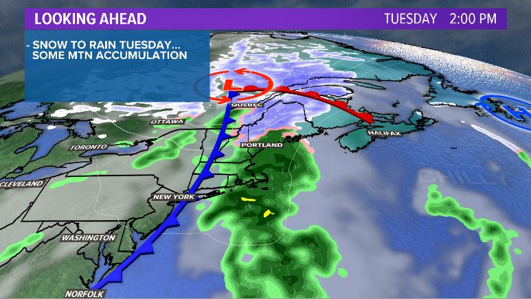
The warmth brought with the system should push the coastline into the mid 40s by the afternoon. Near the capital, temperatures settle closer to 40 degrees. It will be chillier in northern Maine.
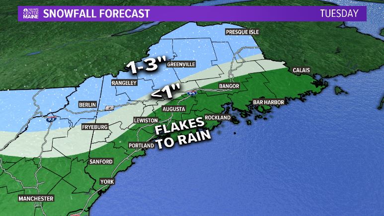
Snow showers continue in northern and western parts of the state, dropping a little bit of snow. Most only see 1-3″ in the highest elevations and in northern Maine. A couple of peaks may end up closer to 4″.
It’s a pretty quick system, though. The bright, sunny days are back on Wednesday with breezy, cooler conditions. Most still make it into the 40s, although the drier air will make it feel a little cooler outside.
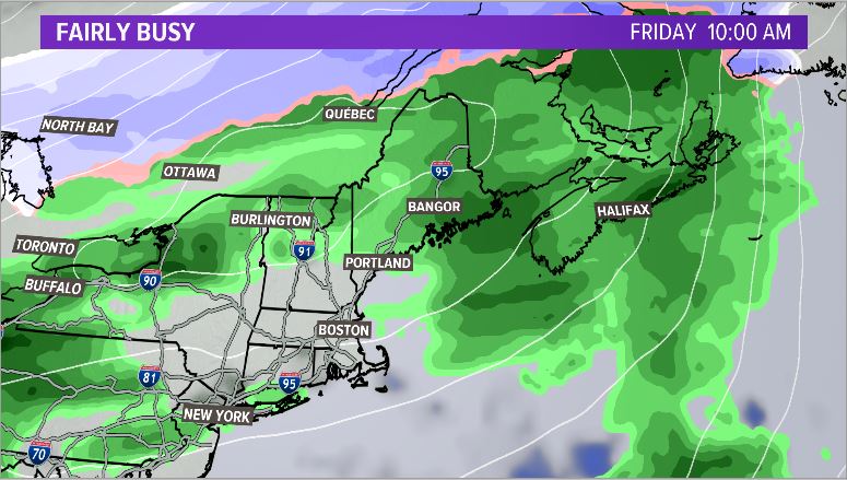
Thursday starts clear and quickly becomes cloudy. A handful of rain showers will be possible on Thursday, but most of that holds off until Friday. Expect temperatures to slowly climb into Thursday evening. They will not fall much into Friday morning.
Friday actually brings a chance at 60° in parts of southwestern Maine! With it, though, comes another batch of heavy rain. It’s possible that some areas could receive an inch or so of rain. More details on this as we get closer.
There’s a lot going on in the headlines right now. Weather is not one of them. Other than a weak system on Tuesday and heavier rain Friday, the weather is still relatively calm for this time of year. Plus, I hear there could be some wonderful weather on the way for next weekend.
For more forecast information, follow me on Twitter and Facebook.
Comments are no longer available on this story