
Hope you all had a wonderful Fourth of July weekend! The weather this week in Maine will be a bit tumultuous, going from sun to rain and chilly to hot as the week progresses.
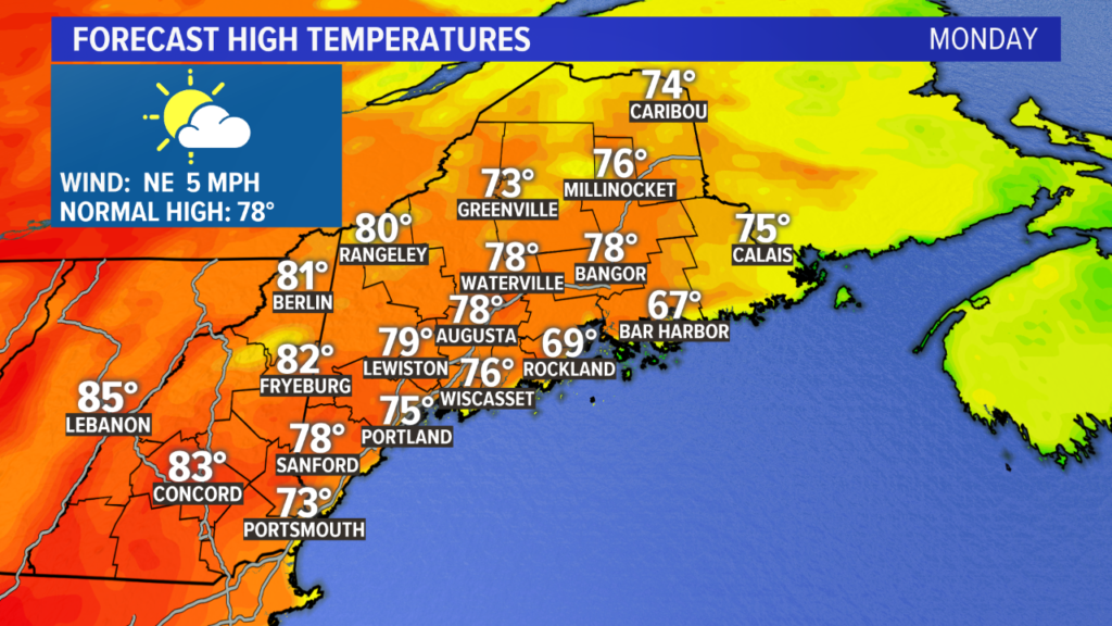
Monday will be the nicest day of the week. Humidity will be low, high pressure keeps us dry, and a north wind means we finally clear out that pesky coastal fog. There will still be some lingering clouds and fog through the morning, but major improvements are on the way for the afternoon.
Highs in the 70s with low humidity and sunshine will feel great.
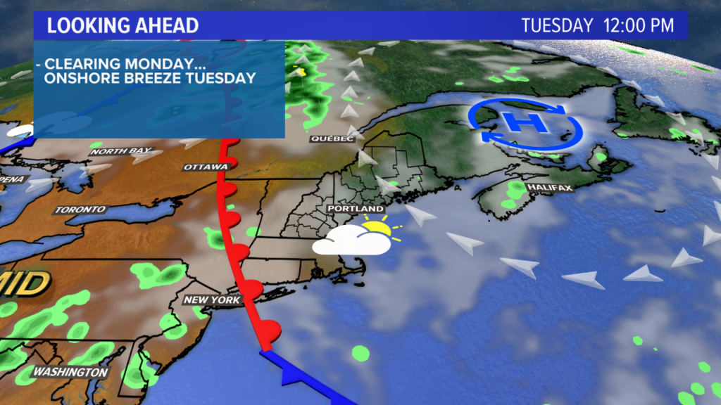
Tuesday we are not as lucky. Onshore wind returns, bringing back the threat for lingering coastal fog. High temperatures at the coastline likely stay near 70 degrees. Inland, it will be nicer, but still a cooler day with mostly cloudy skies.
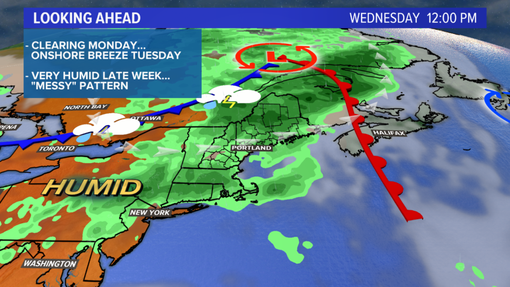
By Wednesday, the humidity returns and a warm front surges north. I think we still stay on the cooler side, with most in the 70s. However, the increased humidity means increasing shower and storm chances.
Wednesday afternoon will be a bit more active with thunderstorms rolling through. A couple of storms could get gusty, depending on how the set up evolves. Either way, it looks active.
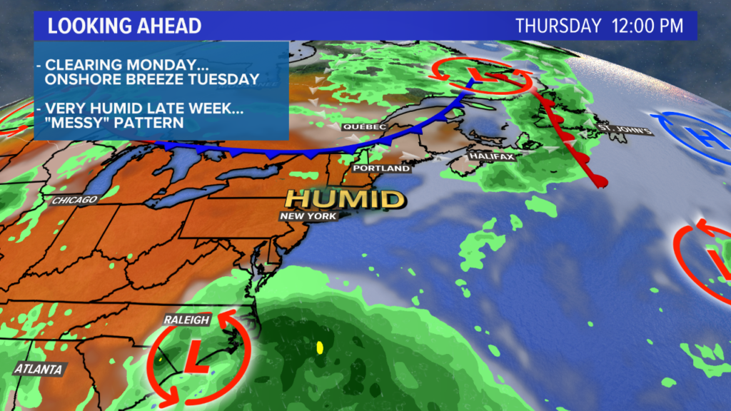
Thursday could be a bit drier. High temperatures will be in the 80s at the coastline on Thursday and into the upper 80s or even low 90s inland. With humidity still increasing, expect it to feel hotter out than it actually is.
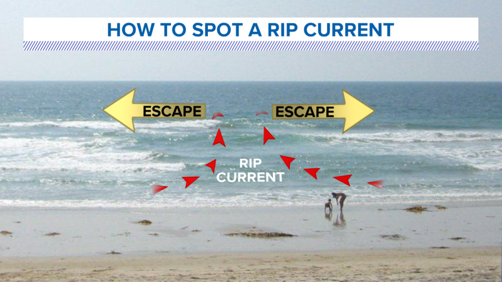
Heading to the beach? Let’s talk about beach safety! Rip currents are an issue along the coastline.
A rip current is a narrow, strong current that moves out away from the breaking waves at the shoreline and back toward the open ocean.
If you find yourself in a rip current, the best thing to do is swim parallel to the shoreline until you find a break in that current and can swim back in, going with the waves.
Friday looks hot and humid as well, with a growing threat for showers or storms over the weekend. There will a system that develops in the tropics and pushes north. As it does, the tropical moisture comes with it.
Depending on where it lands, we could have a small flooding risk for Saturday or Sunday. It’s a bit too far out for specifics, but it’s something that needs to be watched closely.
Until then, be safe, and enjoy this roller coaster of a forecast. For more forecast information, follow me on Twitter or Facebook.
Comments are no longer available on this story