
Picture this. It’s almost the end of September. You’re looking at the foliage and sipping a pumpkin spice latte. You reach down in you car and…wait a second, why is the air conditioning on?
Thank the warm, humid air that has arrived just in time for the end of the month.
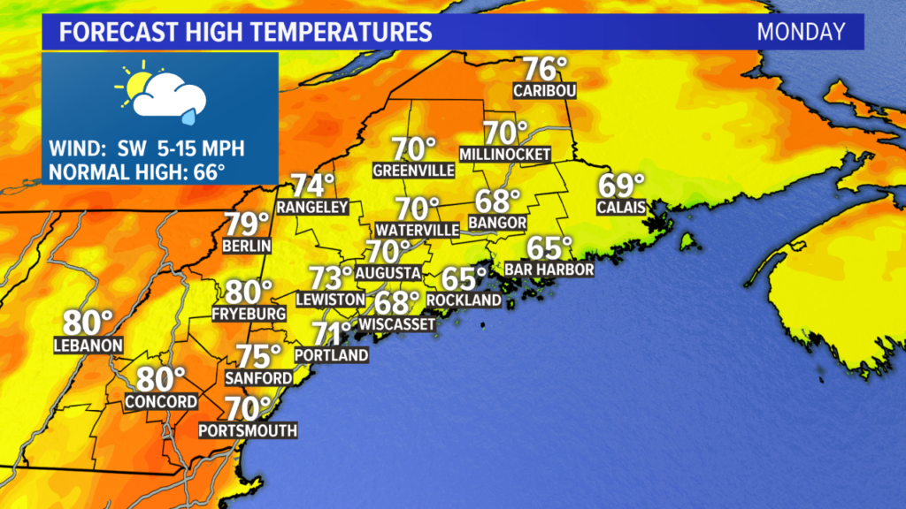
Monday will be a muggy day with high temperatures back in the 70s. This is fairly warm for this time of year, and the added humidity makes it feel even warmer.
Expect some spotty showers, especially in the afternoon. The day does not look like a washout at all, but it will be somewhat unsettled.
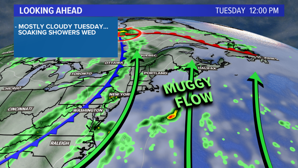
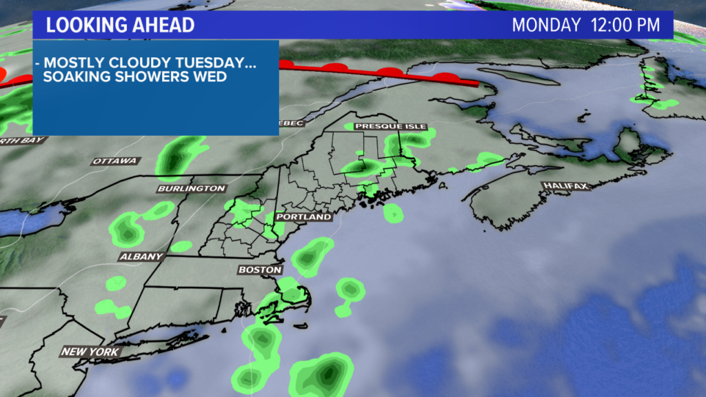
The humid air sticks around Tuesday. It looks generally dry, despite the mostly cloudy skies.
Without passing showers, highs get pushed well into the 70s. The persistent south and southwest winds will keep pushing the core of the warmest, most humid air into New England.
Showers will be possible late Tuesday night and into Wednesday morning.
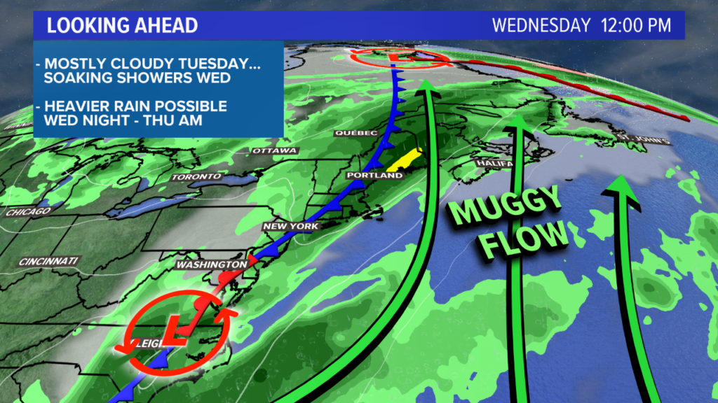
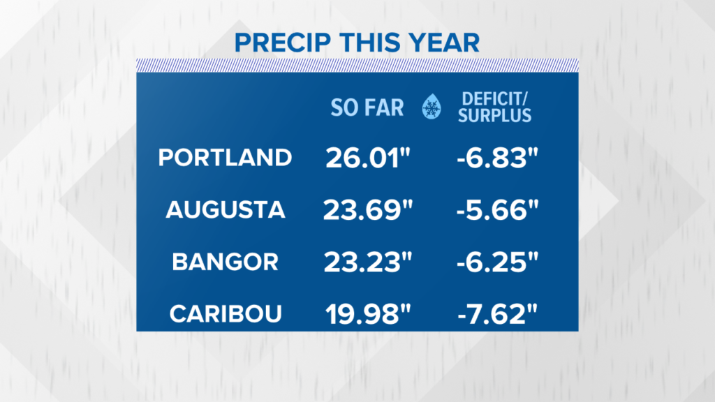
The passing cold front Wednesday afternoon will bring a period of steadier, heavier rain to Maine. Much needed might I add; this will be the first chance in a while that we’ve had to make a dent in the drought. Take a look at our current rainfall deficits.
A few rumbles of thunder might even happen on Wednesday afternoon if the timing works out correctly.
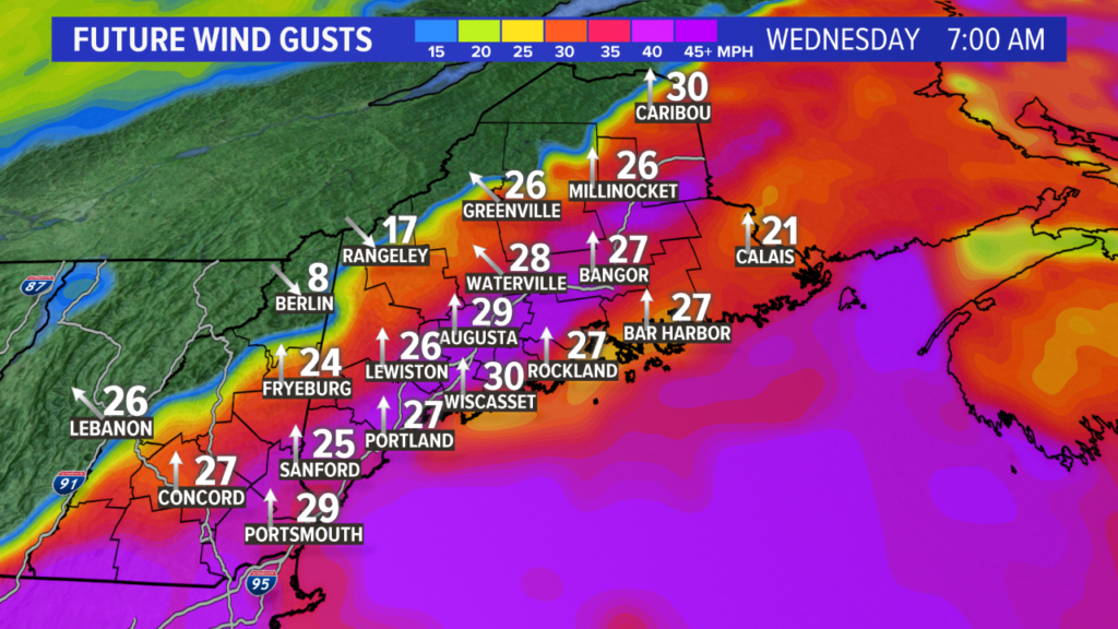
On top of the rain and thunder potential, wind gusts will be on the rise through Wednesday morning and into the early afternoon. Thankfully, damage seems unlikely given these forecast gust amounts. Lots of trees will shed their leaves, though.
Should the wind gust forecast increase, some power outages may be on the table. I don’t know how likely that is just yet. I’m learning toward a lower gust solution than modeled right now.
The pattern evolves in a pretty interesting way after this. As the front slows over Maine, a second area of low pressure forms off of the Mid-Atlantic coastline and moves north along the cold front.
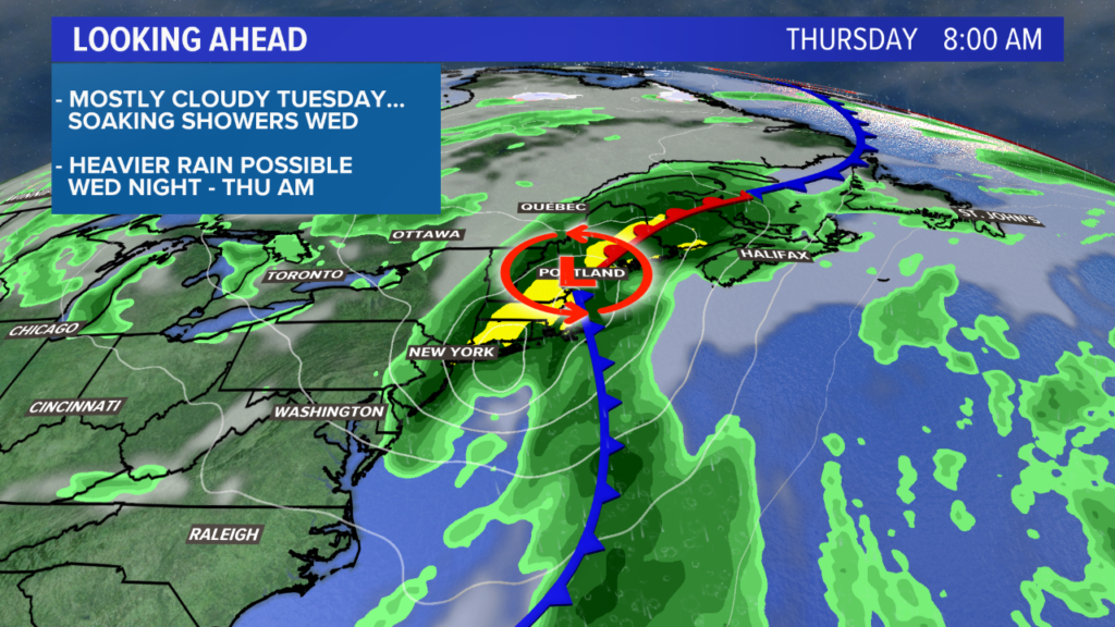
Low pressure tracks towards Maine and heavy rain is back in the forecast for Thursday morning. That’s right! There are two chances for moderate to heavy rain in the forecast this week. Not bad, considering how dry it has been.
By Thursday night, drier and cooler air will slowly spill in.
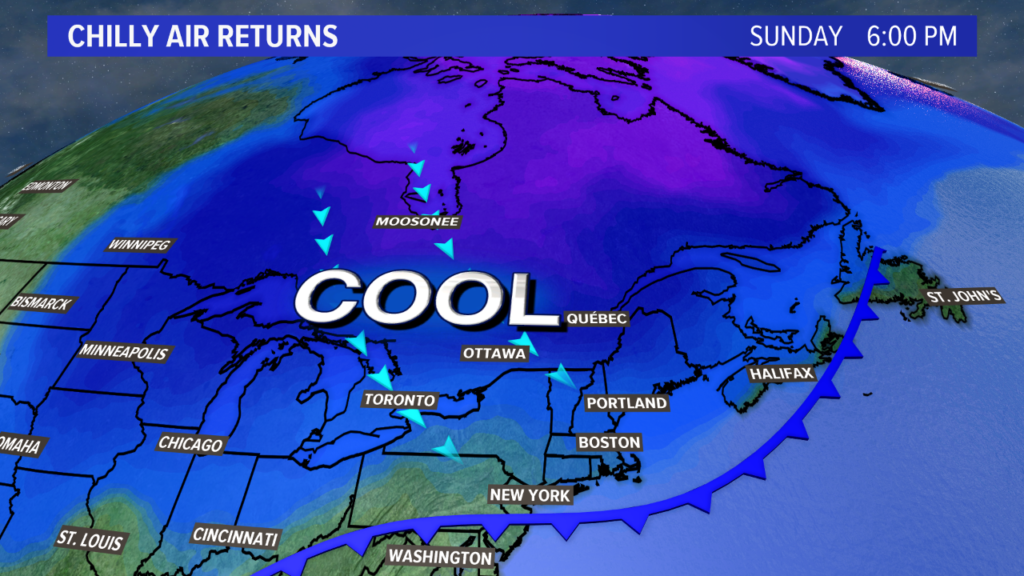
The map above shows the leading edge of cold air settling in through Friday and the weekend. As it builds, the temperatures will steadily decrease through Saturday and Sunday.
Maybe by next Monday, you’ll be able to enjoy a hot apple cider in your flannel without cranking the A/C to make it feel chilly.
For more forecast information and other Maine related musings, check out my Twitter page.
Comments are no longer available on this story