

Time is running out to put the plows on and get the generators fueled up. The first big storm of the winter season will arrive overnight into the start of the weekend and there will be big travel impacts. A power outage threat is also in the cards with the heavy, wet snow and high winds poised to snap tree limbs. Let’s take a deep dive into what is going to happen.
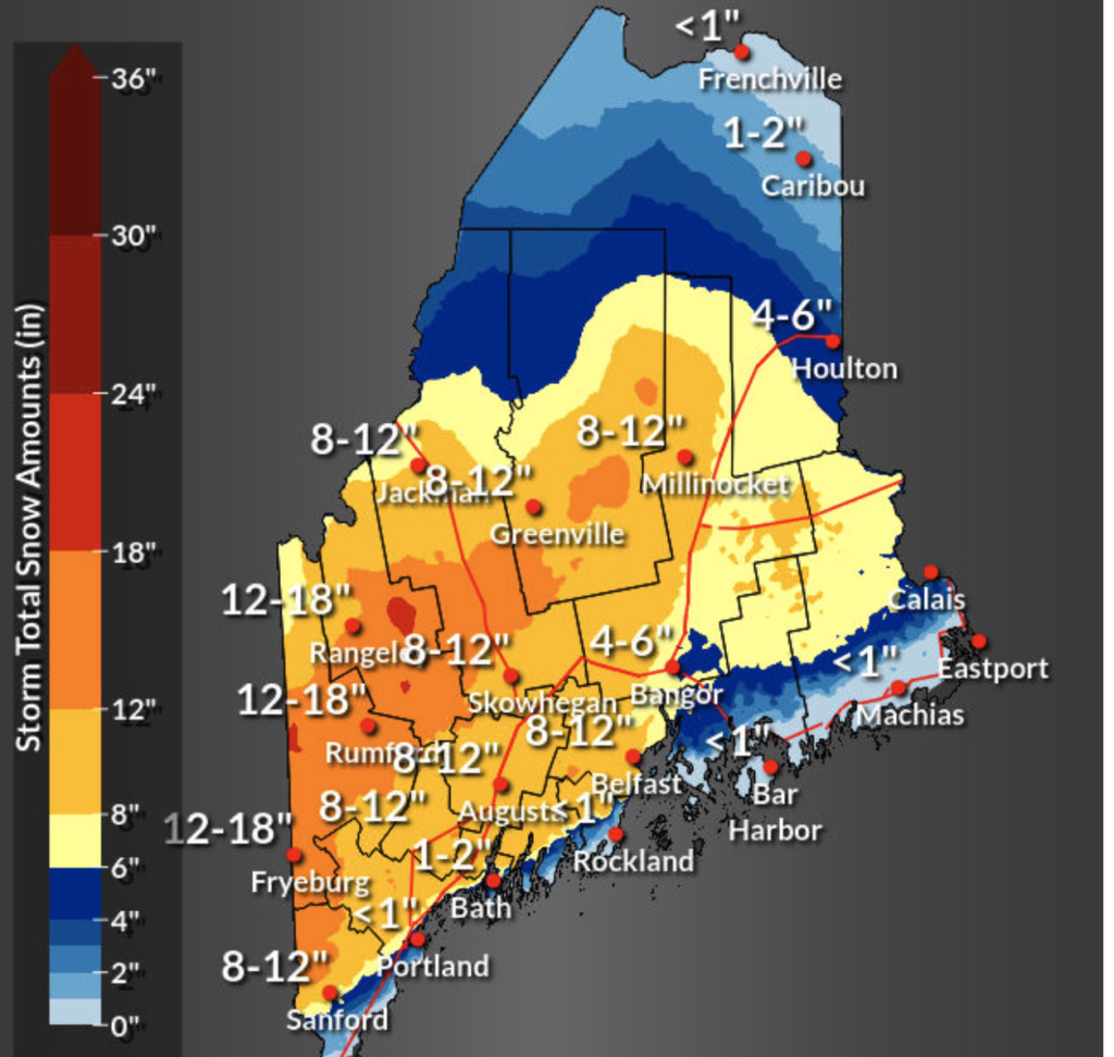
Total snow amounts
Mainers are no strangers to the term “Nor’easter”…but what about a Miller “Type B” nor’easter? That’s when a large storm transfers its energy across the Ohio Valley to an area of low pressure that develops off the mid Atlantic coast and heads northeast. The wind then shifts out of the “northeast” and that’s how you get the term nor’easter. This is in contrast to a more common Miller “Type A” nor’easter that develops in the Gulf of Mexico and heads up the Atlantic coast towards Maine. We are getting the “Type B” this time and here is what will happen.
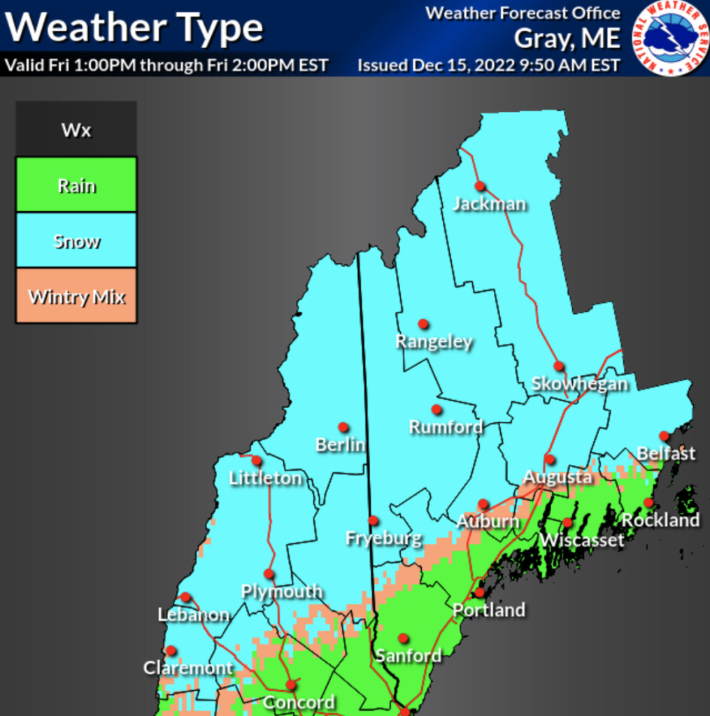
I expect an initial thump of heavy snow for southern Maine tonight as the precipitation begins, but that will quickly change to rain along the coastline. I’ve attached timelines for the start of the rain/snow for all of Maine so you can plan ahead.
The storm really gets cranking Friday towards the afternoon and evening. The wind will pick up out of the east and northeast to gusts of more than 40 mph. Add the high winds to the heavy, wet snow and you have a power outage threat south of the foothills and just inland from the coastline where I expect the heaviest snow.
Note that in the maps attached there will be a rain-snow line that moves throughout the storm. That’s due to a coastal front setting up as the warm and cold air battle near ground level. The ocean is near 40 degrees and I expect the wind coming off the ocean to bring warm air inland. Depending on how hard it snows will decide who gets snow and who gets rain in this battle.
Precipitation amounts in the state
The harder it snows the more cold air is brought down to the ground and less rain will mix in. This will be the feature to watch tomorrow and for a time Saturday as the storm is winding down.
When it’s all said and done you will see streets and backyards covered with 1 – 2 feet of snow from Fryeburg, to Rumford, into Rangeley. Much less snow will add up along the immediate coastline, especially east of Rt. 1 where rain will mix in.
I’ve included the probability of snowfall maps for all of Maine. I’ve also included the Winter Storm Severity Index which shows this will be a “major” storm for part of the state in the red seen on the map.
I’m also tracking the potential for another “big” storm that could roll into town a few days before Christmas.
Send questions/comments to the editors.

Comments are no longer available on this story