

America’s heartland will bake this week as a big ol’ ridge of high pressure sets up an Omega blocking pattern, or “ring of fire.”
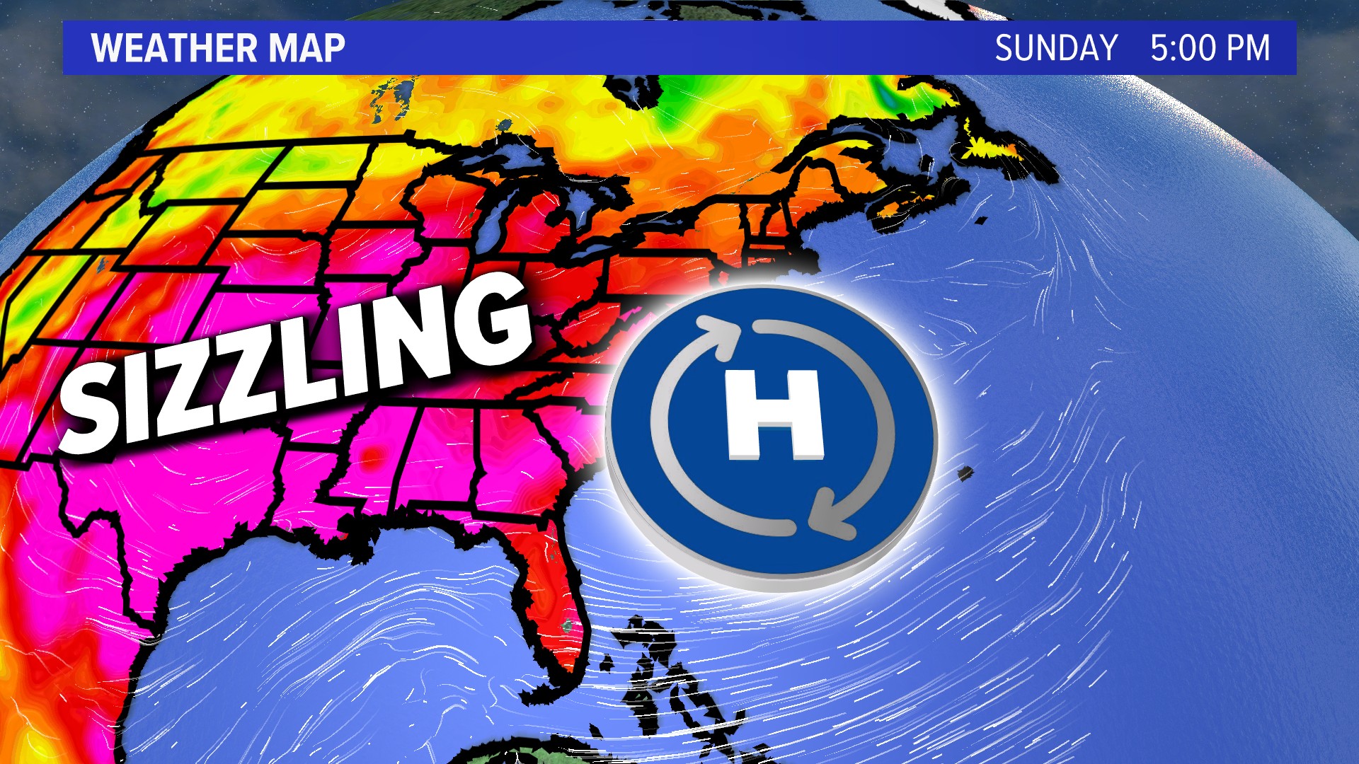
Heat’s been a common theme all summer long, with record highs set in the Midwest, mid-South and Gulf Coast. New England has largely been spared from the blazing heat, with troughs of low pressure dominating our weather picture for months.
Here’s the setup:
High pressure at the ground level over the Southeast will weaken Monday as the “ring of fire” takes over directly above the Great Plains.
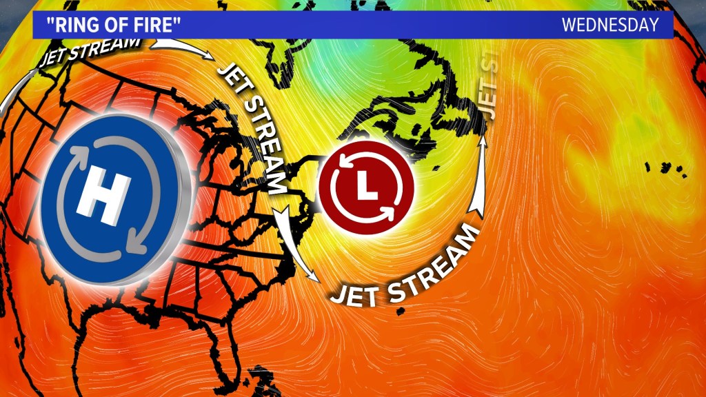
A trough will cover New England and allow milder air to filter in from Canada.
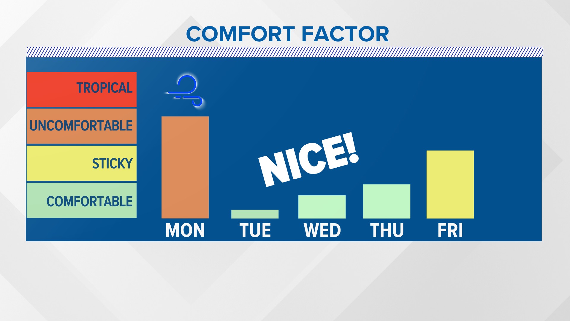
After near-tropical levels of humidity Monday, the dewpoints will come crashing down by midweek with refreshing air for all of Maine.
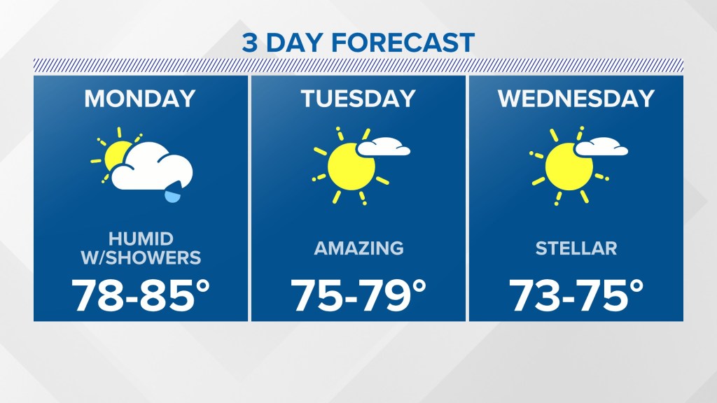
This is one of the better three-day outlooks we’ve had all season long in the Pine Tree State.
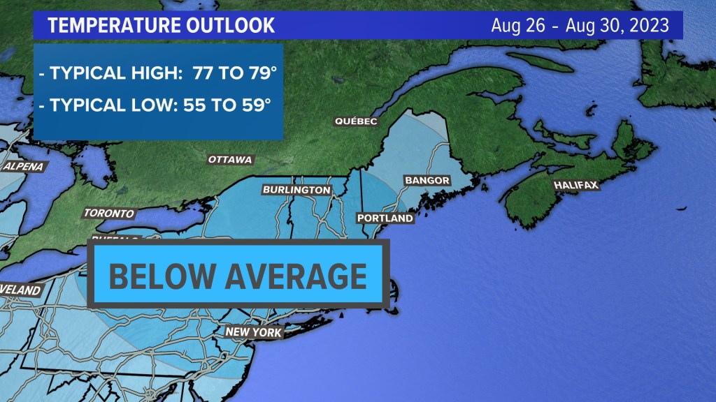
Heat will be hard to find in the Northeast, with the temperature below average for the end of August. Most can expect highs in the low to mid-70s and lows in the mid-50s.
With dewpoints in the 40s and 50s, one could say an early taste of fall will be in the air.
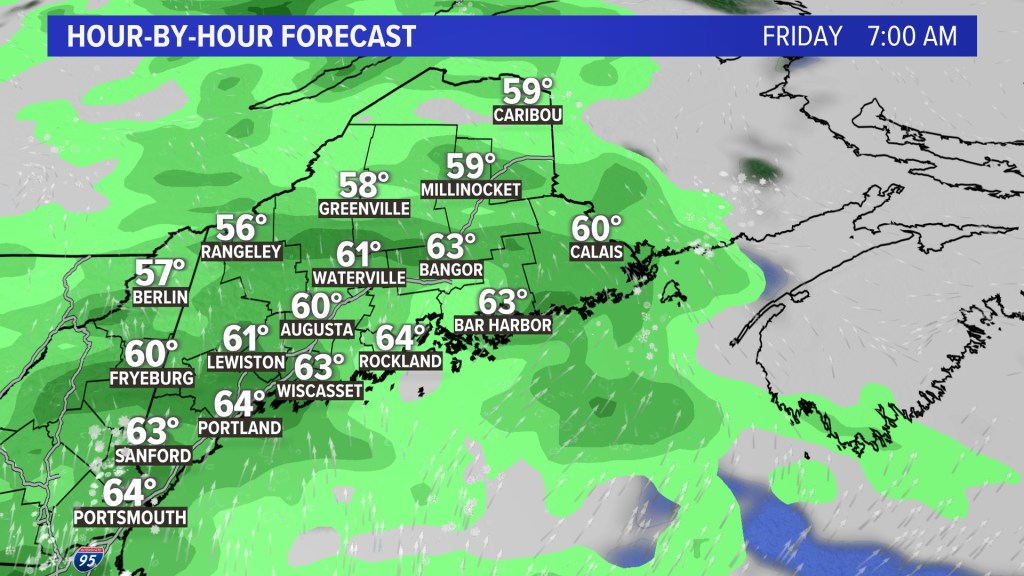
The next rain storm arrives Friday.
Send questions/comments to the editors.

Comments are no longer available on this story