


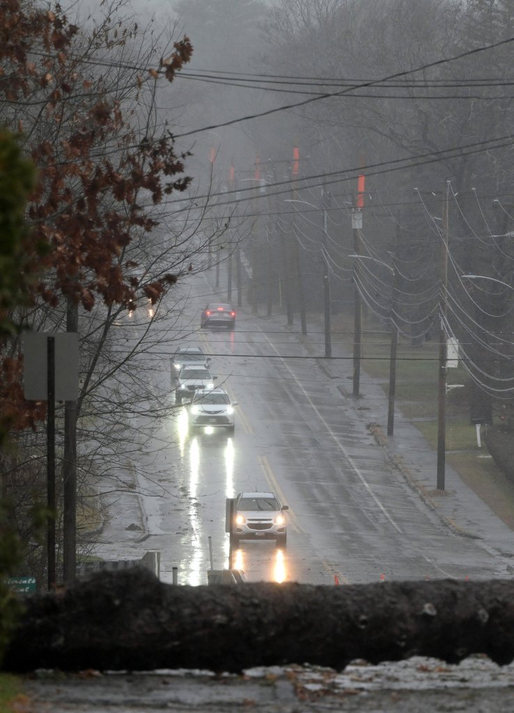


AUGUSTA — High winds and heavy rain moved into central Maine early Monday, bringing down trees, knocking out power to nearly 90,000 across the region and creating flood warnings that could last through the week.
Public works and fire departments scrambled throughout the day to clear roadways and keep people away from live wires. Over a dozen traffic advisories were posted across central Maine due to downed trees or wires and flooding.
A powerful storm Monday knocked down several trees in Augusta’s Capitol Park. Joe Phelan/Kennebec Journal
Meanwhile, school districts in Augusta, Gardiner and Waterville, among others, announced plans for early dismissals and canceled many afternoon sessions because of the weather.
Hunter Tubbs, a meteorologist with the National Weather Service, said wind gusts as high as 62 mph were reported Monday morning in Augusta and 32 mph in Waterville.
“If anything, the wind is expected to increase this morning into this afternoon before gradually decreasing tonight,” Tubbs said.
Gov. Janet Mills ordered state offices to close at 1 p.m., and some municipal offices, including in Augusta, Gardiner, Waterville and Winslow, also closed mid-day. Winthrop closed its town offices and Bailey Library and postponed Monday’s Town Council meeting.
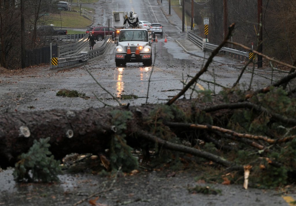
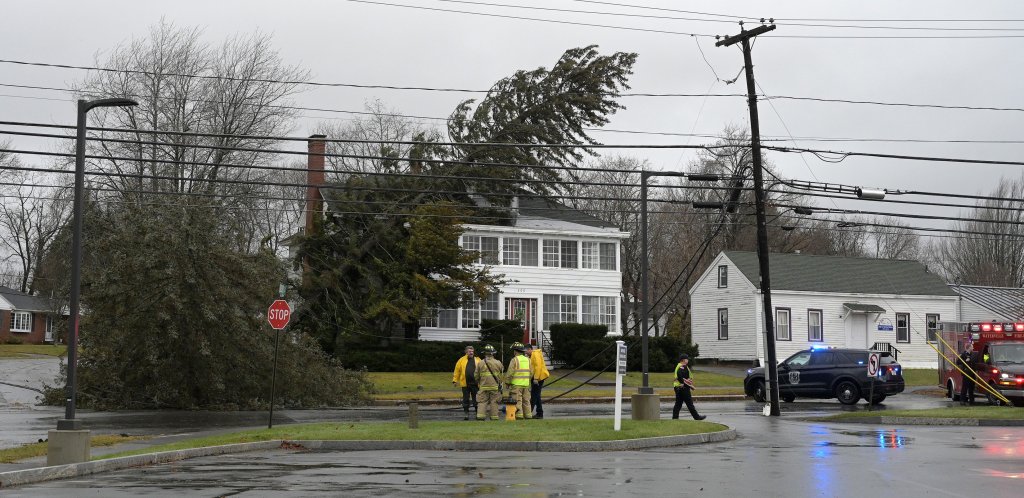
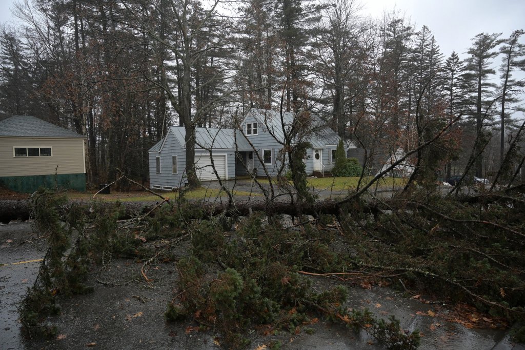
Firefighters and police work the scene Monday where strong winds and rain toppled a tree into a home, forcing the closure of Main Street at Johnson Heights in Waterville. Rich Abrahamson/Morning Sentinel
Reports of storm-related damage and crashes were widespread.
In Chesterville, authorities responded around 1:45 p.m. to a call that power lines and trees had fallen atop a school bus.
Nickolas Wills, the town’s fire chief, said 14 students were aboard the bus at the time but none were harmed.
“We responded to a call with a school bus and power lines involved,” Wills said. “Once the power lines were removed the bus continued on.”
In Augusta, the wind twisted the scaffolding off the Burton M. Cross state office building on Sewall Street.
Stacey Morrison, chief executive officer of Ganneston Construction, said no one was injured; once the the storm was forecast, company officials ensured materials and scaffolding was secure and closed down the job site for the safety of its employees and subcontractors. The company is in the process of developing a demolition plan to bring down the scaffolding safely.
Scaffolding twists off the Burton M. Cross state office building on Sewall Street in Augusta during a powerful wind and rain storm Monday. Joe Phelan/Kennebec Journal
The rubber membrane on the roof of one of the wings at the Gardiner Area High School started peeling off in the high winds. Patricia Hopkins, superintendent of School Administrative District 11, said the district’s roofing company was on site Monday but unable to make repairs due to the wind.
Because of the outages, people across central Maine reported being unable to gas up their vehicles.
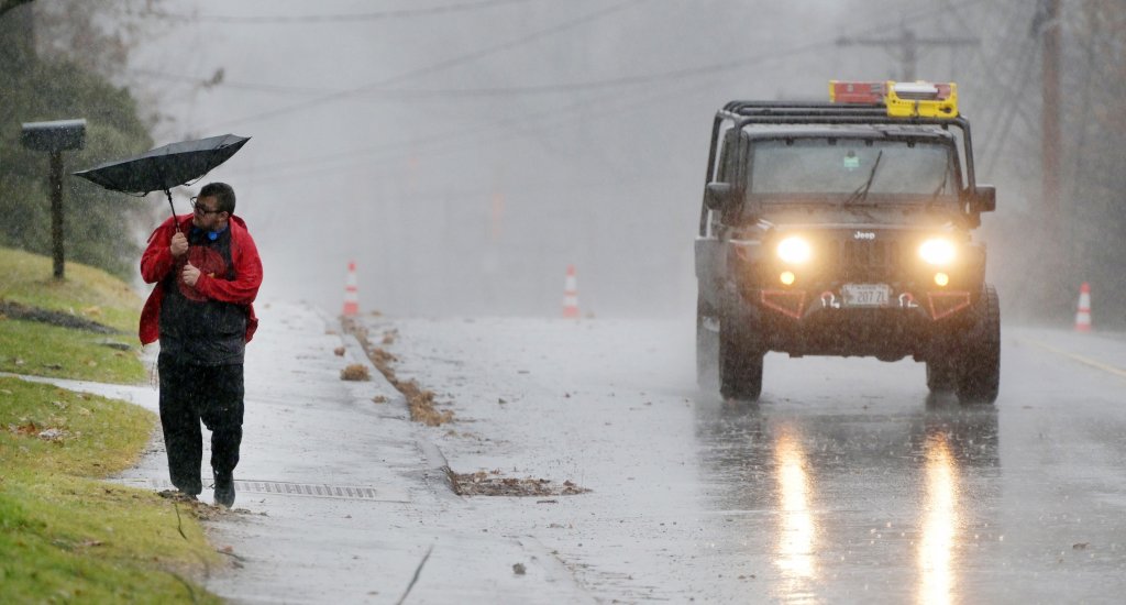
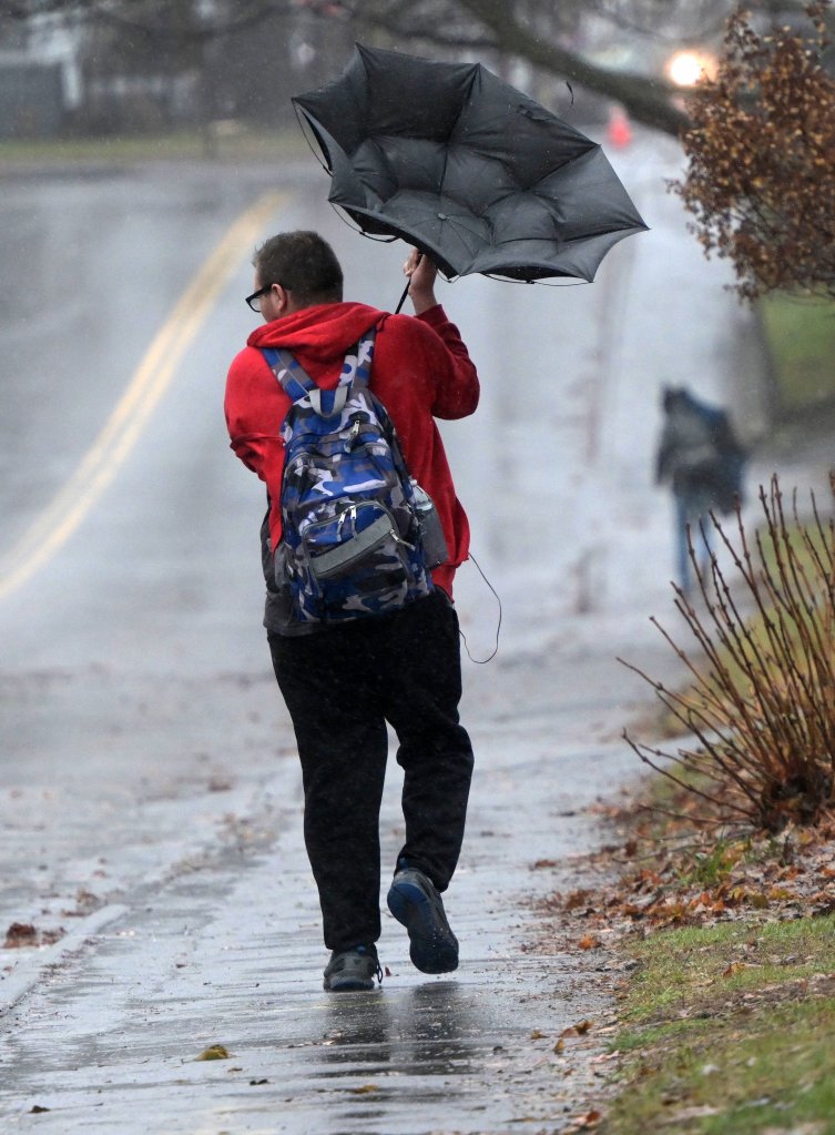
A gust of wind turns an umbrella inside out Monday as a pedestrian in Waterville holds on during a storm that brought strong winds and rain to central Maine. Rich Abrahamson/Morning Sentinel
Reported power outages continued to rise throughout the morning, ballooning midday with widespread outages affecting Augusta, China, Gardiner, Litchfield, Vassalboro and West Gardiner, among other towns.
“Given the already water-saturated soil from previous storms, with more rainfall expected, trees may be more vulnerable to strong winds associated with this storm,” Jonathan Breed, spokesman for Central Maine Power Co., said Sunday. “Our service centers, tree crews and line workers will be pre-staging across our service area and will be prepared to respond to any storm damage that may occur.”
By late Monday afternoon, Breed said the damage that CMP crews were seeing was extensive.
“We have been assisting local emergency management agencies with calls for assistance to clear roads and make fallen power lines safe,” he said.
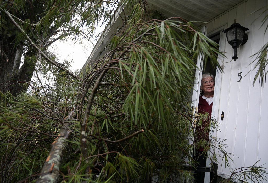
A fallen tree Monday prevents Carmen Bourgoin from opening the front door of her home off Fuller Drive in Winslow. The tree, which Bourgoin says fell around 1 p.m. Monday during a powerful wind and rain storm, also blocks the front entrance to the home where Bourgoin lives with her husband, Wayne Bourgoin. Rich Abrahamson/Morning Sentinel
Because of the sustained high winds, power company crews weren’t able to get up in their bucket trucks to start repairs. But, he added, as the winds subside, CMP crews will work to restore power as quickly and safely as possible.
In Lincoln County, the emergency operations center was activated midday, and this message was sent out:
“At this time, if you avoid driving on the roads and just stay where you are until the winds calm down this afternoon, that would be best. The height of the storm is noon to 2 p.m. All emergency crews are overwhelmed with calls and CMP is doing the best they can. There are many trees and powerlines down all over the county. Thank you.”
That message was echoed across central Maine as public safety workers struggled to keep up with the volume of calls.
Downed power lines hang above Main Street near where paramedics and police responded Monday after strong winds and rain toppled a tree into a home, forcing the street to close at Johnson Heights in Waterville on Monday. Rich Abrahamson/Morning Sentinel
Waterville firefighters were spread thin as they responded to dozens of reports of trees and powerlines falling houses and roadways.
Jason Frost, Waterville’s deputy fire chief, said he couldn’t even count the reports.
“We’ve had enough (firefighters) that have come in to help. The problem is we don’t have enough apparatus to keep up with the calls,” Frost said. “It’s taken us considerable amount of time to get to some of them.”
Departments throughout the area scrambled to provide mutual aid to their partner even as they fielded their own calls.
Crews in a Central Maine Power Co. truck respond Monday after strong winds combined with rain toppled a tree, blocking both lanes of Gilman Street in Waterville. Rich Abrahamson/Morning Sentinel
He, like other officials, advised residents to stay put until the storm passed and to avoid fallen trees and power lines.
“If a road is blocked off by a tree or traffic control device,” he said, “don’t drive around it because it’s there for a reason.”
In Dresden, town officials planned to open Pownalborough Hall at 3:30 p.m., for anyone needing to warm up, charge a device or for temporary shelter, but they recommended people shelter in place if possible.
Along the Kennebec River, city officials announced closures of riverfront parks and low-lying downtown parking areas.
The heavy rain and melting snowpack in the northern part of the Kennebec River watershed was expected to bring flooding into the region Monday and Tuesday.
By midday, 3.19 inches of rainfall was recorded in Manchester; 2.84 inches was reported in Oakland.
Flood warnings for the Kennebec River were expected to go into effect Monday evening until Thursday for locations along the river.
Data from the National Oceanic and Atmospheric Administration indicated that the Kennebec River was experiencing moderate flooding as heavy rain continued pounding central Maine throughout Monday afternoon. Water gauges along the Kennebec in Augusta, Skowhegan, Gardiner, and near Waterville showed that the river’s water level was steadily rising, with water flow nearing NOAA’s flood standard of 35,000 cubic feet per second.
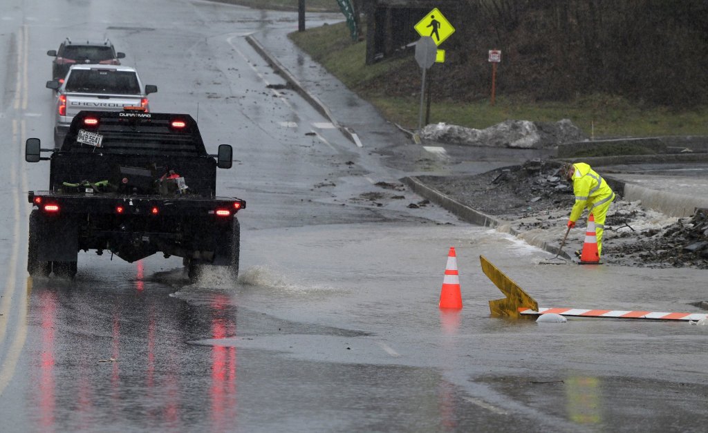
A worker tries to mitigate street flooding Monday along China Road by the McDonald’s restaurant in Winslow. Rich Abrahamson/Morning Sentinel
Tubbs said in addition to small stream flooding, the Kennebec River river is expected to reach minor flood stage Tuesdsay in Augusta. In Hallowell, the latest forecast predicts the river may approach the major flood stage on Tuesday.
In Skowhegan, the Kennebec is expected to reach moderate flood stage very early Tuesday morning.
Jon Palmer, a National Weather Service meteorologist in Gray, said it’s not uncommon to see cold air follow an unusually powerful storm like Monday’s.
While the temperatures on Tuesday and Wednesday are expected to be lower than Monday’s record breaking temperature of 56 degrees in Augusta — the old record was 52 degrees — the daytime temperatures should be above freezing, Palmer said.
If the temperature went higher than 56 degrees, it couldn’t be recorded because of the power outage.
Morning Sentinel Staff Writer Dylan Tusinski contributed to this report.
Send questions/comments to the editors.

Comments are no longer available on this story