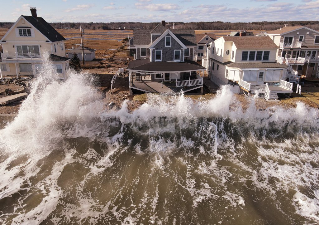
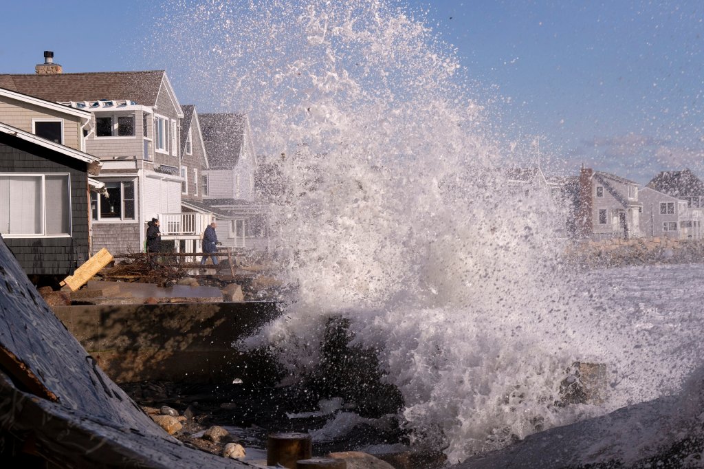
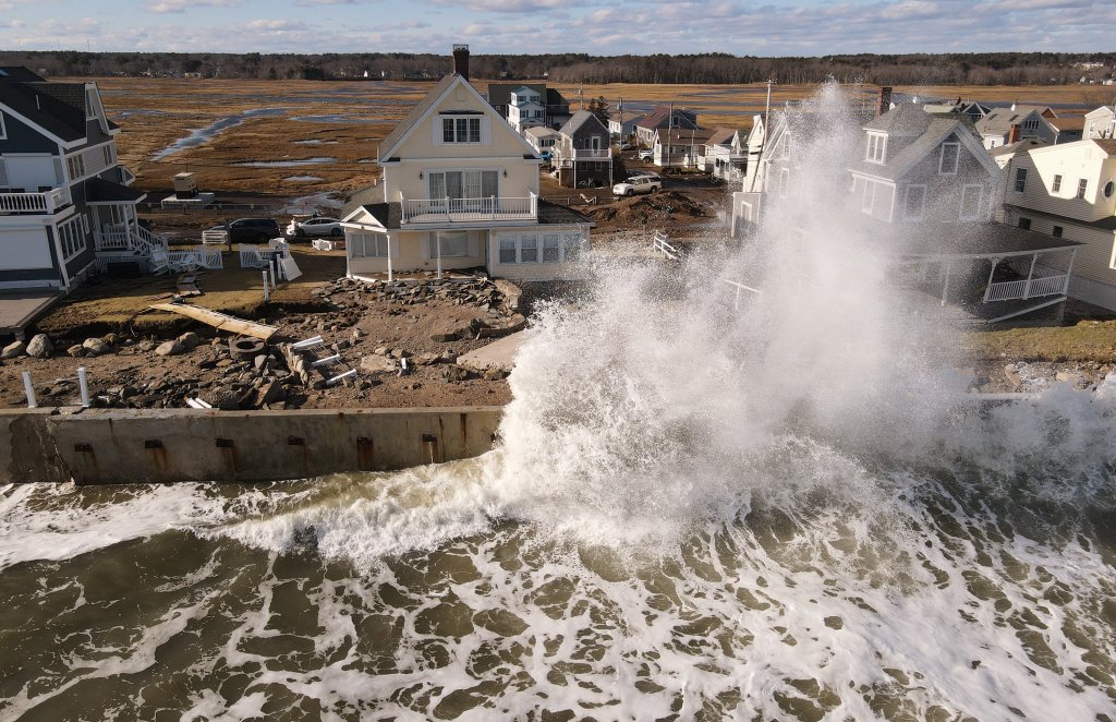
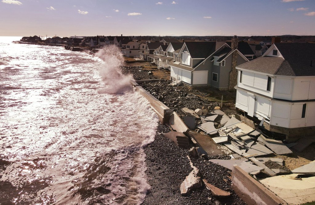
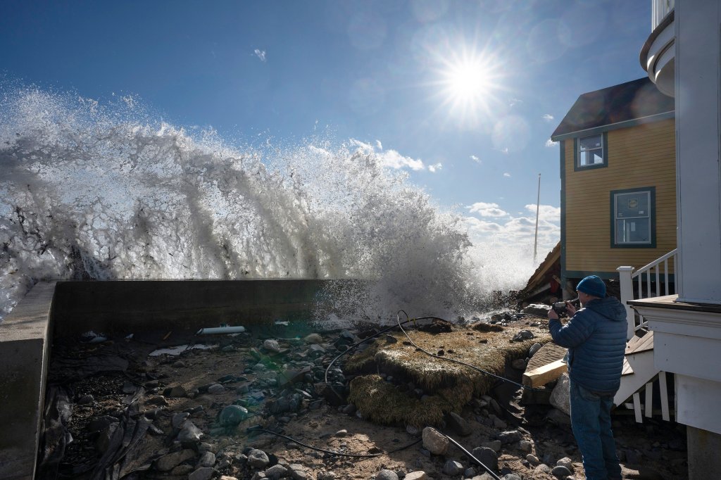
OLD ORCHARD BEACH — All along the southern Maine coast Sunday, residents and businesses were assessing damage and attempting to clean up following the powerful wind and rainstorm that battered the region the day before with waves of up to 20 feet, wind gusts up to 60 mph and historic high tides. The storm also dumped 2 inches or more of rain.
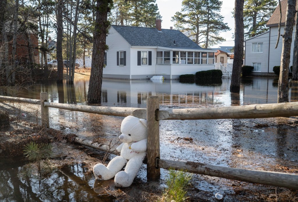
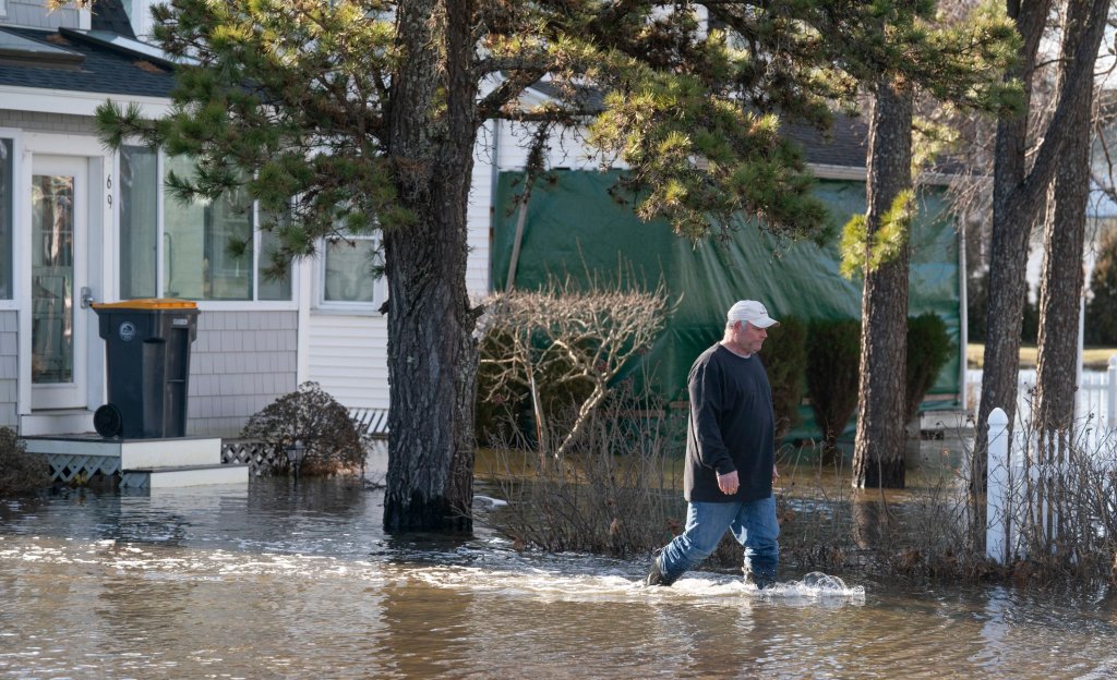
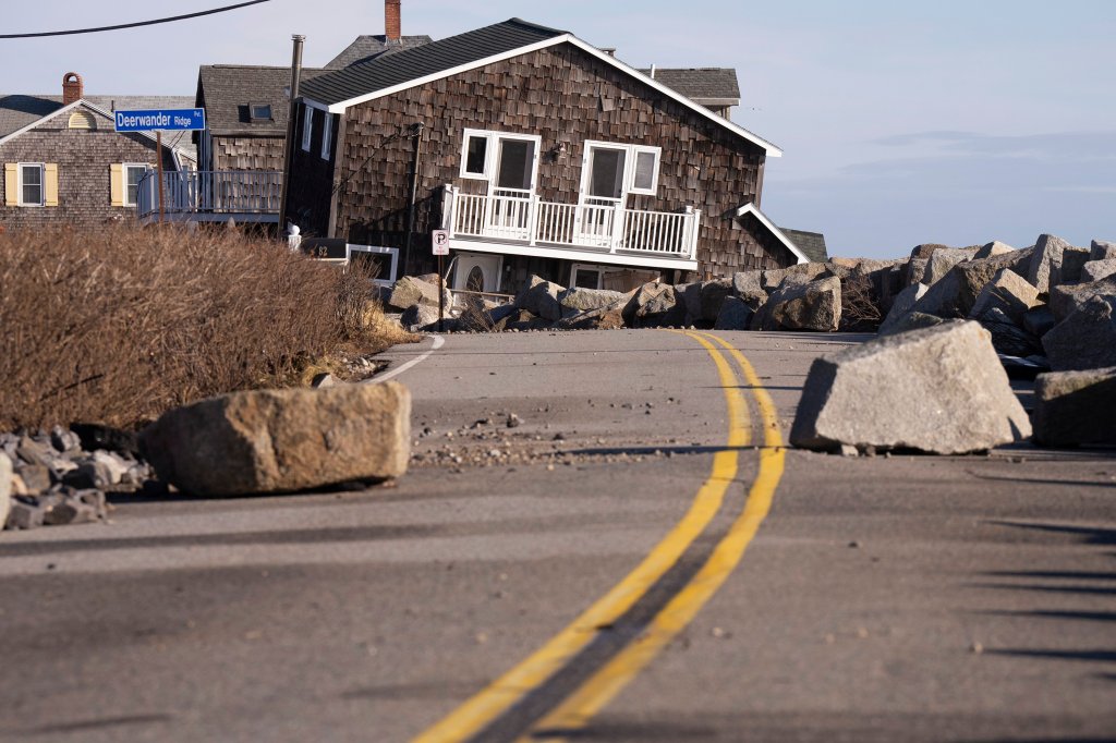
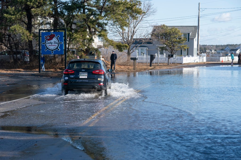
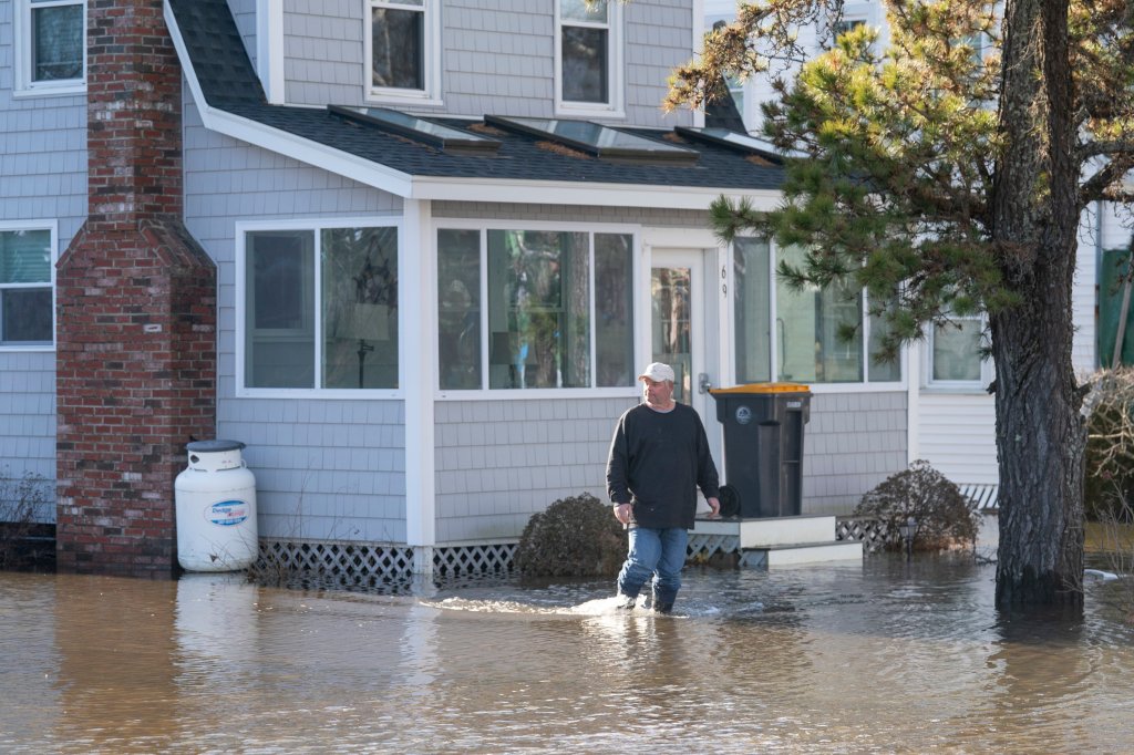
Floodwaters had receded by Sunday in some areas, but not in others, and some coastal roads, particularly those that have been prone to coastal flooding in the past, remained closed as municipal crews worked to clear them of debris.
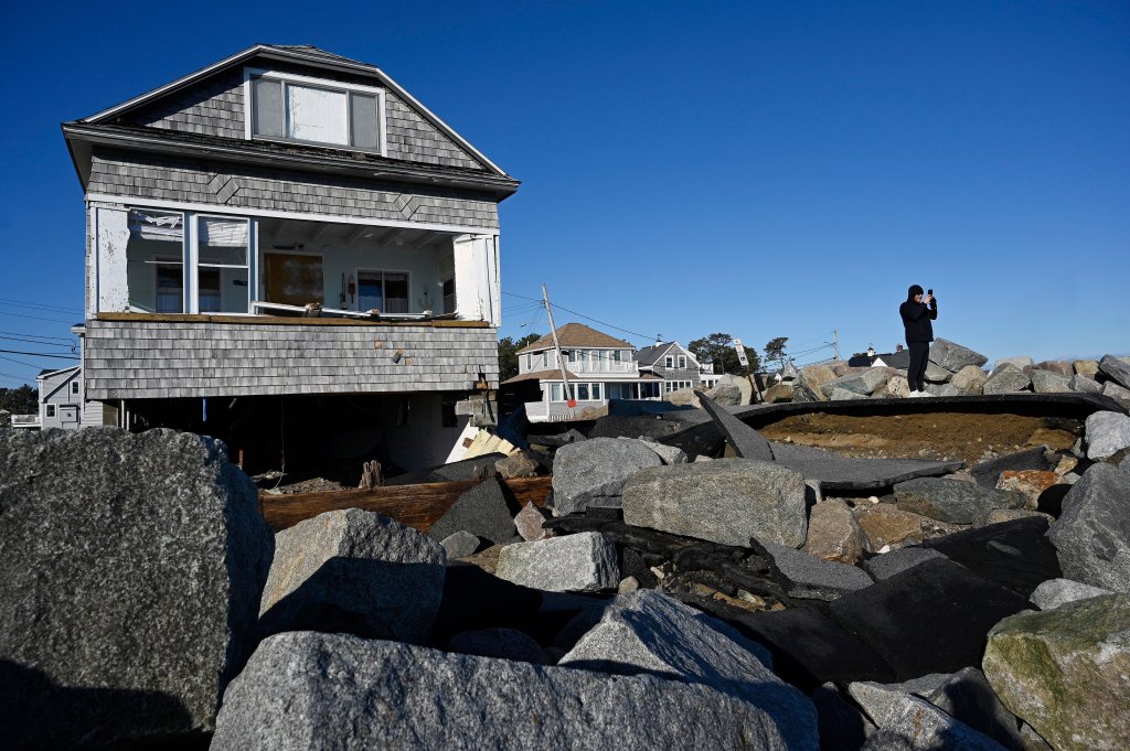
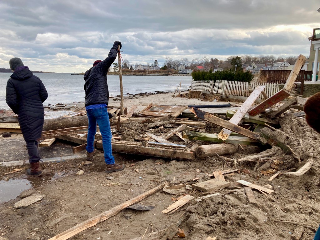
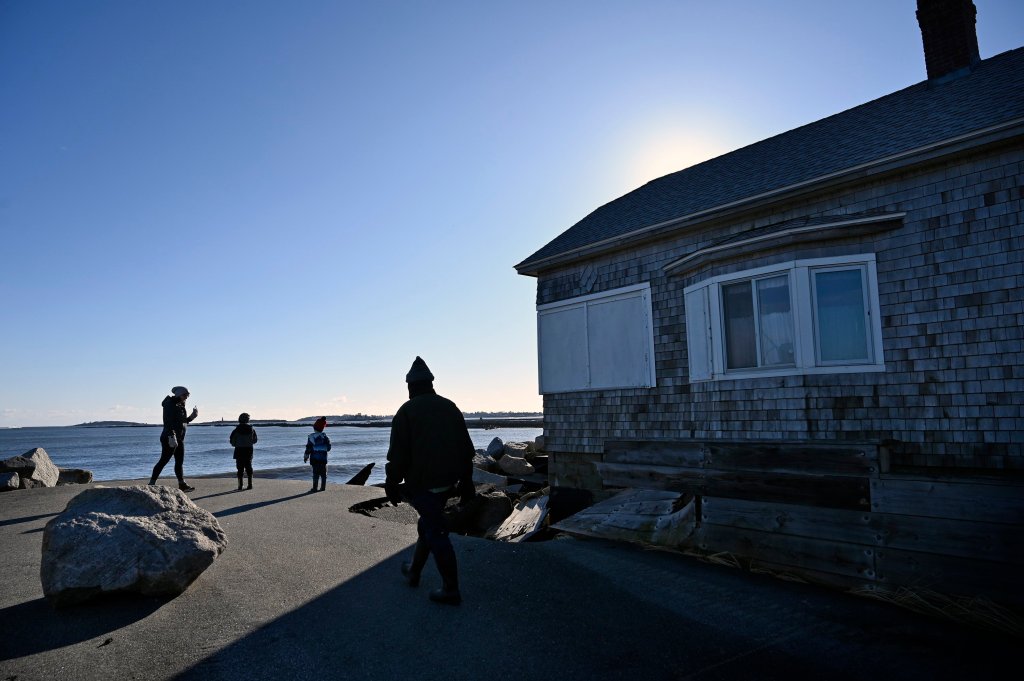
The worst of the damage appears to be concentrated along the southern coast, but there was damage in the Midcoast and areas to the north as well. Damage ranged from flooded piers and buildings along the Portland waterfront to damaged businesses and homes in many communities. Three iconic fishing shacks that had stood near Willard Beach in South Portland since the 1800s were washed away.

The remains of the fishing shacks at Willard Beach are seen Sunday, a day after they were washed out to sea during a fierce rainstorm. Bonnie Washuk/Staff Writer
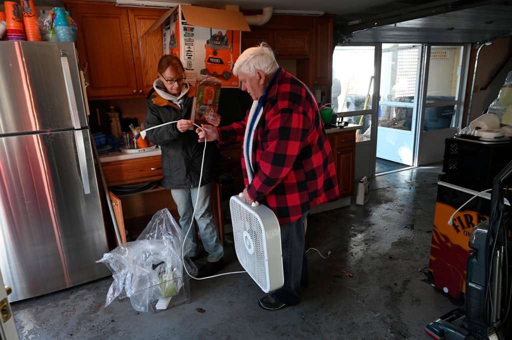
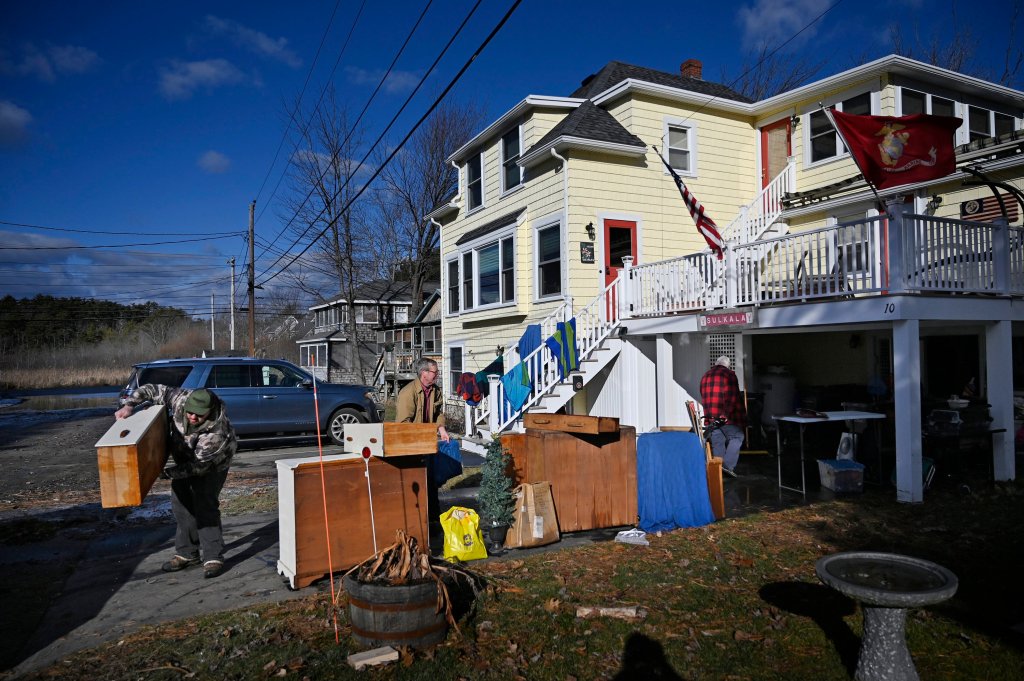
At their home Sunday in Ocean Park, a section of Old Orchard Beach that was walloped by the storm, Chuck and Linda Sulkala were taking stock.
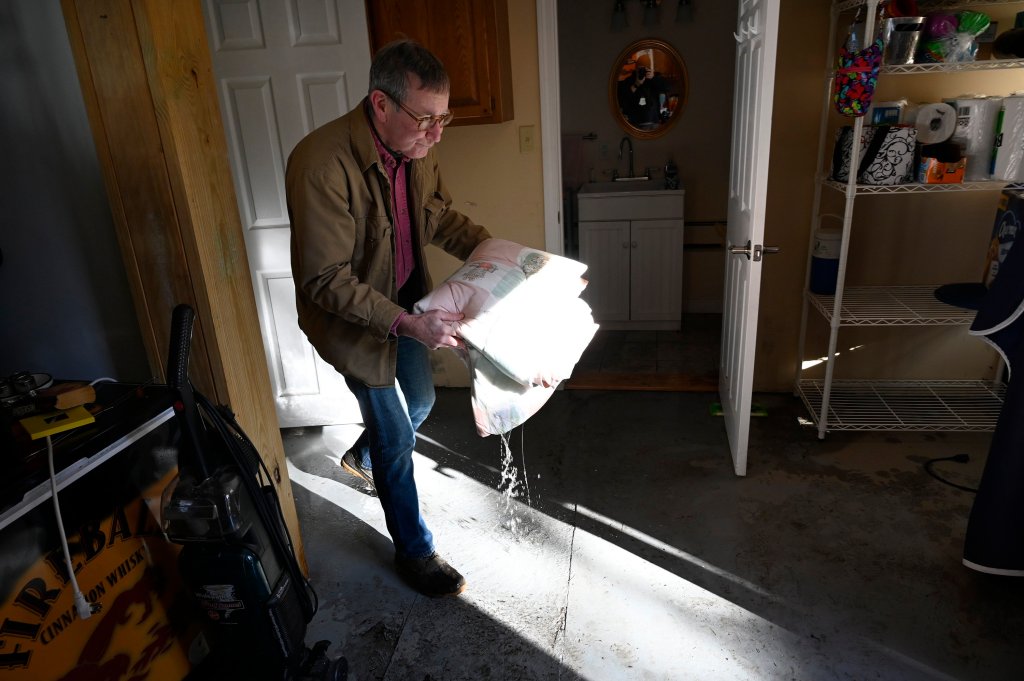
Mattresses had been pulled outside. Dressers, furniture, vacuum cleaners, pots and pans, and other belongings damaged by flooding lined their driveway. Dripping rugs were hanging to dry, and fans were blowing air into their lower-level garage and the building’s first-floor apartment.
At one point Saturday, there was 2 feet of water flowing swiftly through the first floor of their building.
“When I walked in, the water was up to my knees,” Chuck Sulkala said. The current was so strong, it knocked over a refrigerator in the first-floor apartment. The stove was full of water, and so was almost everything else.
“The beds are all gone. The floor is now destroyed. I’ll have to tear the walls out,” Chuck Sulkala said.
Saturday’s storm struck only three days after a similar storm hit the region, and many residents had been struggling to recover from that when a second dose of foul weather arrived. The Sulkalas had still been cleaning up from that storm Friday. The second-floor apartment where they live wasn’t damaged, Chuck Sulkala said. “Thank God our living quarters were not on the first floor,” Linda Sulkala said.
They didn’t know how much repairs would cost, and they – like almost all Mainers – don’t have flood insurance.
Floodwaters had receded in Portland by Sunday, and Exit 7 of I-295 at Franklin Arterial was open again after closing on Saturday. Many city piers and Commercial Street were flooded Saturday at high tide, and Casco Bay Lines ferry service was suspended for a time.
High tide in Portland peaked at 14.57 feet at the Ocean Gateway on Saturday, according to a preliminary measurement – exceeding the previous record high tide of 14.17 feet set on Feb. 7, 1978, said Maura Casey, lead meteorologist at the National Weather Service office in Gray.
The high tide record stemmed from a combination of factors, including a massive storm surge that arrived during an astronomical high tide, pushing water levels 3 or more feet above the normal high tide line. Massive, wind-driven waves exacerbated problems along the coast.
“The water has subsided. We’ve returned to normal with minimal issues,” said Portland police Lt. Robert Doherty. Two streets that flood easily, Somerset and Franklin streets, reopened around 4:30 p.m. Saturday. “We’re back,” he said.
J’s Oyster restaurant on Portland Pier, one of several waterfront businesses that were underwater Saturday during the historic high tide, issued a statement on Facebook on Sunday.
“We’re still standing,” J’s posted.

J’s Oyster, a restaurant in a flood-plagued area of the Old Port, is surrounded by seawater at high tide on Saturday. Ben McCanna/Staff Photographer
In addition to the three historic fishing shacks at Willard Beach that were washed out to sea during Saturday’s storm, Bug Light Park in South Portland will be closed until further notice because of storm damage. City spokesperson Shara Dee said most of the damage occurred along a stretch of paved walkway and in the parking lot between the Liberty Ship Memorial and the historic Portland Breakwater Lighthouse.
“There is significant asphalt damage, buckling, broken and missing asphalt,” Dee said.
The lighthouse, which sits on a column of concrete blocks that juts into Casco Bay, was not damaged, but City Manager Scott Morelli and Mayor Misha Pride said in a news release that the city had been hit hard.
“It’s a sad time for our City,” they wrote. “While it is fortunate that the damage at Bug Light seems mainly to be to the Greenbelt parkway and not the lighthouse itself, the storm washed away dunes and our iconic fishing shacks that have been part of the Willard Beach landscape for many generations.
“Certainly, it is a hard reality that the extreme weather event that caused this hole in our community is not a once in a lifetime phenomenon, but a twice in one week occurrence,” they added.
Another South Portland landmark, Spring Point Ledge Lighthouse, located at the end of a breakwater on the campus of Southern Maine Community College, was not damaged.
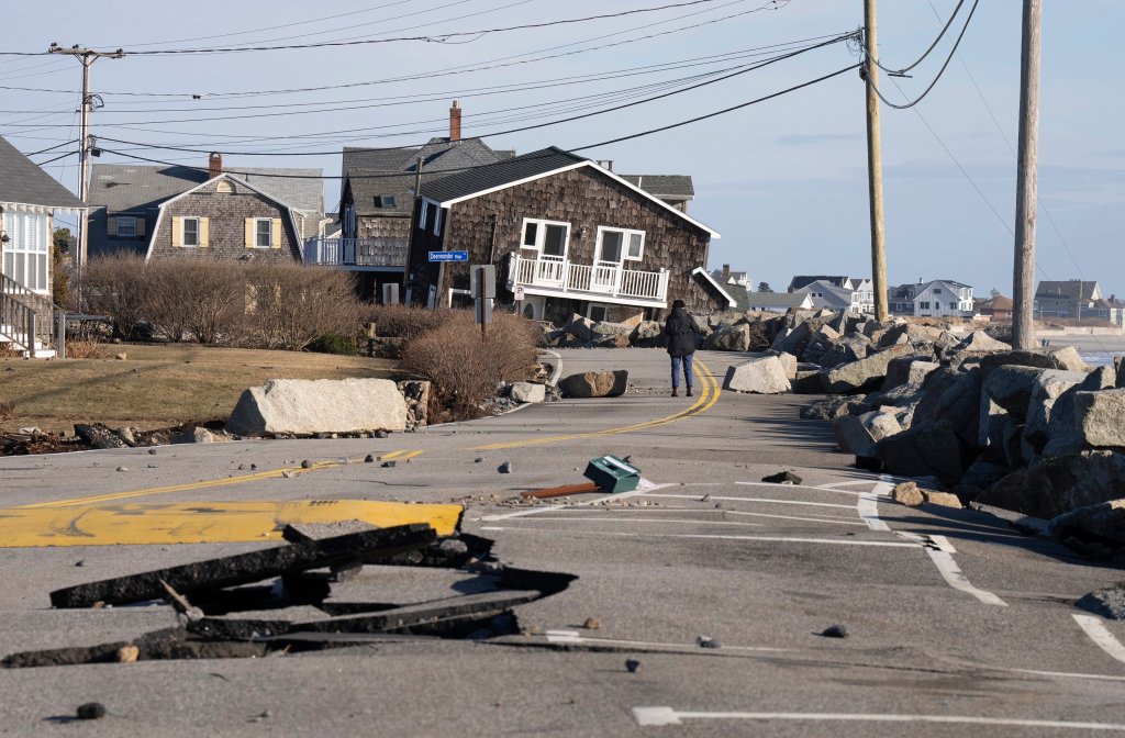
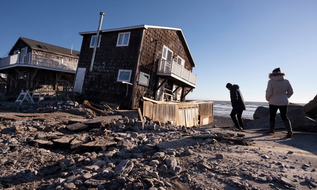
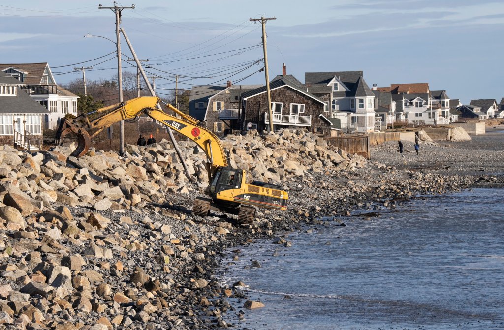
Saco Mayor Jodi MacPhail, a lifelong resident of the city, said Saturday’s storm left damage at Camp Ellis that she had never seen before.
“Our hearts go out to the residents, homeowners, and business owners of Camp Ellis,” she said in a release. “With our battered shoreline and the adverse effects of the jetty, this latest storm created damage I have not seen in my lifetime in Saco,” McPhail said in a statement issued Saturday. “While we have lost roads and possibly homes, there was, thankfully, no loss of life.”
MacPhail said town crews will do everything they can to reopen roads and clean up debris as soon as possible while assessing storm damage.
The mayor thanked the owners of the Camp Ellis General Store, who despite being closed for the season, opened during the storm to provide coffee and other goods for residents and emergency responders. Responders used the store as a base of operations.
McPhail urged people to avoid Camp Ellis during recovery efforts.
Old Orchard Beach Fire Chief John Gilboy said the water had receded in most areas Sunday and most main roads were open, but some side streets were still flooded. Central Maine Power was restoring power in town, he said.
“The Ocean Park area was hit extremely hard,” he said. Several residents who were rescued Saturday from flooded homes had made arrangements to stay with family or at hotels.
In Scarborough’s Pine Point area, streets were still flooded, along with buildings, homes and garages.
Bob McCarthy’s home was surrounded by water, as were five of his neighbors’. His basement still contains several feet of water, but “the water never made it to the first floor,” he said. “There’s no damage inside the house. I’m just not sure about the cellar.” He and his neighbors were all pumping water out of their basements.
McCarthy said his heat pump on the side of the house was high enough to avoid floodwaters. His water heater is on the upper floor.
McCarthy has owned the home for five years and said he’s never seen flooding like Saturday. “The person next to us has lived here for 30 years, and they said they’ve never seen it like this.”

The Sundrenched restaurant in Harpswell was damaged during Saturday’s storm. Photographed on Sunday. Shawn Patrick Ouellette/Staff Photographer
Damage assessments were underway at Higgins Beach, Pine Point, and Prout’s Neck, said Scarborough Fire Chief Rich Kindelan.
“We suffered damage from the storm surge. Today and tomorrow will be damage assessment days. People should stay away from the shoreline while we’re doing damage assessments so we can have free rein to do that.”
Kindelan said there was plenty of property damage and the historic high tide had strewn debris everywhere. But unlike other coastal towns, “we didn’t lose any homes as far as buildings going out to sea like that.” The town said in a release that cleanup will take several days.
Harpswell Harbor Master Paul Plummer said his community, with 216 miles of shoreline (the longest shoreline of any community in Maine), also suffered damage.
“The damage in Harpswell was unprecedented and catastrophic. Many people said it surpassed the storm of 1978,” Plummer said.
“Harpswell is three long fingers sticking out into Casco Bay,” Plummer said, referring to Great Island, Orr’s Island, and Bailey Island. Those islands also are home to several coastal landmarks, including the historic Cribstone Bridge connecting Orr’s and Bailey Island. The bridge was made from granite slabs to withstand waves and winds and was listed on the National Register of Historic Places in 1975.
Plummer said the bridge did not suffer any “catastrophic damage” even though Bailey Island “got hammered” by waves Saturday. He said the Maine Department of Transportation kept an eye on the bridge during the storm and it remained open.

The Harpswell town dock on Potts Point tipped over and broke in half not long after this photo was taken Saturday afternoon, harbormaster Paul Plummer said. The dock was initially damaged in a previous storm Wednesday. Photo courtesy of Paul Plummer
But other areas of Harpswell were damaged. Plummer said the town landing at Potts Point collapsed during the storm. The town also experienced extreme erosion in coastal areas and sea walls “blew out.”
Giant’s Stairs, a walkway that sits on a cliff overlooking the ocean, also sustained damage. A newly installed stone walkway was washed out to sea.
Plummer said an outbuilding at the Sundrenched Restaurant on Bailey Island “disintegrated” into the ocean.
Copy the Story LinkSend questions/comments to the editors.




Success. Please wait for the page to reload. If the page does not reload within 5 seconds, please refresh the page.
Enter your email and password to access comments.
Hi, to comment on stories you must . This profile is in addition to your subscription and website login.
Already have a commenting profile? .
Invalid username/password.
Please check your email to confirm and complete your registration.
Only subscribers are eligible to post comments. Please subscribe or login first for digital access. Here’s why.
Use the form below to reset your password. When you've submitted your account email, we will send an email with a reset code.