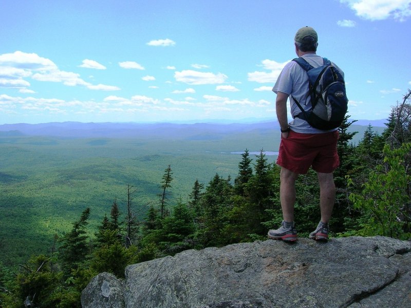
Maine’s amazing state park system includes 40 individual park units on some 67,000 acres of public land. From the Allagash River to Vaughan Woods, Grafton Notch to Cobscook Bay, there’s a lot to see and do on our state park lands, which accommodate a wide variety of recreational uses. Hiking enthusiasts, especially, can delight in the many miles of excellent trails that are available for exploration. Here’s a sampler of my favorite state park trails.
Mt. Blue State Park, Weld. A new observation tower, erected by the state in 2011, adorns the 3,190-foot summit of Mt. Blue. From this airy vantage point the panoramic view includes Saddleback, Abraham, Spaulding and Sugarloaf mountains, the Presidential Range, and the peaks of the Carter and Mahoosuc ranges. The Mt. Blue Trail, a steady 3.4-mile round-trip hike of moderate difficulty, gets you there. Cool off after your hike with a swim at the park beach on Webb Lake.
Aroostook State Park, Presque Isle. Maine’s first state park, established in 1939, features a three-mile hiking loop over the twin peaks of Quaggy Jo Mountain. Start from the campground on South Peak Trail and climb steeply to the ridge and a rock outcrop with good views. Continue on the North-South Ridge Trail, passing several viewpoints before reaching the ledges and lookout on North Peak. North Peak Trail descends back to the day-use parking area. Enjoy a refreshing post-hike dip in Echo Lake.
Bradbury Mountain State Park, Pownal. Ten trails wend through the west side of the park, providing more than six miles of easy, fun hiking. Four dedicated footpaths ascend to the open ledges on Bradbury Mountain and its classic view to the coast. Six other multi-use trails climb the peak and extend into the park’s interior. Bring your mountain bike along for a post-hike ride on the single-track trails on the park’s east side. Wind down from your adventure with a picnic lunch in the pines just past the park entrance station.
Grafton Notch State Park, Grafton Township. From the head of Grafton Notch and the trailhead parking area on Route 26, hiking options abound. To the east, a 2.3-mile loop climbs steeply to Table Rock and a magnificent view of the notch, Old Speck and Sunday River Whitecap. Make it a longer outing by hiking to the East Peak of Baldpate Mountain, an additional 6.4-mile round trip. West of the notch, climb the Eyebrow Trail to spectacular views from the precipitous 800-foot cliffs of The Eyebrow. Loop back to the car via the Appalachian Trail for a short 2.2-mile trip. Or continue south on the AT to the observation tower atop 4,170-foot Old Speck, adding just under six miles round trip. A bracing splash in the Bear River will help wash away your well earned sweat.
Camden Hills State Park, Camden. Try the Megunticook Traverse for a fabulous walk of about six miles that uses at least seven trails, depending on the route. Climb the Maiden Cliff Trail to the cross atop the cliff and a sweet view over Megunticook Lake. Then head southeast over Mt. Megunticook on the Scenic and Ridge trails to Ocean Lookout and views of Camden village and Penobscot Bay. Continue on the Tableland Trail to Mt. Battie and its observation tower. Descend to Route 52 via Carriage Road and Carriage trails. A car spot or bike stash is necessary to avoid a three-mile road walk back to the trailhead. The town beach at Barrett’s Cove on Megunticook Lake is a wonderful spot to conclude your day.
Each of the aforementioned hikes is described in the new 10th edition of the AMC Maine Mountain Guide. Additional information on these and other Maine state parks can be found online at www.parksandlands.com.
Carey Kish of Bowdoin is editor of the AMC Maine Mountain Guide. Follow his hiking adventures at:
www.facebook.com/careykish
Send questions/comments to the editors.


Success. Please wait for the page to reload. If the page does not reload within 5 seconds, please refresh the page.
Enter your email and password to access comments.
Hi, to comment on stories you must . This profile is in addition to your subscription and website login.
Already have a commenting profile? .
Invalid username/password.
Please check your email to confirm and complete your registration.
Only subscribers are eligible to post comments. Please subscribe or login first for digital access. Here’s why.
Use the form below to reset your password. When you've submitted your account email, we will send an email with a reset code.