
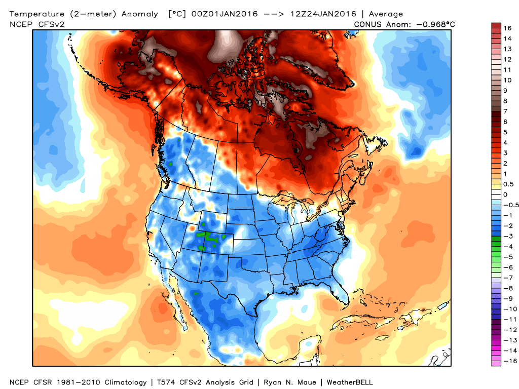
January Thaw! This week will bring a short period of melting in spite of it not being very cold this winter in the first place. The northeast has been the warmest, as compared to average. of the entire country. The map below shows which parts of the nation have seen colder versus warmer temperatures as compared to average this month.
Since January is the coldest month, even a milder than average January is still cold. Therefore when we have temperatures on the way which will rise above freezing, even for a couple of days it’s worth noting. If you have time to hit the slopes today through Wednesday the air will be relatively comfortable and you won’t need the heaviest or warmest apparel.

Thus far, there has been a shortage of natural snow this winter. While last winter also started with less snowfall than we expect, this is meaningless in terms of what will happen the rest of this winter.
I feel very confident about predicting the upcoming February cold won’t be anything even close to what last year brought. I am also comfortable in saying along the coastline there won’t be nearly the amount of snow the later part of January and February brought in 2015.
The reason I refer to the coastline is mountain and northern areas of Maine, while snowy, didn’t have nearly as much snow as other past years in 2015. For the rest of this season, there should be amble opportunity for more snowstorms in the mountains and while the coastline may struggle with the rain/snow line we certainly are not done with winter.
We obviously missed a bit storm this weekend. The computer models are already indicating another coastal low threatening the area for Friday. Since it’s Monday, a lot can happen with the forecast. You definitely want to check the weather once a day this week as it might appear it won’t snow this week one day and then snow is added into the forecast the next.

The map below is from the GFS model and indicates a coastal storm in the ocean Friday. A difference of a few hundred miles in the track of this system is the difference between a partly sunny end of the week and shoveling to start the weekend.
Temperatures rise above freezing in Portland Tuesday and do it again on Wednesday. A cold front will bring colder, but not arctic cold type of air back to the region at the end of the week.
Comments are no longer available on this story