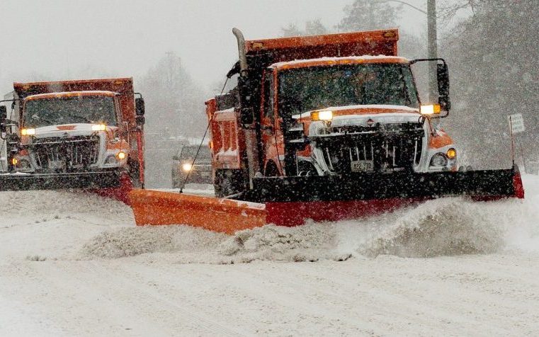
With a storm expected to bring snow and sleet to the region that will make for difficult driving conditions, public works departments in central Maine are preparing to tackle the mid-winter challenge.
Tom Hawley, a meteorologist at the National Weather Service in Gray, said the greater Augusta-Waterville area should see between 3 and 6 inches of snow from the nor’easter, starting with accumulations around midnight Monday night into Tuesday morning.
“This will be all hands on deck,” said Augusta Public Works Director Lesley Jones.
Hawley said the total accumulation depends on when the snow turns to sleet, which he said will likely be at some point during the morning or day on Tuesday. The sleet was expected to continue throughout the day Tuesday, before the storm finally moves out sometime Wednesday morning.
“It will be fairly rotten driving conditions in the morning,” Hawley said of drivers’ commutes. “And I don’t think the night will be any better.”
Hawley said that while the sleet will change to rain closer to the coast, like in the Rockland area, he doesn’t expect that changeover to happen as far inland as Augusta and Waterville.
The meteorologist said he expects the heaviest precipitation to start around 6 a.m. and last until noon.
The state of Maine said in a news release that all legislative sessions, hearings and work sessions would be canceled Tuesday in anticipation of the storm.
And Central Maine Power said it had readiness teams holding planning meetings, and the company was getting crews and equipment ready “to ensure that adequate resources are in place to restore power outages that might occur as a result of the storm,” according to a news release.
Waterville Public Works Director Mark Turner said Monday morning that his team was on standby until they encountered any winter weather. He said his understanding would be the storm would start as snow before possibly transitioning into rain, freezing rain and sleet, and said all equipment and personnel were ready for the storm.
“It’s difficult to plan for because those types of conditions are very difficult to manage with ice build up and cold temperatures,” Turner said.
He said the expected slippery road conditions will be treated with a mix of salt and liquid calcium, and he said that will be supplemented with sand to help provide traction for drivers.
“I think we’ll be very busy out making sure the roads are in decent shape,” he said.
Jones, of Augusta Public Works, said that her staff inspects all the trucks to ensure they are ready for the storm and there are no mechanical issues. Then each truck is loaded with sand and salt. Then a plan is made for staffing the storm. This can be difficult during long storms, like the one moving into the region, because at some point workers need to be sent home to get rest. To combat fatigue and to maintain a viable staff, Jones said public works will have roughly 40 staffers comprised of employees from public works, the town landfill and central garage, as well as volunteers from the Bureau of Parks, Cemeteries and Trees.
Jones said it can be difficult to plan, because forecasts are not something “you can hang your hat on,” because they are just estimates, and fluctuating temperatures can also change conditions. Jones said her department has chainsaws at the ready as well in the event that the ice brings down tree branches.
“We’ve just got to be ready for whatever Mother Nature brings,” she said.
Jones also said if residents don’t need to be on the roads, they should stay off them because it “makes our job easier and makes everybody safer.”
In Skowhegan, Road Commissioner Gregory Dore said he was anticipating more snow in the northern areas with an estimated accumulation of between 5 and 8 inches and perhaps a tenth of an inch of ice. He said they were making sure they had enough salt and sand and that the plows were ready to go for when the storm did start.
“We’re doing the same we usually do,” Dore said.
He did say town staff were working ahead of the storm to clear out snow piles in side streets in order to make room. He said the salt and sand combination can be adjusted if need be, depending on the temperature, but the plan for the storm will be to sand the main streets during the heaviest snowfall and get to the smaller side streets once the storm had dissipated.
“When it’s snowing hard like that, it’s a waste of sand and salt on less traveled roads,” Dore said.
Colin Ellis — 861-9253
cellis@centralmaine.com
Twitter: @colinoellis
Copy the Story LinkSend questions/comments to the editors.


Success. Please wait for the page to reload. If the page does not reload within 5 seconds, please refresh the page.
Enter your email and password to access comments.
Hi, to comment on stories you must . This profile is in addition to your subscription and website login.
Already have a commenting profile? .
Invalid username/password.
Please check your email to confirm and complete your registration.
Only subscribers are eligible to post comments. Please subscribe or login first for digital access. Here’s why.
Use the form below to reset your password. When you've submitted your account email, we will send an email with a reset code.