
We are gradually stepping down in temperatures as cold air filters into northern New England.
This morning isn’t very chilly, however, with temperatures in the 20s and morning sunshine. But, clouds will increase later today as a few snow showers cross the area. During the squall the snow could be briefly heavy but any accumulation will be light.
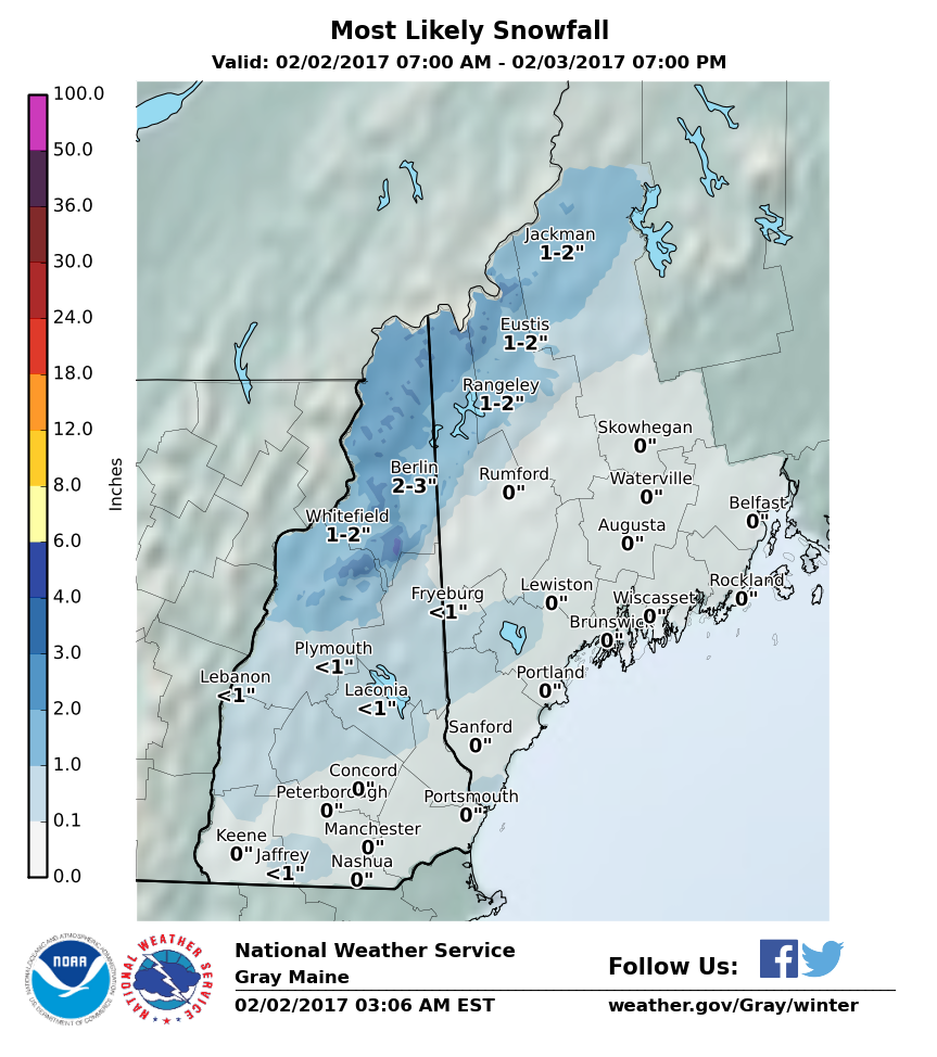
Any accumulation of snow today would be in the mountains. NOAA
Yes, it’s Groundhog Day and whether or not a rodent “sees” his or her shadow, there will be six more weeks of winter. Spring doesn’t arrive in Maine in February. And, come on, it’s a rodent.
There will be blustery conditions Friday and again on Saturday. Highs will stay in the teens and 20s across the area and only reach 30 in southern New England.
A storm will pass out to sea late in the weekend and could bring a few clouds on Sunday. It will be slightly less cold with highs approaching 30 degrees.
Our next chance of a storm is Tuesday. That forecast will need to be refined early next week. The outlook thereafter is for more seasonably cold weather.
February is one of those months where we are likely to see a few days that will get us excited about the coming spring, but also a month that can produce cold and snow. The pattern of La Niña winters – which we are in – tends to be a lot of variation. In other words, cold that doesn’t last and snow that doesn’t necessarily build up to massive levels. This has been the case so far, and it’s likely to continue.
You can follow my weather updates on Twitter at @growingwisdom
Comments are no longer available on this story