
A spring nor’easter will bring snow, sleet and freezing rain, as well as just plain rain, to the region later Friday and into Saturday. This storm has the potential to drop over a foot of heavy wet snow in parts of the region, especially away from the immediate coastline.
This is a very complicated storm even by typical New England standards and the snow amounts will ultimately reflect this.
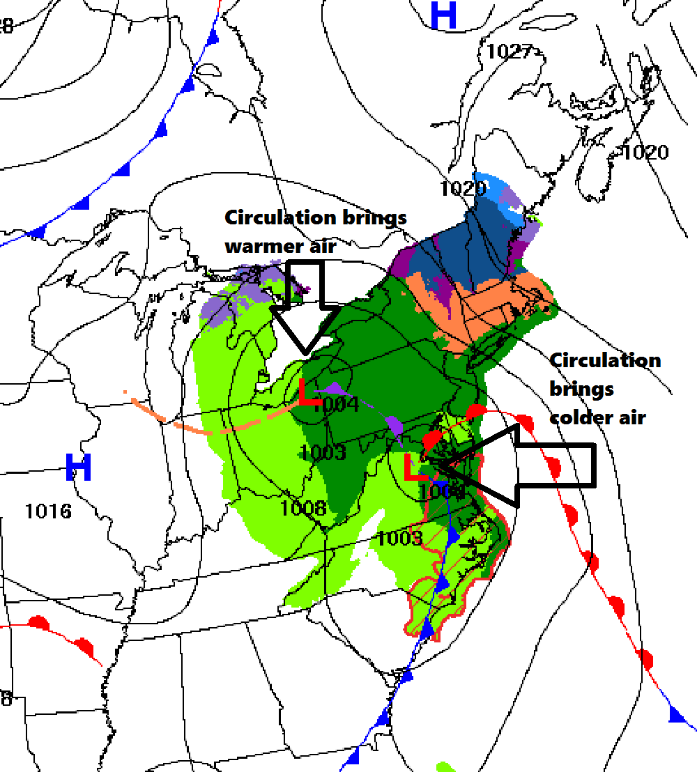
The setup is as follows: A low pressure system will move through the Ohio Valley and up into New York State. This storm track will carry milder air on its eastern side into New England. If this were the only storm, I’d be forecasting a brief period of snow and a change to rain, and it wouldn’t be a big deal.
The complication is a secondary storm that will take shape from the south and then move off the coastline east of New England. This storm will become the primary one and take the energy from the Ohio Valley system. Storms that move east of New England bring colder air on their left – western – side and therein lies the issue. The exact amount of warm air that arrives before the cold air starts coming back is critical in determining the type of precipitation. A temperature difference of a degree or two from the ground to the clouds will mean the difference between rain, sleet, freezing rain and snow.
A double-barreled low pressure area will bring a mixed bag of weather to start April. NOAA
The first weather system may bring some light snow or even rain early Friday, but the main event will hold off until later in the day. Heavier snowfall will break out Friday afternoon to the south and overspread Maine sometime during the evening commute. I don’t expect any travel issues until after sunset. Friday night and the first part of Saturday are when the snow will be most intense and when the most accumulation will occur.
Snow amounts will be somewhat less on the roads and greatest on existing snow or grassy surfaces that tend to be colder.
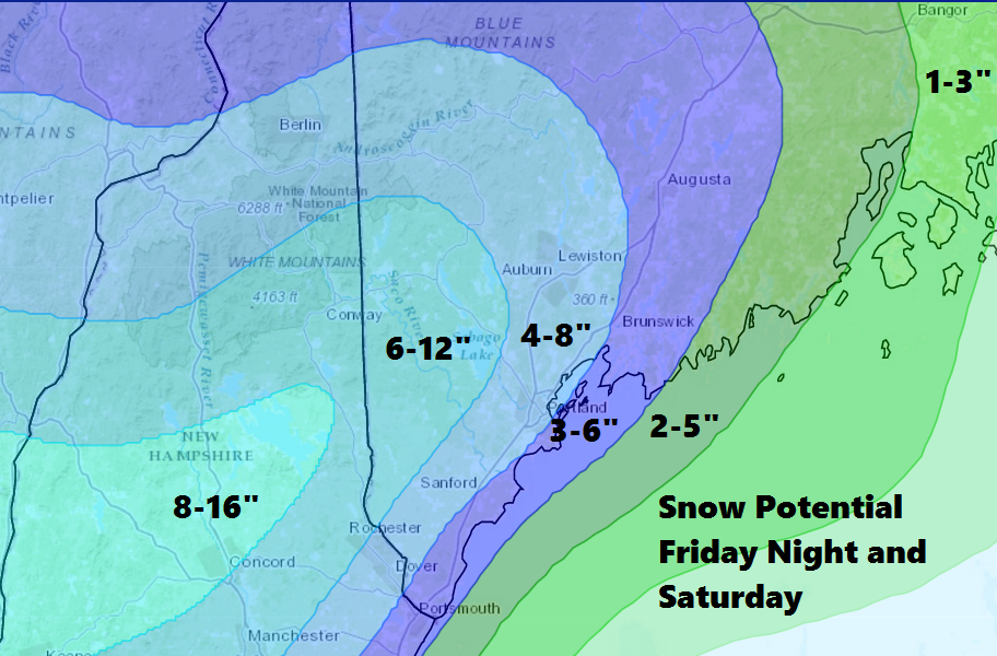
Snow amounts will be heaviest inland, but some accumulation is likely on the coast. This map is subject to shifts based on new data. Dave Epstein
The forecast will change over the next day as I get more information about the thermal profile of the atmosphere during the storm. A colder storm would bring heavier snow to the coast while a warmer one would push the heavier snow farther inland and over higher elevations. Freezing rain could also be an issue, especially for interior York County and parts of New Hampshire.
Because of the heavy wet nature of the snow, power outages are a distinct possibility and this is something you should plan for if you live just inland from the coastline.
You can follow Dave’s forecast on Twitter @growingwisdom
Comments are no longer available on this story