
What a stunning weekend of weather we just had. This, just part of the incredibly warm October with most climate sites across New England in the top five warmest month so far. With only a week left in the month, it’s likely all of these areas will end up having one of their warmest October’s ever. The other aspect of this month has been the dry weather. So far nearly the entire New England region has had less than an inch of rain this comes on the heels of a very dry August and September for most areas and even official drought conditions are prevalent a significant area..
All the great weather had to come to an end at some point. A cold front to the west of New England this morning will continue to slowly move towards the east passing off the coast early Thursday. A combination of both the slow movement of this front and a strong southerly flow of air, will propel very moist conditions into the region.
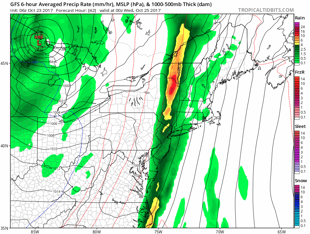
A strong cold front will bring significant rain to the area Tuesday night and Wednesday. Tropical Tidbits
In addition to the moisture we’re going to see some strong winds. The models I use to help make this forecast are showing very strong winds just a thousand feet or so above the ground. Some of this intense wind will mix down to the surface Tuesday night and Wednesday. With the leaves still on the trees it won’t take a lot of wind to bring down some branches and subsequently create power outages. We won’t have widespread power issues, but the set-up looks potentially volatile enough to warrant mentioning this.
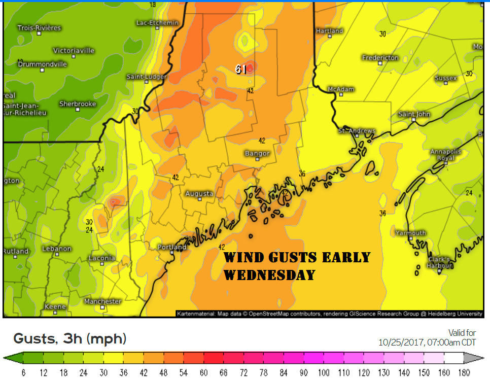
Winds could gusts up to 50 miles per hour across the higher elevations the coast. Weather.us
We are talking about quite a bit of rain. Generally all of us will receive between 1 and 2 inches of rain, but since thunderstorms are also in the forecast, some areas could double these amounts in those heavier downpours.
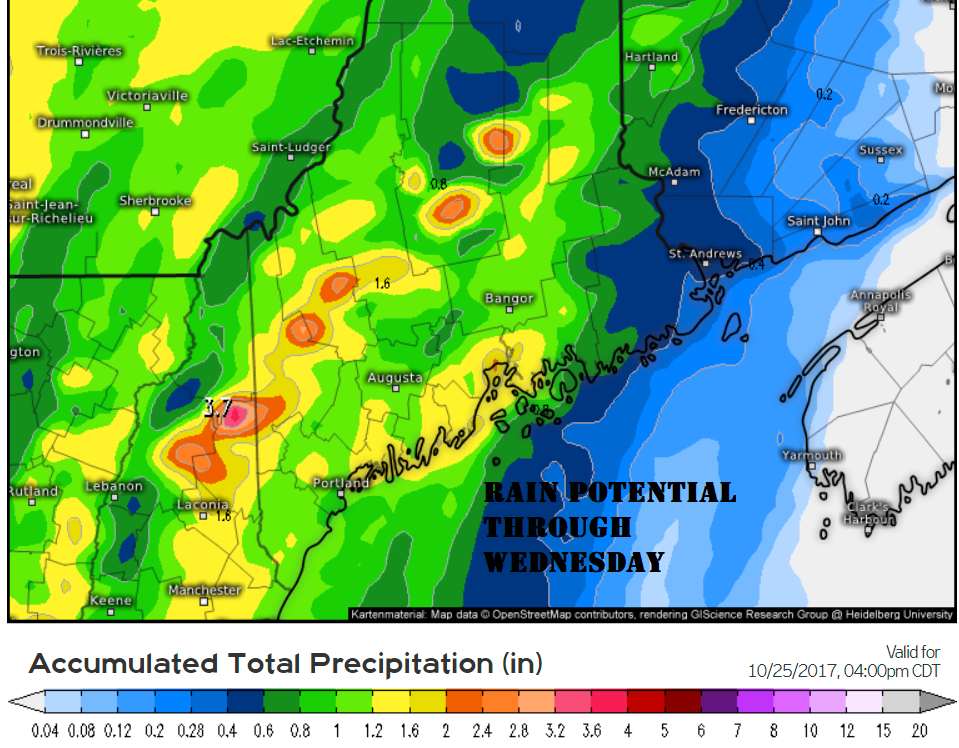
1-2 inches of rain is likely through Wednesday evening with potentially more in thunderstorms. Weather.US
Any precipitation slows down the commute and the heavy rain will have an impact to several upcoming commutes. Tuesday evening’s ride home will feature some showers, but the steadiest rain will not have moved into southern Maine by then. However, by Wednesday morning I expect heavy periods of rain and even some thunderstorms on the radar and this will undoubtedly create a slow morning commute. The evening trek out Portland and other urban centers will also likely be plagued by periods of heavier downpours. The chance of rain falls by Thursday morning with clearing taking place thereafter.
All the rain will occur during a period of very high humidity. While temperatures won’t be hot, the moisture in the air will make it quite uncomfortable for sleeping Tuesday Night. Later Wednesday, as the front pushes eastward moisture levels will start to fall. The steadier showers will become more widespread and the air will cool.
Friday sunshine will dominate and this lasts into at least Saturday. However, another storm may bring more precipitation sometime over the second half of the weekend. With a second potential rainstorm after the upcoming one, October will end up warm, but could finish not unusually dry which would be a big swing from the first three weeks of the month.
Comments are no longer available on this story