
There’s a frontal system slowly moving through the area today with a plume of moisture riding along it. There won’t be rain every minute of the upcoming two days, but you will have a risk of showers through Thursday. Until early this morning much of southern Maine hadn’t gotten a lot of rainfall, but as I write there are heavier downpours moving through greater Portland and an occasional rumble of thunder.
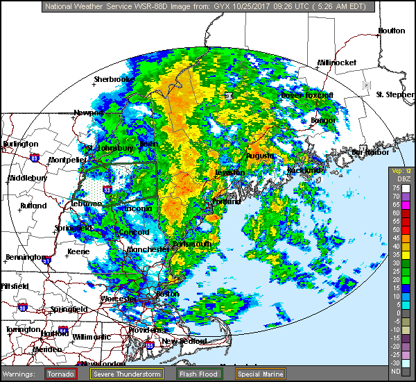
Heavy showers moving through southern Maine early Wednesday. NOAA-Gray
Sometimes the rain will be torrential, falling at rates of an inch or more per hour. At other times it will taper off to just a drizzle. The heavier bands of rain can temporarily flood roadways and prompt flood warnings. Because the weather has been so dry, much of the summer and fall and especially along the coast, there is little risk of river flooding even with some spots getting more than 3 inches of rainfall.
The water vapor loop, which shows the depth of moisture in the atmosphere, not clouds, supports the wet forecast. Notice the moisture transport moving up along the coastline. This will bring us the heavier downpours today, tonight and again Thursday. As a new area of low pressure forms along the front Thursday it will keep the rain quite steady.
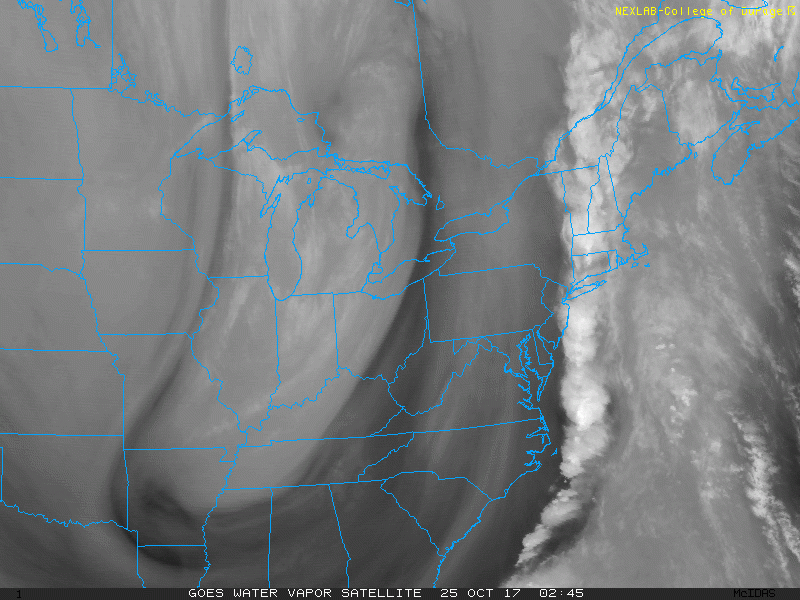
A strong trough in the atmosphere has brought a river of moisture to the East Coast. (Courtesy College of DuPage)
Rainfall totals will be highly variable because of the nature of the shower activity. Many towns will receive over 2 inches of rain between now and Thursday evening – with a few, especially Down East, getting even more – while other spots will get much less.
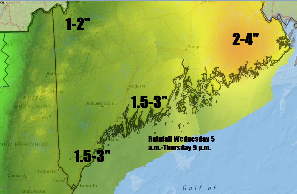
Much-=needed rain will continue through Thursday.
The heaviest rain will be across eastern Maine where a flood watch for urban flooding is posted.
The strongest winds have moved off the coast so we won’t need to contend with that element of the forecast today, however it will still be breezy. Another slug of showers will move through the region Thursday, hugging the coastline. But if it slips a bit farther east than expected we could see less rain. If it jogs west, more areas west of the foothills will get into the heavier showers.
Sunshine returns for Friday and Saturday, but another weather system will bring back clouds and more showers by Sunday night and into Monday. Colder temperatures will follow with some of the chilliest air of the season coming next week.
You can follow my updates here and on Twitter @growingwisdom.
Comments are no longer available on this story