
After a beautiful day on Saturday things are rapidly going to go downhill this afternoon and especially overnight tonight. In thinking about tonight’s storm, my weather brain has a few thoughts toward the perfect storm back in 1991. In that situation highly unusual elements came together to create a monster storm over the ocean. This isn’t the same situation, nor will the storm be nearly as significant. However, we do have a very strong cold front coming in from the west and we do have an unorganized tropical system named Phillipe that will add to the entire event. Eventually this storm will produce very heavy snow near Hudson Bay in Canada.
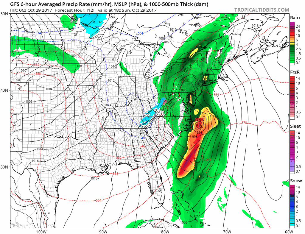
An intense storm will move through New England on Sunday night and Monday. Tropical Tidbits
Three Parts To This Storm
The two known components of what’s going to happen Sunday night will be heavy rain and wind, along with a possible third component — strong to severe thunderstorms. This all ends Monday morning. The most intense part of the storm will last from midnight to 9 a.m Monday.
This is an unusual meteorological setup. For those of you that like math the trough, or the dip in the jet stream, is about 5 standard deviations away from normal meaning it’s highly anomalous. Additionally, the amount of moisture that’s going to be present in the air during this event is also about the same place on a normal curve. You can see this dip on the water vapor loop below.
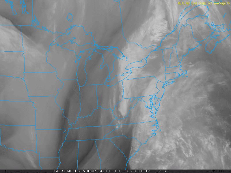
A strong flow from the south will bring heavy rain to the region tonight and early Monday. College Of DuPage
Intense, But Not Long Lasting
Because everything’s moving so quickly the risk of rain and thunderstorms ends early Monday, but as the storm continues to intensify over Quebec winds are going to be a factor throughout the day tomorrow.
Power outages are likely. There’s almost no way we’re not going to see some power outages across parts of Maine and New Hampshire. The greatest risk of these is going to be across the coast and into the foothills including Lewiston, Augusta and Waterville, where a high wind warning is posted and therefore down trees and subsequent power lines are possible.
There is a flood watch out for the area as well; this is mostly for urban and small stream flooding not river flooding. We could see some showers around the area late morning and early afternoon but the bulk of the heaviest rain won’t arrive until after dark. There’s likely to be two circles of maximum rainfall — one over the foothills, but all of us will see very heavy rain. Check your sump pumps Sunday.
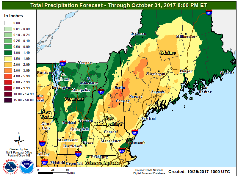
Look for intense rainfall overnight Sunday NOAA-Gray
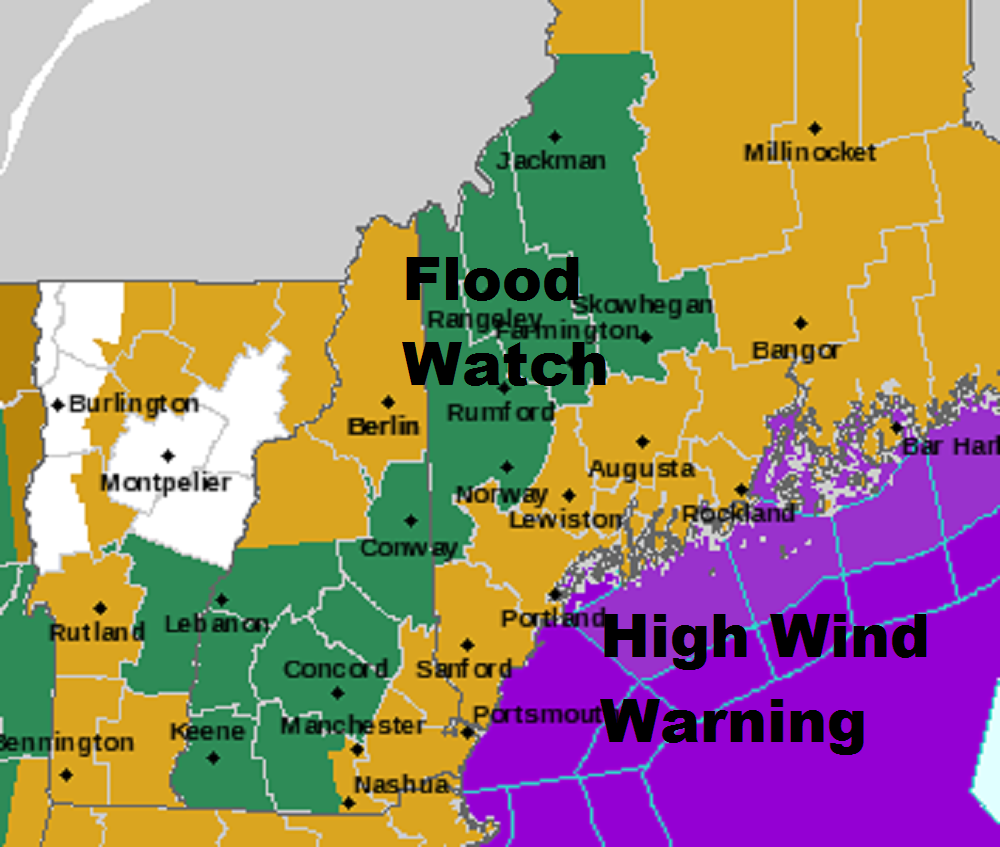
A high wind warning is posted in the mustard color areas. Dave Epstein
What Don’t We Know?
There’s no way we’re going to miss the storm but the strength of the wind could still end up being a little bit less than forecast. We know the winds are going to be very intense at a couple of thousand feet above the ground what we don’t know is how much of that mixes down to the ground. The assumption is a significant amount and therefore the high wind warnings.
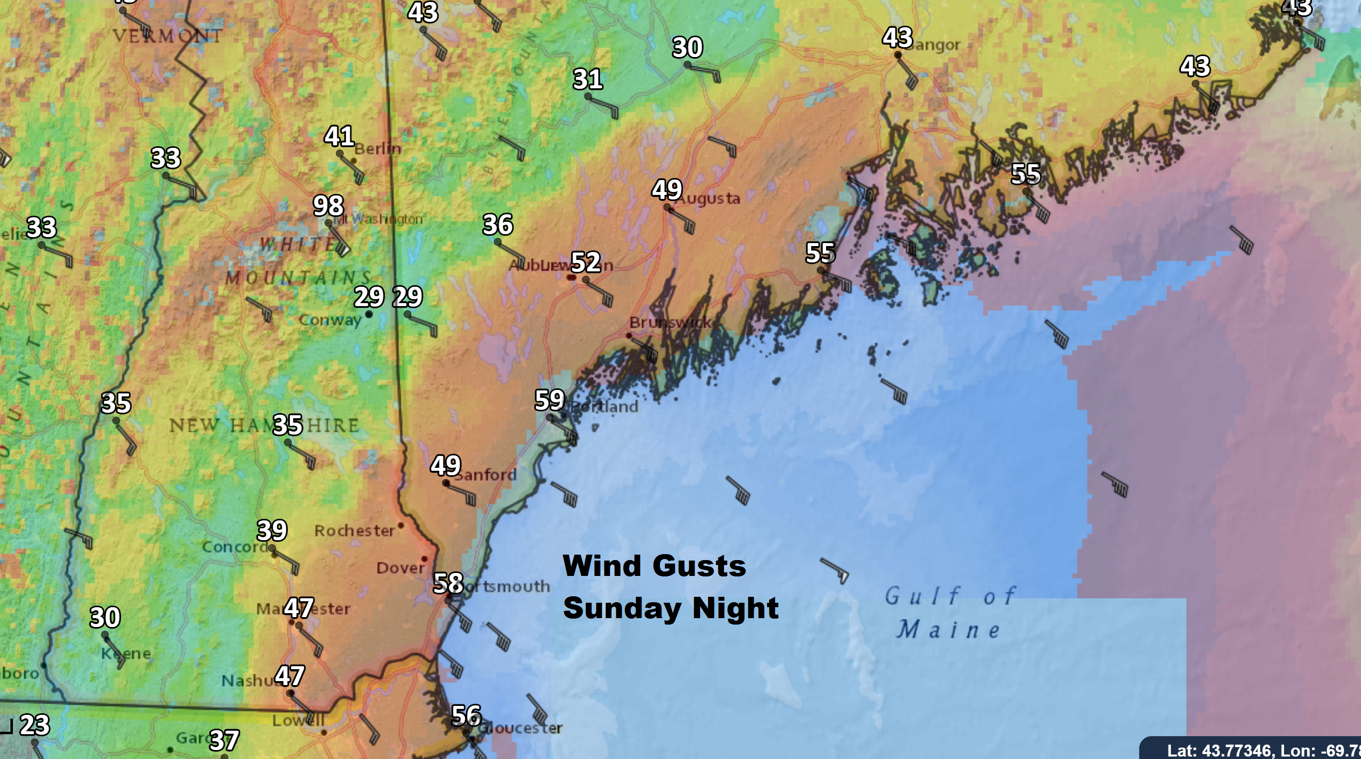
Winds could gust over 50 miles per hour along the coast. Dave Epstein
Delays and Cancellations
There could be delays to flights at the jetport and I wouldn’t be surprised if some areas see school cancellations or delays tomorrow morning, if the winds are really powerful early and knock down trees and power lines.
Better Weather
After a very spooky night tonight, the heaviest winds depart by 8 a.m. Monday, but they remain gusty all day as clearing takes place. Halloween looks dry and seasonable with temperatures around 50 for trick-or-treaters under clear skies.
Comments are no longer available on this story