
It was a pleasant weekend across the region and although there were high clouds at time for some, temperature is reached seasonable levels into the upper 30s to mid 40s both afternoons. It was also another weekend without any precipitation and that has been a trend for the past month. December doesn’t conjure up images of burned-out lawns and wilting flowers, but believe it or not before the ground freezes it is important that we have adequate moisture for the earliest spring blooms which begins in only another 15 weeks — though those are a long few months.
The past 30 days has seen some areas receive only 25% of their normal rainfall. Precipitation for the year is almost exactly average in many places but it’s been dry over the past month and that is about to change.
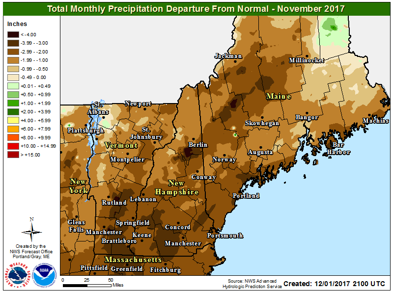
November was a very dry month across nearly all of New England including Maine. NOAA
A frontal system will slowly cross the area Tuesday night into Wednesday. This front is an important weather feature for a couple of reasons. The first is that it will bring a soaking rain storm Tuesday night with total rainfall anywhere from three quarters of an inch to over an inch in a few places. This time of the year when things aren’t growing all that rain will go into the unfrozen ground and remain there until it’s needed in the spring.
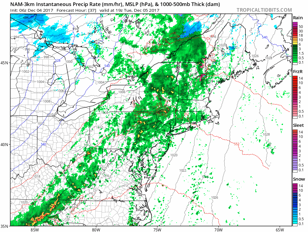
A band of rain will move through the region Tuesday night and Wednesday. Tropical Tidbits
The amount of rain we are looking for will not create any flooding. However there will be enough rainfall that travel will be slowed Tuesday night and early Wednesday. I don’t expect any delays in air travel from this type of system.
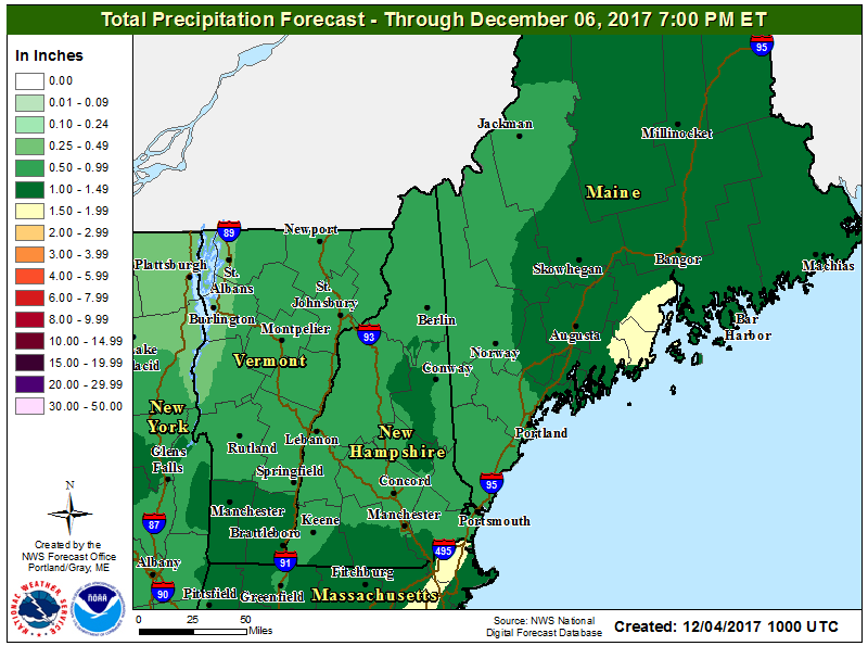
The heaviest rain will fall east of Rockland Tuesday night, but all areas will see a good soaking. NOAA
In actuality Tuesday itself is generally a dry day although we could see a few showers at any point from late morning until the middle or latter half of the afternoon. The steadiest rainfall should arrive after the evening commute and will continue into Wednesday morning.
Ahead of the front, temperatures will be quite mild and we will reach into the 50s by Wednesday. I mentioned there are a couple of reasons this front is important. The other noteworthy aspect of this frontal system is that once it does pass there will be a change in the upper level pattern. This change will bring in colder air with temperatures Thursday through the weekend approaching 40 in the afternoon along the coastline but staying in the 30s over the hillier terrain.
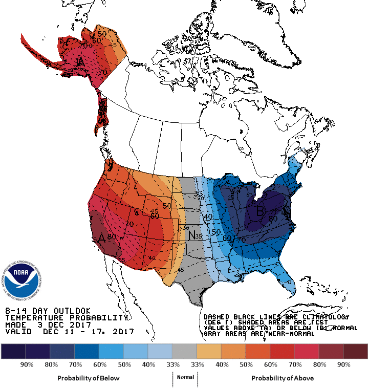
Colder than average weather is likely to move in late this week and continue into next. NOAA
In this new pattern there will be the opportunity for additional precipitation late this week and over the weekend how this materializes and whether we see rain or snow is still a big question and I’ll be writing about that during this week.
Follow Dave Epstein on Twitter @growingwisdom
Comments are no longer available on this story