
Hurricane Michael escalated somewhat quickly. Over the weekend, it was a tropical wave threading the needle near the Yucatan Peninsula. Now, battling wind shear but emerging in the Gulf of Mexico, it’s a strengthening hurricane, with winds up to 110 mph as of 11 a.m. Tuesday.
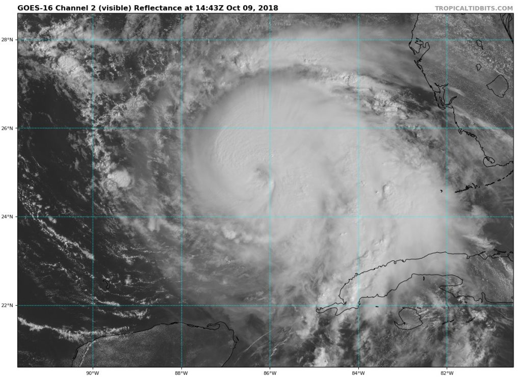
Additional strengthening is expected, and Michael is forecast to be a major hurricane at landfall on the panhandle of Florida Wednesday.
In addition to hurricane-force winds and heavy rain, storm surge flooding is a big concern along the Florida Gulf coast.
By Thursday, Michael will be weakening and moving through the southeastern United States. A cold front will be moving toward the east coast. Some of Michael’s moisture will be drawn northward, meaning periods of rain for us Thursday.
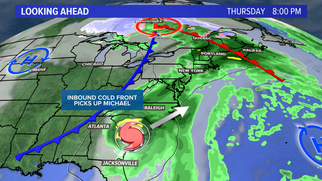
However, the cold front should pick up Michael as it moves north, and kick the center of it out to sea.
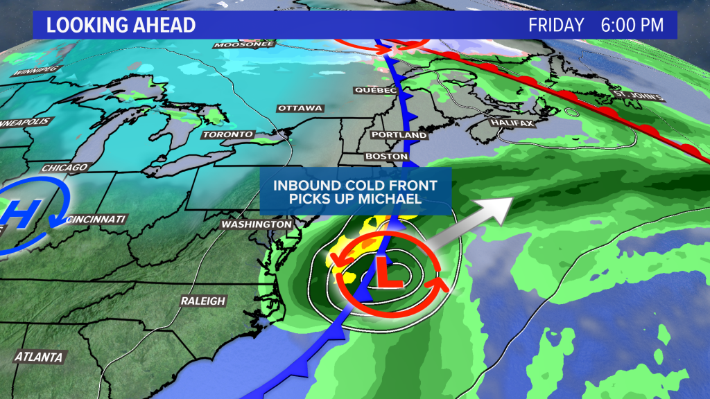
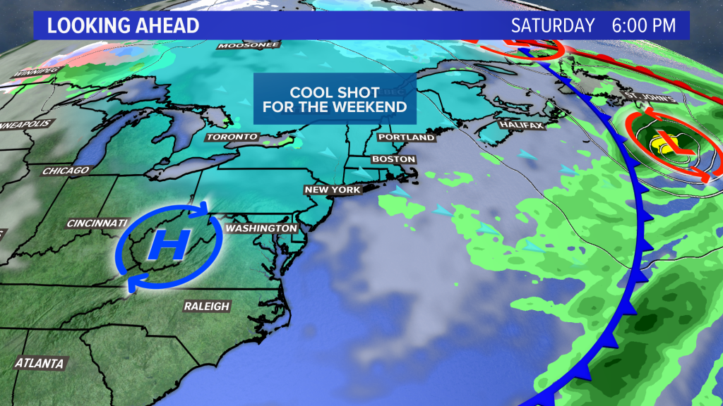
A cool shot of air will be dragged south on the back side of the storm, moving into Maine for the weekend.
The weekend looks dry with a mix of sun and clouds, but highs may only be in the lower half of the 50s, with overnight lows in the 20s and 30s.
Comments are no longer available on this story