
The first of two storms moves in Tuesday morning. It should behave a lot like the most recent storm: Rain near the coast, snow in the mountains, and a mix in between.
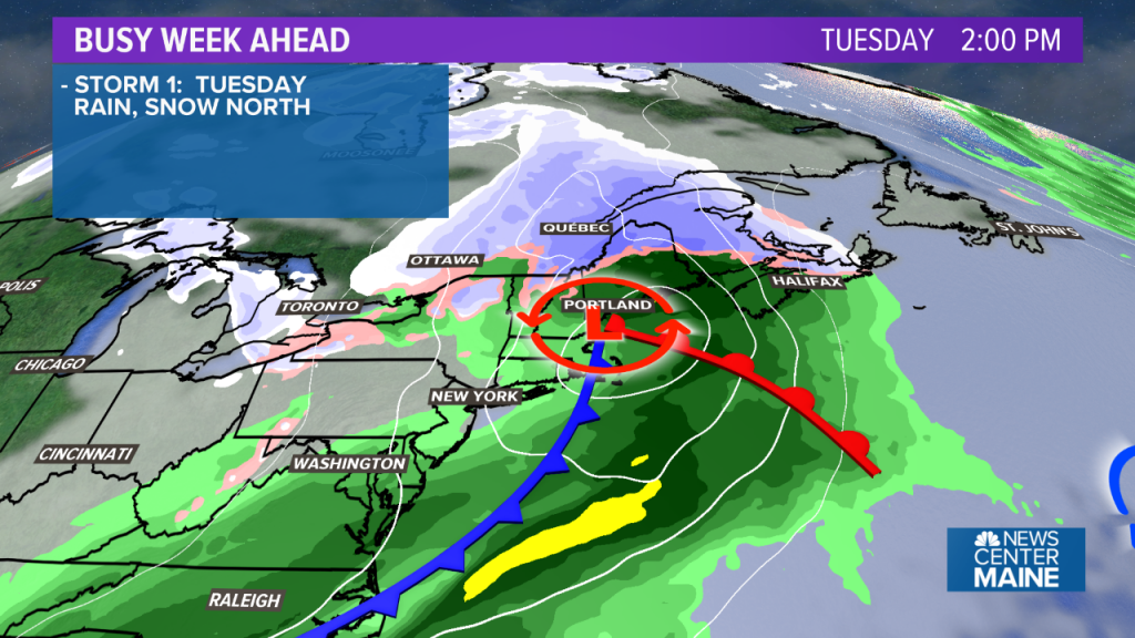
Precipitation will start between 4 a.m. and 8 a.m., from west to east across the state. I’m thinking it will be just cold enough to see flakes and pellets mix in at the start even near the coastline. It’ll be a snowy morning commute in the foothills and mountains. Roads may become slippery in western and northern areas making the ride to work or school a bit of a challenge.
During the midday and afternoon, the rain/snow line will work inland, even approaching the mountains and north.
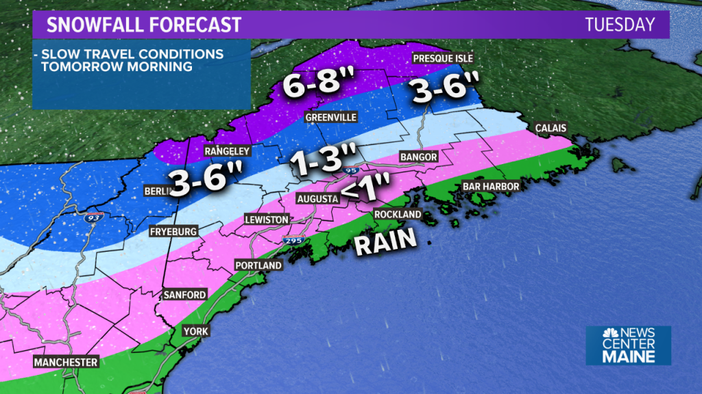
In total, 3 to 6 inches of snow is expected in the mountains. The higher elevations, especially around Rangeley, Jackman and into the Allagash, could see over 6 inches, where precipitation stays snow the longest.
Amounts will quickly decrease farther south, with a slushy coating that gets washed away near I-95.
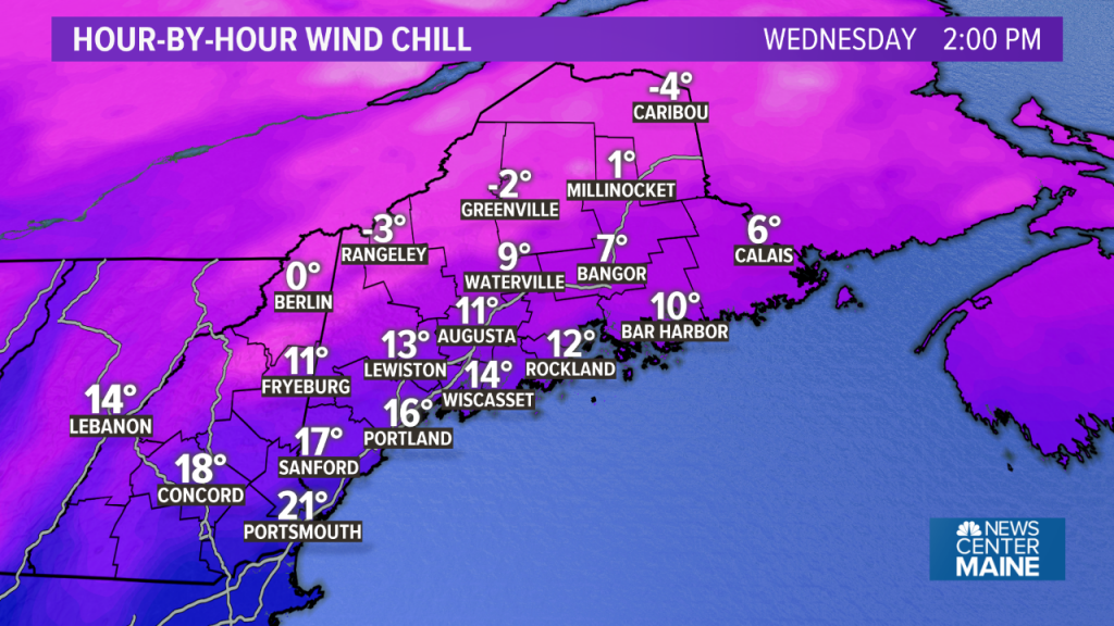
Behind the storm, the coldest air we’ve seen since last winter will move in. High temperatures on Wednesday may only be in the upper 20s to low 30s, records are in jeopardy.
Combined with a gusty northwest wind, the wind chill will be a factor. It may only feel like the single digits and teens during the afternoon.
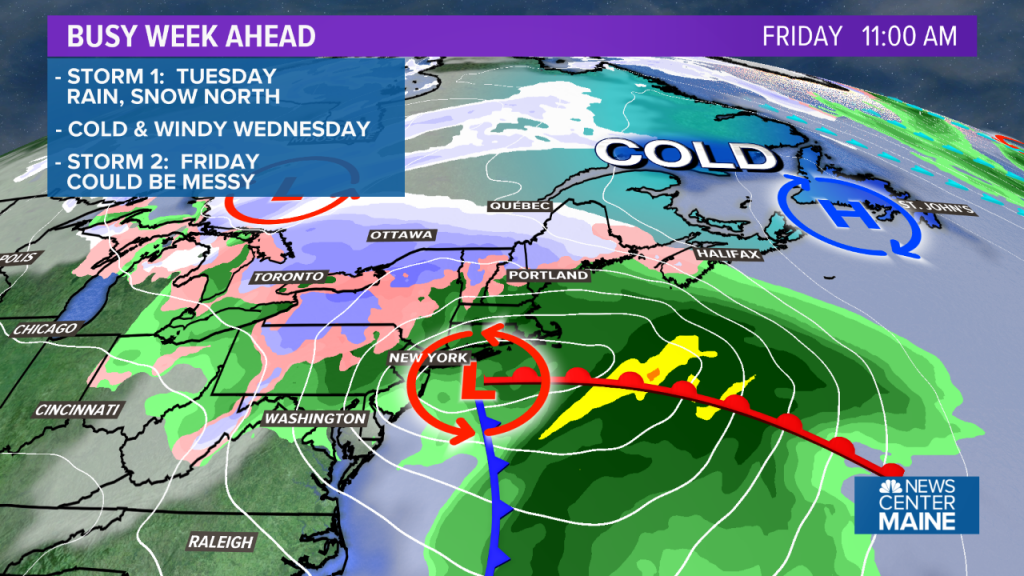
Thursday morning may be very cold, with lows in the teens. In the afternoon, temperatures should make it back into the 30s.
Another coastal storm will move in Friday morning. With very cold air in place ahead of it, this is the first storm that has a shot at bringing at least some snow to the entire state and accumulations down to the coastline. At this point, specific details are still uncertain, but we’ll work those out over the next two days.
Comments are no longer available on this story