
Today is the first day of Meteorological Spring; so to celebrate, let’s talk about two snow events in 3 days.

How it is we always act surprised when we get walloped in March? It happens almost every year.
As Mannix used to say “Even April is a winter month in Maine.” (He probably still says this; he just never calls me anymore….and frankly I’m deeply hurt by that.)
Anyhow, we have two storms to talk about: One Saturday and the other on Monday. So let’s go.
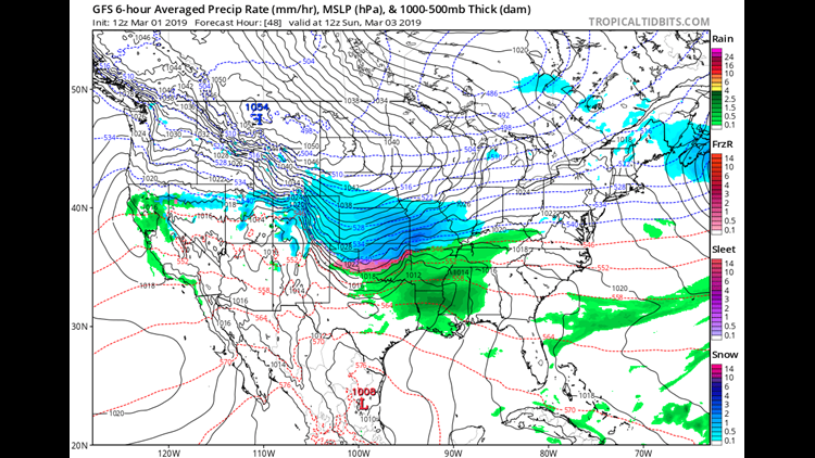
SATURDAY
This storm is, for the most part, out to sea and it’s going to stay that way.
The problem is the size of the snow shield. It’s large. That means even with the low way out to sea, some of us will still be looking at light accumulation.
Look how far away that thing is! Usually I’d call it a fish storm and be done with it.
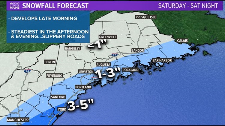
But on the more local level, it’ll likely sneak in some light snow during the day on Saturday.
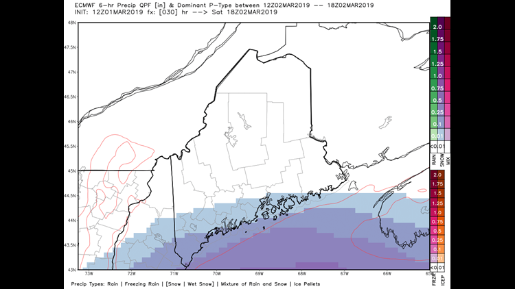
The snow shield should expand slightly on Saturday evening as it tries to “link up” with a weak disturbance to the west.
The biggest battle here will be between the light snow on the Northwest fringe of the storm and the dry air in place that wants to eat it up. As such, accumulations will be light in most spots.
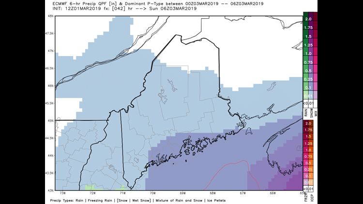
Snow tapers off overnight Saturday and Sunday actually looks pretty good. Partly cloudy with seasonable temperatures.
Next storm arrives…
MONDAY
For months now we’ve lamented in the weather office how we have a good amount of total snow in the season, but not a single TRUE Nor’easter to date (statewide hit, low in the Gulf, mostly snow, heavy amounts).
That might finally change on Monday.
The storm will start out as a “Leeside-low” on Saturday night and then barrel towards the coastline.
By late Sunday night redevelopment will occur over the Mid-Atlantic; giving us a Nor’easter.
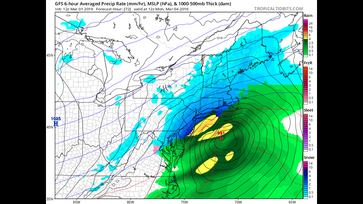
Snow begins early Monday morning, continues through the day and wraps up Monday night.
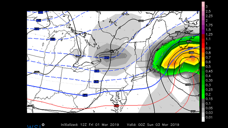
The detail that remains to be worked out is the EXACT placement of the low in the Gulf of Maine.
Relatively small adjustments to that will refine the bullseye zone for this system.
Each one of those little L’s you see on the following map represent a possible position for the center of the storm on Monday. (This is relatively complicated but it’s called Ensemble forecasting if you want to Google it).
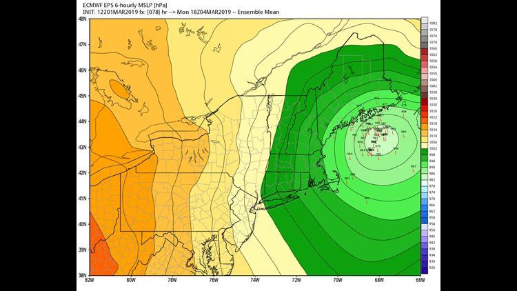
The difference between the most Northwest low and the most Southeast low will represent the impact difference of a mountain jackpot versus a coastal storm.
If I had to make a very early call on it right now…

I’d say 6-12″ almost statewide.
But stay tuned, we’re finally earning our keep in the ol’ weather office.
Comments are no longer available on this story