
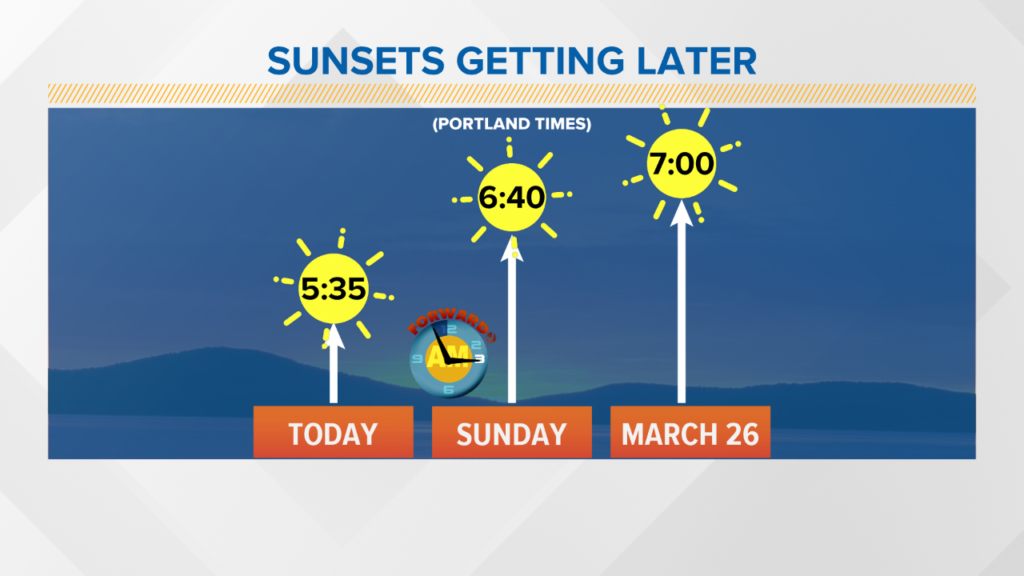
The sunset today is 5:35 p.m., but when daylight saving time begins Sunday, it’ll be an hour later. By the end of the month, we’ll have post-7 p.m. sunsets.
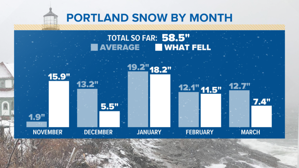
This winter has been pretty interesting. We’re only a few inches off from the seasonal average in Portland, so by the numbers, snowfall has been average so far.
Breaking it down by month really tells the story of the winter: the fast start in November, the relative lull in December, followed by several smaller storms since we began 2019.
Bangor has already reached the seasonal average of 66.1 inches.

It’s a cold, but relatively quiet pattern into the weekend.
To have two days, back-to-back, in March with high temperatures in the teens and low 20s is impressive. Cold at this level becomes far less likely and less sustainable as we run later into the month.
Saturday looks like a great day with sunshine and highs in the 30s.
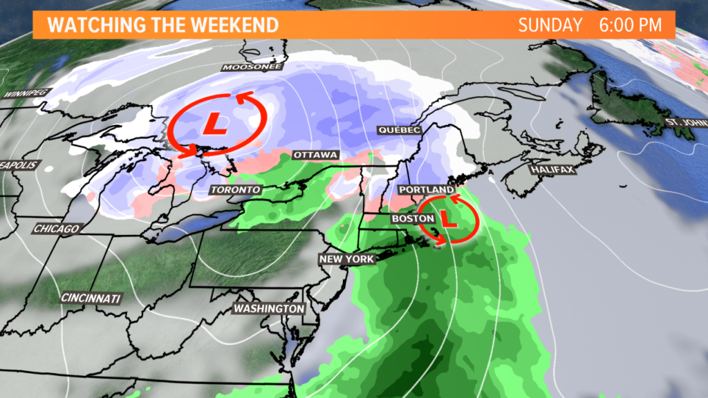
The second half of the weekend is more problematic.
We’re going to have another “inside runner,” a storm traveling far to our northwest. This is a pattern we’ve seen at least a half dozen times this winter.
It means snow to start Sunday afternoon, then a likely change to mixed precipitation or rain from south to north.
If a secondary low is able to form in the Gulf of Maine, it would mean a longer period of sub-freezing temperatures near the surface, and it’s something we’ll keep an eye on.
Comments are no longer available on this story